Rajbari Sadar Upazila
Upazila in Dhaka, Bangladesh
Rajbari রাজবাড়ী সদর | |
|---|---|
Upazila | |
| Rajbari Sadar | |
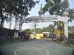 Baba Murshid Jamai Pagal's Mazar, Rajbari | |
 | |
| Coordinates: 23°45.3′N 89°39′E / 23.7550°N 89.650°E / 23.7550; 89.650 | |
| Country |  Bangladesh Bangladesh |
| Division | Dhaka |
| District | Rajbari |
| Headquarters | Rajbari |
| Area | |
| • Total | 322.34 km2 (124.46 sq mi) |
| Population (2011)[1] | |
| • Total | 331,631 |
| • Density | 1,000/km2 (2,700/sq mi) |
| Time zone | UTC+6 (BST) |
| Website | Upazila Portal |
Rajbari Sadar (Bengali: রাজবাড়ী সদর) is an upazila of Rajbari District[2] in the Division of Dhaka, Bangladesh. It has its headquarters in the town of Rajbari.
Geography
Rajbari Sadar is located at 23°45′15″N 89°39′00″E / 23.7542°N 89.6500°E / 23.7542; 89.6500. It has 75,910 households and total area 322.34 km2.
Demographics
| Religions in Rajbari Sadar upazila (2011)[1] | ||||
|---|---|---|---|---|
| Religion | Percent | |||
| Islam | 91.17% | |||
| Hinduism | 8.79% | |||
| Other or not stated | 0.04% | |||
As of the 2011 Bangladesh census, Rajbari Sadar upazila had 75,910 households and a population of 331,631. 70,885 (21.37%) were under 10 years of age. Rajbari Sadar had an average literacy rate of 57.7%, compared to the national average of 51.8%, and a sex ratio of 1041 females per 1000 males. 58,783 (17.73%) of the population lived in urban areas.[1][3]
As of the 1991 Bangladesh census, Rajbari Sadar has a population of 263,555. Males constitute 51.46% of the population, and females 48.54%. This Upazila's eighteen up population is 133,985. Rajbari Sadar has an average literacy rate of 32.3% (7+ years), and the national average of 32.4% literate.[4]
Administration
Rajbari Sadar Upazila is divided into Rajbari Municipality and 14 union parishads: Alipur, Banibaha, Barat, Basantapur, Chandani, Dadshi, Khankhanapur, Khanganj, Mizanpur, Mulghar, Panchuria, Ramkantapur, Shahid Wahabpur, and Sultanpur. The union parishads are subdivided into 200 mauzas and 209 villages.[1]
Rajbari Municipality is subdivided into 9 wards and 31 mahallas.[1]
Education
There are five colleges in the upazila: Belgachi Bikalpa College, Bir Muktijoddha Morji Delowara College, Dr. Abul Hossain Degree College, Government Adarsha Mohila College Rajbari, and Rajbari Government College.[5]
According to Banglapedia, Raja Surja Kumar Institute, founded in 1888, Rajbari Government High School (1892), and Yeasin High School (1950),Sher-e-bangla Girls High School(1972) are notable secondary schools.[2]
See also
References
- ^ a b c d e "Bangladesh Population and Housing Census 2011 Zila Report – Rajbari" (PDF). bbs.gov.bd. Bangladesh Bureau of Statistics.
- ^ a b Badrul Alam Tipu (2012), "Rajbari Sadar Upazila", in Sirajul Islam and Ahmed A. Jamal (ed.), Banglapedia: National Encyclopedia of Bangladesh (Second ed.), Asiatic Society of Bangladesh
- ^ "Community Tables: Rajbari district" (PDF). bbs.gov.bd. Bangladesh Bureau of Statistics. 2011.
- ^ "Population Census Wing, BBS". Archived from the original on 2005-03-27. Retrieved November 10, 2006.
- ^ "List of Colleges". Department of Secondary and Higher Education. Retrieved 6 September 2020.


 | This Dhaka Division location article is a stub. You can help Wikipedia by expanding it. |
- v
- t
- e


