National Register of Historic Places listings in Boise County, Idaho
This is a list of the National Register of Historic Places listings in Boise County, Idaho.
This is intended to be a complete list of the properties and districts on the National Register of Historic Places in Boise County, Idaho, United States. Latitude and longitude coordinates are provided for many National Register properties and districts; these locations may be seen together in a map.[1]
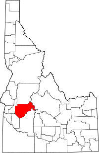
There are 4 properties and districts listed on the National Register in the county. More may be added; properties and districts nationwide are added to the Register weekly.[2]
This National Park Service list is complete through NPS recent listings posted August 30, 2024.[3]
Map all coordinates using OpenStreetMap
Download coordinates as:
- KML
- GPX (all coordinates)
- GPX (primary coordinates)
- GPX (secondary coordinates)
Current listings
| [4] | Name on the Register[5] | Image | Date listed[6] | Location | City or town | Description |
|---|---|---|---|---|---|---|
| 1 | Arrowrock Dam |  | November 9, 1972 (#72000437) | About 10 miles east of Boise on United States Forest Service roads 43°35′44″N 115°55′19″W / 43.595556°N 115.921944°W / 43.595556; -115.921944 (Arrowrock Dam) | Boise | |
| 2 | Idaho City |  | June 27, 1975 (#75000626) | Bounded by the city limits 43°49′47″N 115°49′58″W / 43.829722°N 115.832778°W / 43.829722; -115.832778 (Idaho City) | Idaho City | |
| 3 | Placerville Historic District | 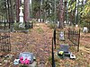 | September 7, 1984 (#84001029) | Roughly bounded by the city limits 43°56′35″N 115°56′49″W / 43.943056°N 115.946944°W / 43.943056; -115.946944 (Placerville Historic District) | Placerville | |
| 4 | Upper Brownlee School |  | March 31, 1998 (#98000264) | Dry Buck Rd., 0.1 miles northeast of its junction with Timber Butte Rd. 44°02′07″N 116°14′14″W / 44.035252°N 116.237096°W / 44.035252; -116.237096 (Upper Brownlee School) | Sweet |
See also
Wikimedia Commons has media related to National Register of Historic Places in Boise County, Idaho.
References
- ^ The latitude and longitude information provided in this table was derived originally from the National Register Information System, which has been found to be fairly accurate for about 99% of listings. Some locations in this table may have been corrected to current GPS standards.
- ^ "National Register of Historic Places: Weekly List Actions". National Park Service. Retrieved March 29, 2009.
- ^ National Park Service, United States Department of the Interior, "National Register of Historic Places: Weekly List Actions", retrieved August 30, 2024.
- ^ Numbers represent an alphabetical ordering by significant words. Various colorings, defined here, differentiate National Historic Landmarks and historic districts from other NRHP buildings, structures, sites or objects.
- ^ "National Register Information System". National Register of Historic Places. National Park Service. April 24, 2008.
- ^ The eight-digit number below each date is the number assigned to each location in the National Register Information System database, which can be viewed by clicking the number.
- v
- t
- e
- Ada
- Adams
- Bannock
- Bear Lake
- Benewah
- Bingham
- Blaine
- Boise
- Bonner
- Bonneville
- Boundary
- Butte
- Camas
- Canyon
- Caribou
- Cassia
- Clark
- Clearwater
- Custer
- Elmore
- Franklin
- Fremont
- Gem
- Gooding
- Idaho
- Jefferson
- Jerome
- Kootenai
- Latah
- Lemhi
- Lewis
- Lincoln
- Madison
- Minidoka
- Nez Perce
- Oneida
- Owyhee
- Payette
- Power
- Shoshone
- Teton
- Twin Falls
- Valley
- Washington

| |
|---|---|
| Topics | |
| Lists by state |
|
| Lists by insular areas | |
| Lists by associated state | |
| Other areas | |
| Related | |
| |


Municipalities and communities of Boise County, Idaho, United States | ||
|---|---|---|
County seat: Idaho City | ||
| Cities |  | |
| CDPs | ||
| Unincorporated communities | ||
| ||


