Gulf Fall and Uplands
Region in Australia
| Gulf Fall and Uplands Australia | |||||||||||||||
|---|---|---|---|---|---|---|---|---|---|---|---|---|---|---|---|
 The interim Australian bioregions, with Gulf Fall and Uplands in red | |||||||||||||||
| Area | 118,479.09 km2 (45,745.0 sq mi) | ||||||||||||||
| |||||||||||||||
The Gulf Fall and Uplands, an interim Australian bioregion, is located in the Northern Territory and Queensland,[1][2] comprising 11,847,909 hectares (29,276,820 acres).[3]
Described in IBRA5.1[1] as "undulating terrain with scattered low, steep hills on Proterozoic and Palaeozoic sedimentary rocks, often overlain by lateritised Tertiary material; skeletal soils and shallow sands; Darwin box (Eucalyptus tectifica) and variable-barked bloodwood (Corymbia erythrophloia) woodland to low open woodland with spinifex understorey."
The abbreviation for the bioregion is GFU.[3]
| IBRA regions and subregions: IBRA7 | ||||
|---|---|---|---|---|
| IBRA region / subregion | IBRA code | Area | States | Location in Australia |
| Gulf Fall and Uplands | GFU | 11,847,909 hectares (29,276,820 acres) | NT / Qld | 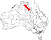 |
| McArthur | GFU01 | 9,330,938 hectares (23,057,250 acres) | ||
| Nicholson | GFU02 | 2,516,971 hectares (6,219,570 acres) | ||
See also
 Queensland portal
 Environment portal


- Geography of Australia
References
- ^ a b Environment Australia. "Revision of the Interim Biogeographic Regionalisation for Australia (IBRA) and Development of Version 5.1 - Summary Report". Department of the Environment and Water Resources, Australian Government. Archived from the original on 5 September 2006. Retrieved 31 January 2007.
- ^ IBRA Version 6.1 data
- ^ a b "Interim Biogeographic Regionalisation for Australia (IBRA7) regions and codes". Department of Sustainability, Environment, Water, Population and Communities. Commonwealth of Australia. 2012. Retrieved 13 January 2013.
Further reading
- Thackway, R and I D Cresswell (1995) An interim biogeographic regionalisation for Australia : a framework for setting priorities in the National Reserves System Cooperative Program Version 4.0 Canberra : Australian Nature Conservation Agency, Reserve Systems Unit, 1995. ISBN 0-642-21371-2
- v
- t
- e
- Arnhem Coast
- Arnhem Plateau
- Australian Alps
- Avon Wheatbelt
- Ben Lomond
- Brigalow Belt North
- Brigalow Belt South
- Broken Hill Complex
- Burt Plain
- Cape York Peninsula
- Carnarvon
- Central Arnhem
- Central Kimberley
- Central Mackay Coast
- Central Ranges
- Channel Country
- Cobar Peneplain
- Coolgardie
- Coral Sea
- Cumberland Plain
- Daly Basin
- Dampierland
- Darling Riverine Plains
- Darwin Coastal
- Davenport Murchison Ranges
- Desert Uplands
- Einasleigh Uplands
- Esperance Plains
- Eyre Yorke Block
- Finke
- Flinders Lofty Block
- Furneaux
- Gascoyne
- Gawler
- Geraldton Sandplains
- Gibson Desert
- Great Sandy Desert
- Great Victoria Desert
- Gulf Coastal
- Gulf Fall and Uplands
- Gulf Plains
- Hampton
- Indian Tropical Islands
- Jarrah Forest
- Kanmantoo
- King
- Little Sandy Desert
- MacDonnell Ranges
- Mallee
- Mitchell Grass Downs
- Mount Isa Inlier
- Mulga Lands
- Murchison
- Murray Darling Depression
- Nandewar
- Naracoorte Coastal Plain
- New England Tablelands
- Northern Kimberley
- New South Wales North Coast
- New South Wales South Western Slopes
- Nullarbor Plain
- Ord Victoria Plain
- Pacific Subtropical Islands
- Pine Creek
- Pilbara
- Riverina
- Simpson Strzelecki Dunefields
- South East Coastal Plain
- South East Corner
- South Eastern Highlands
- South Eastern Queensland
- Southern Volcanic Plain
- Stony Plains
- Sturt Plateau
- Subantarctic Islands
- Swan Coastal Plain
- Sydney Basin
- Tanami
- Tasmanian Central Highlands
- Tasmanian Northern Midlands
- Tasmanian Northern Slopes
- Tasmanian South East
- Tasmanian Southern Ranges
- Tasmanian West
- Tiwi Cobourg
- Victoria Bonaparte
- Victorian Midlands
- Warren
- Wet Tropics
- Yalgoo
| ||
|---|---|---|
| Topics |  | |
| Regions | ||
| Major settlements | ||
| |||||
|---|---|---|---|---|---|
| General |  | ||||
| Politics and Government |
| ||||
| Regions | |||||
| Cities and towns | |||||
| People |
| ||||
| |||||

 | This Northern Territory geography article is a stub. You can help Wikipedia by expanding it. |
- v
- t
- e
 | This Queensland location article is a stub. You can help Wikipedia by expanding it. |
- v
- t
- e


