Burt Plain
Ecoregion in the Northern Territory, Australia
| Burt Plain Northern Territory | |||||||||||||||
|---|---|---|---|---|---|---|---|---|---|---|---|---|---|---|---|
 The interim Australian bioregions, with Burt Plain in red | |||||||||||||||
| Area | 73,797.19 km2 (28,493.3 sq mi) | ||||||||||||||
| |||||||||||||||
Burt Plain, an interim Australian bioregion, is located in the Northern Territory,[1][2] and comprises 7,379,719 hectares (18,235,680 acres).[3]
The bioregion has the code BRT. There are four subregions.[3]
| IBRA regions and subregions: IBRA7 | ||||
|---|---|---|---|---|
| IBRA region / subregion | IBRA code | Area | States | Location in Australia |
| Burt Plain | BRT | 7,379,719 hectares (18,235,680 acres) | NT | 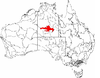 |
| Yuendumu | BRT01 | 2,931,061 ha (7,242,810 acres) | ||
| Atartinga | BRT02 | 3,531,111 ha (8,725,570 acres) | ||
| Mount Chapple | BRT03 | 390,981 ha (966,140 acres) | ||
| Dulcie | BRT04 | 526,567 ha (1,301,180 acres) | ||
See also
 Environment portal

- Geography of Australia
- Dulcie Range National Park
References
- ^ Environment Australia. "Revision of the Interim Biogeographic Regionalisation for Australia (IBRA) and Development of Version 5.1 - Summary Report". Department of the Environment and Water Resources, Australian Government. Archived from the original on 5 September 2006. Retrieved 31 January 2007.
- ^ IBRA Version 6.1 data
- ^ a b "Interim Biogeographic Regionalisation for Australia (IBRA7) Codes". Department of Climate Change, Energy, the Environment and Water. Commonwealth of Australia. 2012. Retrieved 31 October 2022.
Further reading
- Thackway, R and I D Cresswell (1995) An interim biogeographic regionalisation for Australia : a framework for setting priorities in the National Reserves System Cooperative Program Version 4.0 Canberra : Australian Nature Conservation Agency, Reserve Systems Unit, 1995. ISBN 0-642-21371-2
- v
- t
- e
- Arnhem Coast
- Arnhem Plateau
- Australian Alps
- Avon Wheatbelt
- Ben Lomond
- Brigalow Belt North
- Brigalow Belt South
- Broken Hill Complex
- Burt Plain
- Cape York Peninsula
- Carnarvon
- Central Arnhem
- Central Kimberley
- Central Mackay Coast
- Central Ranges
- Channel Country
- Cobar Peneplain
- Coolgardie
- Coral Sea
- Cumberland Plain
- Daly Basin
- Dampierland
- Darling Riverine Plains
- Darwin Coastal
- Davenport Murchison Ranges
- Desert Uplands
- Einasleigh Uplands
- Esperance Plains
- Eyre Yorke Block
- Finke
- Flinders Lofty Block
- Furneaux
- Gascoyne
- Gawler
- Geraldton Sandplains
- Gibson Desert
- Great Sandy Desert
- Great Victoria Desert
- Gulf Coastal
- Gulf Fall and Uplands
- Gulf Plains
- Hampton
- Indian Tropical Islands
- Jarrah Forest
- Kanmantoo
- King
- Little Sandy Desert
- MacDonnell Ranges
- Mallee
- Mitchell Grass Downs
- Mount Isa Inlier
- Mulga Lands
- Murchison
- Murray Darling Depression
- Nandewar
- Naracoorte Coastal Plain
- New England Tablelands
- Northern Kimberley
- New South Wales North Coast
- New South Wales South Western Slopes
- Nullarbor Plain
- Ord Victoria Plain
- Pacific Subtropical Islands
- Pine Creek
- Pilbara
- Riverina
- Simpson Strzelecki Dunefields
- South East Coastal Plain
- South East Corner
- South Eastern Highlands
- South Eastern Queensland
- Southern Volcanic Plain
- Stony Plains
- Sturt Plateau
- Subantarctic Islands
- Swan Coastal Plain
- Sydney Basin
- Tanami
- Tasmanian Central Highlands
- Tasmanian Northern Midlands
- Tasmanian Northern Slopes
- Tasmanian South East
- Tasmanian Southern Ranges
- Tasmanian West
- Tiwi Cobourg
- Victoria Bonaparte
- Victorian Midlands
- Warren
- Wet Tropics
- Yalgoo
| ||
|---|---|---|
| Topics |  | |
| Regions | ||
| Major settlements | ||
 | This Northern Territory geography article is a stub. You can help Wikipedia by expanding it. |
- v
- t
- e


