Marysville (Ohio)
| Marysville | |||
|---|---|---|---|
 | |||
| | |||
| Land |  USA USA | ||
| Delstat |  Ohio Ohio | ||
| Fylke | Union County | ||
| Grunnlagt | 1816 | ||
| Postnummer | 43040–43041 | ||
| Retningsnummer | 937 | ||
| Areal | 42,88 km²[1] | ||
| Vannfylt arealandel | 1,76 % | ||
| Befolkning | 25 571[2] (2020) | ||
| Bef.tetthet | 596,29 innb./km² | ||
| Antall husholdninger | 8 786 | ||
| Høyde o.h. | 302 meter | ||
| Nettside | www | ||
 Marysville 40°14′02″N 83°21′59″V | |||
Marysville på Commons | |||

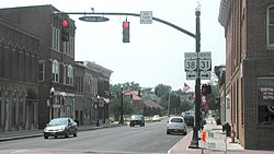
Marysville er en amerikansk by som ligger i Union County i Ohio.
Den har 25 571 innbyggere (2020)[2][3] og dekker et areal på 42,88 km².
Referanser
- ^ United States. Bureau of the Census (2016) (på en), 2016 U.S. Gazetteer Files, Washington D.C.: Bureau of the Census, Wikidata Q32859555, https://www.census.gov/geographies/reference-files/time-series/geo/gazetteer-files.2016.html
- ^ a b https://data.census.gov/cedsci/table?t=Populations%20and%20People&g=0100000US,%241600000&y=2020; folketellingen i USA 2020; redaktør: Bureau of the Census; besøksdato: 1. januar 2022.
- ^ «Annual Estimates of the Resident Population for Incorporated Places in Ohio: April 1, 2010 to July 1, 2019 (SUB-IP-EST2019-ANNRES-39)». Besøkt 10. november 2020.
Eksterne lenker
- (en) Offisielt nettsted

- (en) Marysville, Ohio – kategori av bilder, video eller lyd på Commons
- (en) Innbyggertall 2010 - 2019 – United States Census Bureau


