ブグニ
| ブグニ Bougouni | |
|---|---|
 ブグニのバス停(2017年撮影) | |
| 位置 | |
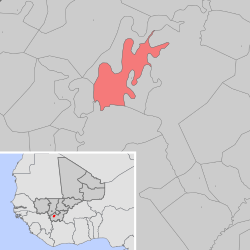 ブグニ・コミューンの地図 | |
| 位置 | |
  ブグニ ブグニ (マリ共和国) | |
| 座標 : 北緯11度25分0秒 西経7度29分0秒 / 北緯11.41667度 西経7.48333度 / 11.41667; -7.48333 | |
| 行政 | |
| 国 |  マリ マリ |
| 州 | ブグニ州 |
| 圏 | ブグニ圏 |
| コミューン | ブグニ |
| 地理 | |
| 面積 | |
| コミューン域 | 186[1] km2 |
| 標高 | 344 m |
| 人口 | |
| 人口 | (2009年現在) |
| コミューン域 | 58,538人 |
| 人口密度 | 315人/km2 |
| 備考 | [1] |
| その他 | |
| 等時帯 | グリニッジ標準時 (UTC+0) |

ブグニ(フランス語: Bougouni)は、マリ共和国ブグニ州ブグニ圏の都市型コミューン[2]。同州、同圏の首府でもある。バマコから南へ170キロメートル、シカソから西へ210キロメートルの位置にある。
人口は58,538人(2009年国勢調査[1])。フラニ族とバンバラ族が多く住む。
歴史
ブグニはフランス領スーダン時代に創設され、1894年7月10日に植民地初代行政官であったアンリ・グロー(英語版)中尉によって行政の中心と定められた。
1982年4月1日、同国14番目のコミューンとして創設された[3]。
植民地時代の公文書が保管されていたが、1991年3月のムーサ・トラオレ大統領に対する民衆蜂起の際に焼失した。
| 年 | 1976 | 1987 | 1998 | 2009 |
|---|---|---|---|---|
| 人口 | 17,410 | 22,374 | 37,192 | 58,538 |
気候
ケッペンの気候区分ではサバナ気候に分類される。農業に十分な降雨量に恵まれており、町周辺では綿花が栽培されている。
| ブグニ(1991-2020)の気候 | |||||||||||||
|---|---|---|---|---|---|---|---|---|---|---|---|---|---|
| 月 | 1月 | 2月 | 3月 | 4月 | 5月 | 6月 | 7月 | 8月 | 9月 | 10月 | 11月 | 12月 | 年 |
| 平均最高気温 °C (°F) | 34.2 (93.6) | 37.1 (98.8) | 39.0 (102.2) | 38.9 (102) | 37.0 (98.6) | 34.0 (93.2) | 31.4 (88.5) | 31.0 (87.8) | 31.6 (88.9) | 33.7 (92.7) | 35.5 (95.9) | 34.5 (94.1) | 34.83 (94.69) |
| 日平均気温 °C (°F) | 25.6 (78.1) | 28.6 (83.5) | 31.3 (88.3) | 32.2 (90) | 30.9 (87.6) | 28.6 (83.5) | 26.8 (80.2) | 26.4 (79.5) | 26.8 (80.2) | 27.9 (82.2) | 27.4 (81.3) | 25.5 (77.9) | 28.2 (82.8) |
| 平均最低気温 °C (°F) | 17.1 (62.8) | 20.0 (68) | 23.5 (74.3) | 25.5 (77.9) | 24.8 (76.6) | 23.2 (73.8) | 22.2 (72) | 22.1 (71.8) | 21.9 (71.4) | 22.1 (71.8) | 19.1 (66.4) | 16.5 (61.7) | 21.5 (70.71) |
| 降水量 mm (inch) | 1.5 (0.059) | 1.2 (0.047) | 7.2 (0.283) | 36.0 (1.417) | 103.5 (4.075) | 160.0 (6.299) | 263.9 (10.39) | 292.7 (11.524) | 221.2 (8.709) | 73.8 (2.906) | 5.3 (0.209) | 0.0 (0) | 1,166.3 (45.918) |
| 平均降水日数 (≥1.0 mm) | 0.4 | 0.5 | 1.4 | 4.5 | 9.3 | 12.7 | 17.6 | 20.1 | 17.7 | 8.8 | 0.9 | 0.0 | 93.9 |
| 平均日照時間 | 8.8 | 8.7 | 8.1 | 7.8 | 8.1 | 7.9 | 6.8 | 6.3 | 7.1 | 8.1 | 8.6 | 8.4 | 7.89 |
| 出典1:NOAA[5] | |||||||||||||
| 出典2:ドイツ気象局 (daily sun)[6] | |||||||||||||
出身人物
姉妹都市

出典
- ^ a b c “BOUGOUNI”. Citypopulation (2017年7月26日). 2024年5月14日閲覧。
- ^ “Mali. Document sur le nouveau découpage administratif février 2023”. Malinews tv (2023年2月22日). 2024年5月13日閲覧。
- ^ “Recherche sur l’Historique de la Décentralisation au Mali” (2004年3月1日). 2009年8月2日時点のオリジナルよりアーカイブ。2024年5月14日閲覧。
- ^ “MALI/Regions & Cities”. Citypopulation (2024年3月1日). 2024年5月14日閲覧。
- ^ “World Meteorological Organization Climate Normals for 1991-2020: Bougouni” (CSV). NOAA. 7 January 2024閲覧。
- ^ “Climate Averages for Bougouni” (ドイツ語). DWD. 7 September 2022閲覧。
外部リンク
- Bougouni, Mali, Falling Rain.
- Cheich Abd El Kader Bougouni, ma ville natale ! Archived 2011-05-27 at the Wayback Machine., 1999-2008 - Afribone Mali SA.
- "Mother and Child [Mali, Bougouni or Dioila area; Bamana peoples (1979.206.121)". In Timeline of Art History. New York: The Metropolitan Museum of Art, 2000–. (October 2006).
- Bougouni Mosque: ArchNet listing.
- Geographic features & Photographs around Forêt Classée de Bougouni-Foulaboula, in Mali.
- Bougouni Village Raw Cotton, Alibaba.com company profile.
- Action Santé et Education pour Bougouni - ASEB, Bougouni based health services cooperative/ngo, 2006.
- 1957 area map of Bougouni Cercle, US Army.


