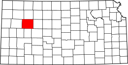
Contea di Gove

Questa voce sull'argomento contee del Kansas è solo un abbozzo.
Contribuisci a migliorarla secondo le convenzioni di Wikipedia.
| Contea di Gove contea | |
|---|---|
 | |
| Localizzazione | |
| Stato |  Stati Uniti Stati Uniti |
| Stato federato |  Kansas Kansas |
| Amministrazione | |
| Capoluogo | Gove City |
| Data di istituzione | 1868 |
| Territorio | |
| Coordinate del capoluogo | 38°55′12″N 100°29′48″W38°55′12″N, 100°29′48″W (Contea di Gove) |
| Superficie | 2 775 km² |
| Abitanti | 2 695 (2010) |
| Densità | 0,97 ab./km² |
| Altre informazioni | |
| Fuso orario | UTC-6 |
| Cartografia | |
  Gove City | |
 | |
| Sito istituzionale | |
| Modifica dati su Wikidata · Manuale | |
La contea di Gove in inglese Gove County (codice contea GO) è una contea dello Stato del Kansas, negli Stati Uniti. La popolazione al censimento del 2010 era di 2 695 abitanti. Il capoluogo di contea è Gove City.
Storia
 Questa sezione sull'argomento centri abitati degli Stati Uniti d'America è ancora vuota. Aiutaci a scriverla!
Geografia fisica
Secondo lo United States Census Bureau, la contea ha una superficie di 2.776 km2(99,99 %).

Contee confinanti
- Sheridan County (nord)
- Graham County (nordest)
- Trego County (est)
- Ness County (sudest)
- Lane County (sud)
- Scott County (sudovest)
- Logan County (ovest)
- Thomas County (nordovest)
Politica
Questa sezione sull'argomento centri abitati degli Stati Uniti d'America è ancora vuota. Aiutaci a scriverla!Infrastrutture e trasporti
Strade
 Kansas Highway 25
 U.S. Highway 40
 U.S. Highway 83
 Interstate 70


Geografia antropica

Città
- Gove
- Grainfield
- Grinnell
- Oakley (part)
- Park
- Quinter
Unincorporated community
- Campus
Ghost towns
- Alanthus
- Jerome
- Orion
Townships
Gove County is divided into nine townships. None of the cities within the county are considered governmentally independent, and all figures for the townships include those of the cities. In the following table, the population center is the largest city (or cities) included in that township's population total, if it is of a significant size.
| Township | FIPS | Population center | Population | Population density /km² (/sq mi) | Land area km² (sq mi) | Water area km² (sq mi) | Water % | Geographic coordinates |
|---|---|---|---|---|---|---|---|---|
| Baker | 03775 | Quinter | 1,357 | 4 (11) | 324 (125) | 0 (0) | 0% | 39°02′18″N 100°13′56″W39°02′18″N, 100°13′56″W |
| Gaeland | 25000 | 46 | 0 (1) | 208 (80) | 0 (0) | 0% | 38°56′21″N 100°44′30″W38°56′21″N, 100°44′30″W | |
| Gove | 27075 | 215 | 1 (2) | 301 (116) | 0 (0) | 0% | 38°57′19″N 100°31′44″W38°57′19″N, 100°31′44″W | |
| Grainfield | 27225 | Grainfield | 430 | 2 (6) | 184 (71) | 0 (0) | 0% | 39°05′41″N 100°28′28″W39°05′41″N, 100°28′28″W |
| Grinnell | 28925 | Grinnell | 480 | 2 (4) | 320 (123) | 0 (0) | 0.04% | 39°05′50″N 100°41′41″W39°05′50″N, 100°41′41″W |
| Jerome | 35425 | 132 | 0 (1) | 370 (143) | 0 (0) | 0.01% | 38°48′03″N 100°28′45″W38°48′03″N, 100°28′45″W | |
| Larrabee | 38750 | 80 | 0 (1) | 371 (143) | 0 (0) | 0.01% | 38°47′24″N 100°15′14″W38°47′24″N, 100°15′14″W | |
| Lewis | 39750 | 13 | 0 (0) | 372 (144) | 0 (0) | 0% | 38°46′23″N 100°43′39″W38°46′23″N, 100°43′39″W | |
| Payne | 55050 | 315 | 1 (3) | 324 (125) | 0 (0) | 0% | 39°03′04″N 100°20′42″W39°03′04″N, 100°20′42″W | |
| Sources: Census 2000 U.S. Gazetteer Files, su census.gov, U.S. Census Bureau, Geography Division (archiviato dall'url originale il 2 agosto 2002). | ||||||||
Altri progetti
Altri progetti
- Wikimedia Commons
 Wikimedia Commons contiene immagini o altri file su contea di Gove
Collegamenti esterni
- (EN) Sito ufficiale, su govecountyks.com.

- (EN) Contea di Gove, su Geographic Names Information System, USGS.

V · D · M | |
|---|---|
| Contee | Allen · Anderson · Atchison · Barber · Barton · Bourbon · Brown · Butler · Chase · Chautauqua · Cherokee · Cheyenne · Clark · Clay · Cloud · Coffey · Comanche · Cowley · Crawford · Decatur · Dickinson · Doniphan · Douglas · Edwards · Elk · Ellis · Ellsworth · Finney · Ford · Franklin · Geary · Gove · Graham · Grant · Gray · Greeley · Greenwood · Hamilton · Harper · Harvey · Haskell · Hodgeman · Jackson · Jefferson · Jewell · Johnson · Kearny · Kingman · Kiowa · Labette · Lane · Leavenworth · Lincoln · Linn · Logan · Lyon · Marion · Marshall · McPherson · Meade · Miami · Mitchell · Montgomery · Morris · Morton · Nemaha · Neosho · Ness · Norton · Osage · Osborne · Ottawa · Pawnee · Phillips · Pottawatomie · Pratt · Rawlins · Reno · Republic · Rice · Riley · Rooks · Rush · Russell · Saline · Scott · Sedgwick · Seward · Shawnee · Sheridan · Sherman · Smith · Stafford · Stanton · Stevens · Sumner · Thomas · Trego · Wabaunsee · Wallace · Washington · Wichita · Wilson · Woodson · Wyandotte |
| Regioni | Altopiano d'Ozark · Area metropolitana di Kansas City · Cherokee Strip · East Central · Flint Hills · High Plains · Red Hills · Smoky Hills · Southeast |
| Aree metropolitane | Capitale: Topeka Maggiori città: Derby · Dodge City · Emporia · Garden City · Hays · Hutchinson · Kansas City · Lawrence · Leavenworth · Leawood · Lenexa · Liberal · Manhattan · Olathe · Overland Park · Prairie Village · Salina · Shawnee · Topeka · Wichita |
| Controllo di autorità | VIAF (EN) 136027607 · LCCN (EN) n79036849 · J9U (EN, HE) 987007559526605171 |
|---|
 Portale Stati Uniti d'America: accedi alle voci di Wikipedia che parlano degli Stati Uniti d'America


