Wheatland (Iowa)
Pour les articles homonymes, voir Wheatland.

Cet article est une ébauche concernant l’Iowa.
Vous pouvez partager vos connaissances en l’améliorant (comment ?) selon les recommandations des projets correspondants.
| Wheatland | ||||
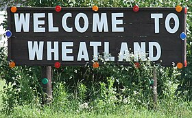 Panneau d'accueil à Wheatland | ||||
| Administration | ||||
|---|---|---|---|---|
| Pays |  États-Unis États-Unis | |||
| État |  Iowa Iowa | |||
| Comté | Clinton | |||
| Type de localité | City | |||
| Maire | Century Schnede | |||
| Code ZIP | 52777 | |||
| Code FIPS | 19-84945 | |||
| GNIS | 0462960 | |||
| Indicatif(s) téléphonique(s) local (locaux) | 563 | |||
| Démographie | ||||
| Population | 764 hab. (2010) | |||
| Densité | 484 hab./km2 | |||
| Géographie | ||||
| Coordonnées | 41° 49′ 58″ nord, 90° 50′ 22″ ouest | |||
| Altitude | 210 m | |||
| Superficie | 158 ha = 1,58 km2 | |||
| · dont terre | 1,58 km2 (100 %) | |||
| · dont eau | 0 km2 (0 %) | |||
| Fuseau horaire | CST (UTC-6) | |||
| Divers | ||||
| Fondation | 1858 - Incorporée en 1869 | |||
| Localisation | ||||
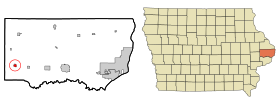 Carte du comté de Clinton. | ||||
| Géolocalisation sur la carte : États-Unis
Géolocalisation sur la carte : États-Unis
Géolocalisation sur la carte : Iowa
| ||||
| Liens | ||||
| Site web | Site officiel de Wheatland | |||
modifier  | ||||


Wheatland est une ville du comté de Clinton, en Iowa, aux États-Unis. La ville est fondée en 1858 sous la direction de John Bennett[1]. Elle est nommée en l'honneur de la propriété de James Buchanan à Lancaster (Pennsylvanie)[2]. Elle est incorporée le [3].
Références
- ↑ (en) Wolfe Patrick B., Wolfe's History of Clinton County, Iowa, vol. 1, B. F. Bowen, , p. 330
- ↑ (en) Chicago and North Western Railway Company, A History of the Origin of the Place Names Connected with the Chicago & North Western and Chicago, vol. 1, St. Paul, Minneapolis & Omaha Railways, , p. 138
- ↑ (en) « Wheatland, Iowa » [« Données sur la ville de Wheatland, Iowa »], sur le site city-data.com (consulté le )
Articles connexes
Liens externes
Sur les autres projets Wikimedia :
- Wheatland (Iowa), sur Wikimedia Commons
- (en) « Wheatland, Iowa » [« Données sur la ville de Wheatland, Iowa »], sur le site city-data.com (consulté le ).
Source de la traduction
- (en) Cet article est partiellement ou en totalité issu de l’article de Wikipédia en anglais intitulé « Wheatland, Iowa » (voir la liste des auteurs).
Municipalités et communautés du comté de Clinton (Iowa) | ||
|---|---|---|
| Siège du comté |
|  |
| Villes |
| |
| Townships |
| |
| Communautés non constituées en municipalité |
| |
| Notes |
| |
 Portail de l’Iowa


