District de Bhaktapur

Cet article est une ébauche concernant le Népal et l’administration territoriale.
Vous pouvez partager vos connaissances en l’améliorant (comment ?) selon les recommandations des projets correspondants.
| District de Bhaktapur भक्तपुर जिल्ला | |
| |
| Administration | |
|---|---|
| Pays |  Népal Népal |
| Région | Centre |
| Province | Bagmati |
| Type | District |
| Chef-lieu | Bhaktapur |
| Démographie | |
| Population | 304 651 hab. (2011) |
| Densité | 2 560 hab./km2 |
| Géographie | |
| Coordonnées | 27° 40′ 00″ nord, 85° 25′ 00″ est |
| Superficie | 11 900 ha = 119 km2 |
modifier  | |
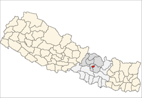
Le district de Bhaktapur – en népalais : भक्तपुर जिल्ला – est l'un des 75 districts du Népal. Il est rattaché à la zone de la Bagmati et à la région de développement Centre. La population du district s'élevait à 304 651 habitants en 2011[1].

Notes et références
- ↑ National Population and Housing Census 2011
v · m | |
|---|---|
| Koshi |
|
| Madhesh | |
| Bagmati | |
| Gandaki | |
| Lumbini |
|
| Karnali | |
| Sudurpashchim | |
| |
 Portail du Népal


