Yuhuatai, Nanjing
District in Jiangsu, People's Republic of China
Yuhuatai 31°56′24″N 118°42′06″E / 31.9401°N 118.7017°E / 31.9401; 118.7017 | |||||||||||||||||||||||||||||||||
|---|---|---|---|---|---|---|---|---|---|---|---|---|---|---|---|---|---|---|---|---|---|---|---|---|---|---|---|---|---|---|---|---|---|
| Country | People's Republic of China | ||||||||||||||||||||||||||||||||
| Province | Jiangsu | ||||||||||||||||||||||||||||||||
| Sub-provincial city | Nanjing | ||||||||||||||||||||||||||||||||
| Area | |||||||||||||||||||||||||||||||||
| • Total | 132.39 km2 (51.12 sq mi) | ||||||||||||||||||||||||||||||||
| Population (2020) | |||||||||||||||||||||||||||||||||
| • Total | 608,780 | ||||||||||||||||||||||||||||||||
| • Density | 4,600/km2 (12,000/sq mi) | ||||||||||||||||||||||||||||||||
| Time zone | UTC+8 (China Standard) | ||||||||||||||||||||||||||||||||
| Postal code | 210012 | ||||||||||||||||||||||||||||||||
| Nanjing district map |
| ||||||||||||||||||||||||||||||||

Yuhuatai (Chinese: 雨花台区; pinyin: Yǔhuātái Qū) is one of 11 districts of Nanjing, the capital of Jiangsu province, China.
Geography
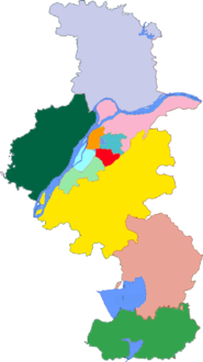
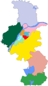
Yuhuatai District is located in the south of the main city of Nanjing, in the lower reaches of the Yangtze River, bordering Jiangning District in the east and south, facing Pukou District across the Yangtze River in the west, and bordering Qinhuai District and Jianye District in the north, covering an area of 132.39 square kilometers (excluding the river area).[1]
Administrative divisions
In the present, Yuhuatai District has 7 subdistricts.[2]
- 7 Subdistricts
|
|
Transportation
See also
References
- www.xzqh.org (in Chinese)
Wikimedia Commons has media related to Yuhuatai District.
- v
- t
- e
City of Nanjing
| Parks and lakes |
|
|---|---|
| Temples |
|
| Historic sites | |
| Other sites |
- Nanjing University
- Southeast University
- Nanjing University of Information Science and Technology
- Hohai University
- Nanjing Agricultural University
- China Pharmaceutical University
- Nanjing University of Aeronautics and Astronautics
- Nanjing University of Science & Technology
- Nanjing Normal University
- Nanjing University of Technology
- Nanjing Forestry University
- Nanjing Medical University
- Nanjing University of Finance & Economics
- Nanjing University of Posts and Telecommunications
- Nanjing University of the Arts
- Nanjing Audit University
- Sanjiang College
- Hopkins-Nanjing Center
- Nanjing Library
2014 Youth Summer Olympics
 Category
 Commons

 | This Jiangsu location article is a stub. You can help Wikipedia by expanding it. |
- v
- t
- e


