Wetto
Village in Sagaing Region, Burma
23°21′N 94°24′E / 23.350°N 94.400°E / 23.350; 94.400 Burma
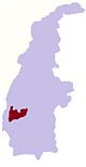
BurmaWetto is a village in Kalewa Township, Kale District, in the Sagaing Region of western Burma.[1][2]
References
External links
- Maplandia World Gazetteer
- v
- t
- e
 Kalewa Township of the Sagaing Region
Capital: Kalewa
- Auktawgyi
- Chaungzon
- Chingyaung
- Gaundi
- Gazet
- Hintin
- Hkonbyin
- Hmangon
- Indaing
- Ingon
- Inmatin
- Kado
- Kaing
- Kaing Shwedaung
- Kalewa
- Kanni
- Kazet
- Kongyi
- Kunbyo
- Kyauktan
- Kyaunggyigon
- Kyawdaw
- Kyawzin
- Kyudaw Chaungzon
- Kywegu
- Kywegyan
- Kywenan
- Laungmin
- Legyidaw
- Letpannginaung
- Manpagale
- Mankaw
- Masein
- Matu
- Mutaik
- Myittha
- Nammaw
- Nanmawke
- Naungput
- Nwedan
- Paga
- Pagyizu
- Paluzawa
- Paunggyaung
- Pawlaw
- Sabagyi
- Segyi
- Shan-in
- Shwedaung
- Shwegyin
- Shwewagaw
- Sinaingma
- Singaung
- Sizwe
- Tadichaungwa
- Taya
- Thanbaya
- Thetkegyin
- Thingan
- Tunhlaw
- Webon
- Welon
- Wetto
- Yawzu
- Ywatha
  | This Kale District location article is a stub. You can help Wikipedia by expanding it. |
- v
- t
- e


