Volders
You can help expand this article with text translated from the corresponding article in German. (May 2020) Click [show] for important translation instructions.
- View a machine-translated version of the German article.
- Machine translation, like DeepL or Google Translate, is a useful starting point for translations, but translators must revise errors as necessary and confirm that the translation is accurate, rather than simply copy-pasting machine-translated text into the English Wikipedia.
- Do not translate text that appears unreliable or low-quality. If possible, verify the text with references provided in the foreign-language article.
- You must provide copyright attribution in the edit summary accompanying your translation by providing an interlanguage link to the source of your translation. A model attribution edit summary is
Content in this edit is translated from the existing German Wikipedia article at [[:de:Volders]]; see its history for attribution. - You may also add the template
{{Translated|de|Volders}}to the talk page. - For more guidance, see Wikipedia:Translation.
Place in Tyrol, Austria

Coat of arms
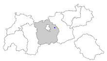
Location of Volders within Tyrol
[1]
(2018-01-01)[2]
6111
Volders is a municipality in the district of Innsbruck-Land in the Austrian state of Tyrol located 12 km east of Innsbruck on the southern side of the Inn River.
Geography
Sights are Schloss Friedberg and Schloss Aschach and the church of Saint Charles Borromeo,[3] attached to a Servite convent.[4]
Next to the church at the entrance of the village lies the Volderer See,[5] a small lake which has shrunk significantly and now resembles a pond.[6] It has no natural inflow or outflow, and receives water primarily from rain, and also the groundwater of the Inn River. The water quality is moderate, varying between grades B and C, and is often plagued by algae.[6] There is a local legend that a giant blocked the inflow to the lake with a large boulder, causing it to shrink.[6][7]
Population
| Year | Pop. | ±% |
|---|---|---|
| 1869 | 846 | — |
| 1880 | 883 | +4.4% |
| 1890 | 921 | +4.3% |
| 1900 | 1,024 | +11.2% |
| 1910 | 1,341 | +31.0% |
| 1923 | 1,212 | −9.6% |
| 1934 | 1,307 | +7.8% |
| 1939 | 1,276 | −2.4% |
| 1951 | 1,710 | +34.0% |
| 1961 | 1,960 | +14.6% |
| 1971 | 2,446 | +24.8% |
| 1981 | 2,822 | +15.4% |
| 1991 | 3,549 | +25.8% |
| 2001 | 4,166 | +17.4% |
| 2011 | 4,330 | +3.9% |

References
- ^ "Dauersiedlungsraum der Gemeinden Politischen Bezirke und Bundesländer - Gebietsstand 1.1.2018". Statistics Austria. Retrieved 10 March 2019.
- ^ "Einwohnerzahl 1.1.2018 nach Gemeinden mit Status, Gebietsstand 1.1.2018". Statistics Austria. Retrieved 9 March 2019.
- ^ Frick, Schmid-Pittl: Klosterkirche hl. Karl Borromäus, Karlskirche. In: Tiroler Kunstkataster
- ^ Frick, Schmid-Pittl: Tiroler Kunstkataster: Servitenkloster Volders
- ^ Seen.de: Volderer See
- ^ a b c "Volderer See" (in German). geomix. Archived from the original on 28 September 2007. Retrieved 11 May 2021.
- ^ "Volders" (in German). Peer GmbH. Retrieved 11 May 2021.
External links
Wikimedia Commons has media related to Volders.
- Municipality of Volders: Official website of the municipality in the Hall-Wattens region
- v
- t
- e
Municipalities in the district of Innsbruck-Land
- Absam
- Aldrans
- Ampass
- Axams
- Baumkirchen
- Birgitz
- Ellbögen
- Flaurling
- Fritzens
- Fulpmes
- Gnadenwald
- Götzens
- Gries am Brenner
- Gries im Sellrain
- Grinzens
- Gschnitz
- Hall in Tirol
- Hatting
- Inzing
- Kematen in Tirol
- Kolsass
- Kolsassberg
- Lans
- Leutasch
- Matrei am Brenner
- Mieders
- Mils
- Mutters
- Natters
- Navis
- Neustift im Stubaital
- Oberhofen im Inntal
- Obernberg am Brenner
- Oberperfuss
- Patsch
- Pettnau
- Pfaffenhofen
- Polling in Tirol
- Ranggen
- Reith bei Seefeld
- Rinn
- Rum
- St. Sigmund im Sellrain
- Scharnitz
- Schmirn
- Schönberg im Stubaital
- Seefeld in Tirol
- Sellrain
- Sistrans
- Steinach am Brenner
- Telfes
- Telfs
- Thaur
- Trins
- Tulfes
- Unterperfuss
- Vals
- Volders
- Völs
- Wattenberg
- Wattens
- Wildermieming
- Zirl

Authority control databases | |
|---|---|
| International |
|
| National |
|
 | This Tyrol location article is a stub. You can help Wikipedia by expanding it. |
- v
- t
- e


