Tundra, Texas
Unincorporated community in Texas, United States
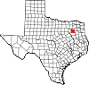
32°27′50″N 95°52′50″W / 32.46389°N 95.88056°W / 32.46389; -95.88056Tundra is an unincorporated community in Van Zandt County, Texas, United States.[1] According to the Handbook of Texas, the community had a population of 34 in 2000. It is located within the Dallas/Fort Worth Metroplex.
Geography
Tundra is located on Farm to Market Road 1851, 7 mi (11 km) southwest of Canton in south-central Van Zandt County.[2]
Education
Lone Star school was established in Tundra in the 1880s. It had 131 students enrolled in 1904. It continued to operate in 1936. Since the 1950s, the community has been served by the Canton Independent School District.[2]
References
- ^ a b U.S. Geological Survey Geographic Names Information System: Tundra, Texas
- ^ a b Kleiner, Diana J. "Tundra, TX". tshaonline.org. Retrieved December 23, 2022.
- v
- t
- e
Municipalities and communities of Van Zandt County, Texas, United States
County seat: Canton
- Canton
- Edom
- Fruitvale
- Grand Saline
- Van
- Wills Point
communities
- Texas portal
- United States portal


