Toorale National Park
Protected area in New South Wales, Australia
- NSW National Parks and Wildlife Service
- Kurnu-Baakandji people
New South Wales
The Toorale National Park is a protected national park that is located in the far-west region of New South Wales, in eastern Australia. The 30,866-hectare (76,270-acre) national park is located approximately 80 kilometres (50 mi) southwest of Bourke, at the junction of the Darling and Warrego rivers.[2] The national park is located adjacent to both the Darling River and the Gundabooka National Park, located to the south-east of the park, and the Toorale State Conservation Area, located to the north-west of the park.[2] The park is jointly managed by the NSW National Parks and Wildlife Service and the local indigenous Kurnu-Baakandji people.
Features

The Toorale National Park consists of land that was previously part of Toorale Station, used for irrigated cropping and grazing.[3] Toorale has a broadly flat landscape with extensive floodplains, and smaller areas of low ridges, riparian strips, and two notable peaks.[3] Small ephemeral lakes (gilgais) occur in depressions and swamps, whilst historic water management practices have created a vast wetland ecosystem on the park.[3]
Flora

Toorale has diverse vegetation with 27 vegetation communities described and mapped. Of these, inland floodplain shrublands are the dominant community, consisting of lignum shrublands, confined swamps dominated by cane grass, eurah shrublands, riverine chenopod shrublands and low chenopod shrublands.[3] Low chenopod shrubland is the most extensive vegetation community on Toorale, covering over 40 per cent of the park and is a highly variable community.[3]
The banks and internal river bends of the Darling River are lined by a tall open forest of river red gum.[3] Outer bends of the Darling and Warrego rivers and tributaries are lined by coolibah open woodland, which extends onto the surrounding alluvial floodplains.[3] Floodplain woodlands also include those characterised by black box.[3]
Areas associated with semi-permanent water support shallow freshwater sedgelands.[3] Bimble box grows in periodically flooded depressions on sandplains and alluvial plains.[3] On dryland areas there are extensive woodlands of belah, black oak, western rosewood and leopardwood.[3] A relatively large expanse of Whitewood–Western Rosewood low woodland occurs on the stony tablelands.[3] There are small patches of supplejack dominated woodland and Western Peneplain woodlands dominated by coolibah and beefwood or ironwood.[3] Gidgee and occasionally Whitewood tall shrublands, mulga (Acacia spp.) communities and Aeolian dunefields comprising patches of gum coolibah woodland also occur.[3]
Fauna
Mammals
Within the combined area of national park and the Toorale State Conservation Area, at least 28 species of mammal have been recorded.[2] The terrestrial species include the red kangaroo, western grey kangaroo and eastern grey kangaroo, as well as the common dunnart and short-beaked echidna.[4] Several bat species have been recorded, including Gould's wattled bat, the lesser long-eared bat, inland broad-nosed bat, little broad-nosed bat,[4] yellow-bellied sheath-tailed bat and little pied bat.[2][4]
Several introduced pest species occur, including the European fox, European rabbit, brown hare, feral cat, feral goat, feral pig, European cow and House mouse.[4][2]
Reptiles and amphibians
At least 57 species of reptile have been recorded within the combined area of national park and the Toorale State Conservation Area.[2] These include the Murray River turtle, Interior blind snake, leopard Ctenotus, ringed brown snake,[2] sand goanna, Bynoe's gecko and Central bearded dragon.[4]
Seventeen species of amphibian have also been recorded including the broad-palmed frog, desert froglet and rough frog.[2]
Gallery
-
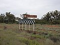 Toorale National Park sign on Bourke–Milparinka Road (2021).
 -
 Toorale National Park entrance, Toorale Road (2021).
 -
 Toorale National Park stock fence (2021).


See also
 New South Wales portal
 Environment portal


References
- ^ a b "Toorale National Park: Park management". Office of Environment & Heritage. Government of New South Wales. Retrieved 14 October 2014.
- ^ a b c d e f g h "Toorale National Park and Toorale State Conservation Area: Draft plan of management" (PDF). NSW National Parks & Wildlife Service (PDF). Government of New South Wales. January 2018. ISBN 978-1-76039-999-3. Retrieved 2 October 2018.
- ^ a b c d e f g h i j k l m n "Toorale National Park and Toorale State Conservation Area: Statement of management intent" (PDF). NSW National Parks & Wildlife Service (PDF). Government of New South Wales. June 2014. ISBN 978-1-74359-546-6. Retrieved 13 October 2014.
- ^ a b c d e "Toorale National Park and Toorale State Conservation Area NSW Supplement" (PDF). Bush Blitz (PDF). Government of Australia. March 2014. Retrieved 3 October 2018.
External links
- "Toorale National Park and Toorale State Conservation Area: Statement of management intent" (PDF). NSW National Parks & Wildlife Service (PDF). Government of New South Wales. June 2014. ISBN 978-1-74359-546-6.
- v
- t
- e
- Abercrombie
- Breelong
- Capertee
- Conimbla
- Coolah Tops
- Drillwarrina
- Gardens of Stone
- Garrawilla
- Goobang
- Goulburn
- Kanangra-Boyd
- Lachlan Valley
- Marrangaroo
- Nangar
- Popran
- Turon
- Warrumbungle
- Weddin Mountains
- Wollemi
- Brindingabba
- Culgoa
- Gundabooka
- Kalyarr
- Kemendok
- Kinchega
- Koonaburra
- Mallee Cliffs
- Mungo
- Mutawintji
- Narriearra Caryapundy Swamp
- Paroo-Darling
- Sturt
- Toorale
- Yanga
- Barakee
- Barrington Tops
- Belford
- Ben Halls Gap
- Biriwal Bulga
- Booti Booti
- Bouddi
- Brisbane Water
- Coolah Tops
- Coorabakh
- Crawney Pass
- Crowdy Bay
- Dharug
- Gir-um-bit
- Goulburn River
- Gin-Doo-Ee
- Hunter Wetlands
- Karuah
- Middle Brother
- Mount Royal
- Myall Lakes
- Saltwater
- Scone Mountain
- Tapin Tops
- Tilligerry
- Towarri
- Tomaree
- Wallarah
- Wallingat
- Watagans
- Werakata
- Woko
- Wollemi
- Wyrrabalong
- Yengo
- Bald Rock
- Barool
- Basket Swamp
- Boonoo Boonoo
- Ben Halls Gap
- Burral Yurrul
- Butterleaf
- Capoompeta
- Carrai
- Cascade
- Cataract
- Cathedral Rock
- Coolah Tops
- Cottan-Bimbang
- Couradda
- Crawney Pass
- Cunnawarra
- Dowe
- Gibraltar Range
- Guy Fawkes River
- Indwarra
- Kings Plain
- Koreelah
- Kwiambal
- Maryland
- Mount Clunie
- Mount Kaputar
- Mount Nothofagus
- Mummel Gulf
- New England
- Nowendoc
- Nullamanna
- Nymboida
- Oxley Wild Rivers
- Single
- Timbarra
- Tooloom
- Towarri
- Warra
- Warrabah
- Washpool
- Watsons Creek
- Werrikimbe
- Arakwal
- Bago Bluff
- Bellinger River
- Bindarri
- Biriwal Bulga
- Bongil Bongil
- Border Ranges
- Broadwater
- Bundjalung
- Bungawalbin
- Carrai
- Chaelundi
- Cottan-Bimbang
- Crowdy Bay
- Dooragan
- Dorrigo
- Dunggir
- Fortis Creek
- Gibraltar Range
- Goonengerry
- Guy Fawkes River
- Hat Head
- Junuy Juluum
- Kumbatine
- Limeburners Creek
- Mallanganee
- Maria
- Mebbin
- Middle Brother
- Mooball
- Mount Jerusalem
- Mount Nothofagus
- Mount Pikapene
- New England
- Nightcap
- Nymboi-Binderay
- Nymboida
- Ramornie
- Richmond Range
- Sea Acres
- Toonumber
- Ulidarra
- Washpool
- Werrikimbe
- Willi Willi
- Wollumbin
- Yabbra
- Yarrahapinni Wetlands
- Yarriabini
- Yuraygir
- Benambra
- Brindabella
- Cocoparra
- Jimberoo
- Jindalee
- Kalyarr
- Kosciuszko
- Lachlan Valley
- Livingstone
- Minjary
- Murray Valley
- Murrumbidgee Valley
- Oolambeyan
- Willandra
- Woomargama
- Yanga
- Abercrombie
- Bangadilly
- Beowa
- Biamanga
- Blue Mountains
- Bournda
- Brindabella
- Budawang
- Budderoo
- Clyde River
- Deua
- Eurobodalla
- Gourock
- Gulaga
- Kooraban
- Kosciuszko
- Mares Forest
- Macquarie Pass
- Mimosa Rocks
- Monga
- Morton
- Mount Imlay
- Murramarang
- Nattai
- South East Forests
- Tallaganda
- Tarlo River
- Wadbilliga
- Yanununbeyan


