Special routes of U.S. Route 1
U.S. highway system
This transport-related list is incomplete; you can help by adding missing items. (August 2008) |
 Special routes of U.S. Route 1 | |
|---|---|
| Highway system | |
Several special routes of U.S. Route 1 (US 1) exist, from Florida to Maine. In order from south to north, separated by type, these special routes are as follows.
Alternate routes
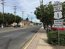
Jacksonville alternate route
  U.S. Highway 1 Alternate | |
|---|---|
| Location | Jacksonville, Florida |
| Length | 7.563 mi[1] (12.171 km) |
U.S. Highway 1 Alternate (US 1 Alt.) is an alternate U.S. Highway in Jacksonville, Florida. It bypasses downtown to the east via the Hart Bridge, running mostly on freeways.
Like all American Association of State Highway and Transportation Officials (AASHTO)-designated highways in Florida, US 1 Alt. always carries a Florida Department of Transportation (FDOT)-designated state road number, be it signed or unsigned:
- State Road 126 (SR 126) from Philips Highway (US 1/SR 5) to the south end of the Hart Expressway
- SR 228A from the end of the Hart Expressway to the junction with the Commodore Point Expressway (SR 228 east)
- SR 228 from the north end of the Hart Expressway to the Downtown Jacksonville exit (SR 228 west) via the Hart Bridge
- SR 115A from the Downtown Jacksonville exit to the junction with the Martin Luther King Jr. Parkway (SR 115 south)
- SR 115 from the junction with the Martin Luther King Jr. Parkway to the route's northern terminus at US 1/US 17 (SR 5/SR 15/SR 115 north)
Major intersections
The entire route is in Jacksonville, Duval County.
| mi[1] | km | Destinations | Notes | ||||
|---|---|---|---|---|---|---|---|
| 0.000 | 0.000 |    US 1 (Philips Highway / SR 5) / SR 126 west (Emerson Street) – Downtown Jacksonville, St. Augustine US 1 (Philips Highway / SR 5) / SR 126 west (Emerson Street) – Downtown Jacksonville, St. Augustine | |||||
| 0.32 | 0.51 |  I-95 (SR 9) – Downtown Jacksonville, St. Augustine I-95 (SR 9) – Downtown Jacksonville, St. Augustine | I-95 exit 347 | ||||
| 1.289 | 2.074 | north end of SR 126 overlap; south end of SR 228A overlap and of freeway | |||||
| 1.49 | 2.40 |  US 90 (Beach Boulevard / SR 212) US 90 (Beach Boulevard / SR 212) | |||||
| 2.219 | 3.571 |    To US 90 east (Beach Boulevard via SR 228 east) / SR 109 (University Boulevard) To US 90 east (Beach Boulevard via SR 228 east) / SR 109 (University Boulevard) | southbound exit and northbound entrance; north end of SR 228A overlap; south end of SR 228 overlap | ||||
| 2.53 | 4.07 |  SR 10 (Atlantic Boulevard) / Art Museum Drive SR 10 (Atlantic Boulevard) / Art Museum Drive | |||||
| 2.781– 3.517 | 4.476– 5.660 | Hart Bridge over St. Johns River | |||||
| 3.626 | 5.835 | Downtown Jacksonville (SR 228 west) | northbound exit and southbound entrance; north end of SR 228 overlap; south end of SR 115A overlap | ||||
| 4.0 | 6.4 | Sports Complex (Duval Street) | |||||
| 4.59 | 7.39 |   SR 115 south (Mathews Bridge) – Arlington, Jax Beaches, Sports Complex SR 115 south (Mathews Bridge) – Arlington, Jax Beaches, Sports Complex | southbound exit and northbound entrance; north end of SR 115A overlap; south end of SR 115 overlap | ||||
| see MLK Parkway (mile 0.34-3.08) | |||||||
| 7.563 | 12.171 |  US 1 / US 17 (Main Street / SR 5 / SR 115 north) US 1 / US 17 (Main Street / SR 5 / SR 115 north) | |||||
| 1.000 mi = 1.609 km; 1.000 km = 0.621 mi | |||||||
Washington DC alternate route
U.S. Route 1 Alternate | |
|---|---|
| Location | Washington DC–Hyattsville, Maryland |
| Length | 6.8 mi[2] (10.9 km) |
 U.S. Route 1 Bypass | |
|---|---|
| Location | Washington DC |
U.S. Route 1 Alternate (US 1 Alt.) is an alternate route forming a loop off US 1 between Washington DC and Hyattsville, Maryland.

Route description
In DC, US 1 Alt. splits from US 1 at the intersection of Constitution Avenue NW and 6th Street NW. US 1 goes up 6th Street NW on its way to the intersection of Rhode Island Avenue NW. US 1 Alt. stays on Constitution Avenue NW/NE as it traverses Capitol Hill, then follows Maryland Avenue NE, going around Stanton Park, to the Starburst Intersection comprising Maryland Avenue, Florida Avenue, H Street, Bladensburg Road, 15th Street NE, and the DC Streetcar line. US 1 Alt. then follows Bladensburg Road Northeast, which takes it into Prince George's County, Maryland, after an at-grade intersection with New York Avenue NE (US 50) and after passing under Amtrak's Northeast Corridor. After passing through Colmar Manor and Cottage City, the road enters Bladensburg and turns onto Baltimore Avenue toward Hyattsville, where it rejoins US 1 at Rhode Island Avenue.
US 1 Alt. crosses Eastern Avenue NE and enters the state of Maryland from DC in Prince George's County. The route heads northeast along the partially four-lane divided Bladensburg Road passing industrial areas and warehouses on the northwest and the Fort Lincoln Funeral Home and Cemetery on the southeast straddling the southeastern boundary of the town of Cottage City. US 1 Alt. crosses over Dueling Creek adjacent to Bladensburg Dueling Grounds on the southeast before heading into a commercial area where the route begins to follow the northwestern boundary of the town of Colmar Manor. In this area, the route insects the southern terminus of Maryland Route 208 (MD 208; 38th Street), before continuing along the town line and passing through a mix of residential and commercial areas. US 1 Alt. leaves the boundary between Colmar Manor and Cottage City as it crosses over the Anacostia River just to the southeast of the confluence between its Northeast and Northwest branches and enters the town of Bladensburg. Immediately after crossing the river, the route's median for its directional Y intersection with the eastern terminus of MD 450 (Annapolis Road), which is the old alignment of US 50 in the capital region of Maryland which heads east into downtown Bladensburg. In the middle of the insection is a Maryland memorial for World War I soldiers known as the Peace Cross.
Past MD 450, US 1 Alt. curves north and its name changes to Baltimore Avenue passing industrial areas on the east and the Old Port of Bladensburg Community Park on the west. The route leaves Bladensburg at its crossing over the Northeast Branch and enters the city of Hyattsville. The route narrows to a two-lane undivided road and continues through a mix of residential, commercial, and industrial areas. US 1 Alt. reaches an at-grade railroad crossing with a component of the Y junction between CSX Transportation's Capital Subdivision line and its Alexandria Extension. A short distance past the crossing, the route enters a long bridge with a sweeping curve that crosses over the Capital Subdivision before the route reaches its northern terminus at US 1 (Baltimore Avenue) in downtown Hyattsville. Baltimore Avenue turns northward on US 1, taking over that route name from US 1 Alt. through the northern suburbs of Prince George's County including Riverdale Park, University Park, College Park, Beltsville, and Laurel.
History
In the 1940s, this route was known as U.S. Route 1 Bypass (US 1 Byp.) and was cosigned with U.S. Route 50 Alternate (US 50 Alt.) and MD 411.
Major intersections
| State | Location | mi[2] | km | Destinations | Notes |
|---|---|---|---|---|---|
| District of Columbia | Federal Triangle | 0.0 | 0.0 |  US 1 / US 50 (Constitution Avenue / 6th Street) US 1 / US 50 (Constitution Avenue / 6th Street) | |
| 0.1 | 0.16 | Pennsylvania Avenue | |||
| Capitol Hill | 1.2 | 1.9 | Massachusetts Avenue – Eastern Market | Stanton Park | |
| Near Northeast–Kingman Park | 2.2 | 3.5 | Florida Avenue west / H Street west / Benning Road east | Starburst Intersection; no southbound left turn onto Benning Road | |
| Gateway | 3.5 | 5.6 | US 50 (New York Avenue) to US 1 south | No left turns onto New York Avenue | |
| Maryland | Bladensburg | 5.8 | 9.3 |  MD 450 east (Annapolis Road) MD 450 east (Annapolis Road) | Western terminus of MD 450 |
| Hyattsville | 6.8 | 10.9 | US 1 (Baltimore Avenue) | ||
1.000 mi = 1.609 km; 1.000 km = 0.621 mi
| |||||
Baltimore alternate route
U.S. Route 1 Alternate | |
|---|---|
| Location | Baltimore, Maryland |
| Length | 3.92 mi[3][4] (6.31 km) |
U.S. Route 1 Alternate (US 1 Alt.) is a 3.92-mile-long (6.31 km) alternate route forming a loop off US 1 between Arbutus and Baltimore, Maryland. US 1 Alt. serves the southwestern Baltimore County community of Halethorpe and connects US 1 with full-access interchanges with Interstate 95 (I-95) and I-695.
Business routes
St. Augustine business loop
 U.S. Highway 1 Business | |
|---|---|
| Location | St. Augustine, Florida |
| Length | 3.243 mi[1] (5.219 km) |
| Existed | c. 1959–present |

U.S. Highway 1 Business (US 1 Bus.) in St. Augustine, Florida, is a business route of US 1. From its southern terminus at US 1 to the intersection with SR 16, it carries the hidden FDOT designation of State Road 5A (SR 5A). The segment from SR 16 to the northern terminus at US 1 is maintained by the City of St. Augustine and is the only AASHTO-defined road in Florida that is not under state maintenance.
US 1 Bus. begins at the intersection of US 1 and King Street (County Road 214, or CR 214). US 1 Bus. travels east on King Street, with a short water crossing of the San Sebastian River two blocks east of US 1. The route continues, passing the southern end of Flagler College and then becoming a one-way pair for four blocks, with King Street taking eastbound traffic and Cathedral Place, one block north, taking westbound traffic. At the intersection with SR A1A just west of the Bridge of Lions toward Anastasia Island, US 1 Bus. heads north as a two-way road, starting a concurrency with SR A1A, now known as North Ocean Boulevard, going through the heart of St. Augustine. US 1 Bus. and SR A1A run along the west shore of the Matanzas River then curves to the northwest in front of the Castillo de San Marcos. At West Castillo Drive, the name changes to San Marco Avenue. At May Street, SR A1A heads east, splitting off from US 1 Bus. A bit further north, it intersects with the eastern terminus of SR 16 at Picolata Road. Six blocks to the north, US 1 Bus. terminates at US 1.[5]
Major intersections
The entire route is in St. Augustine, St. Johns County.
| mi[1] | km | Destinations | Notes | ||
|---|---|---|---|---|---|
| 0.000 | 0.000 | US 1 (Ponce de Leon Boulevard / SR 5) / King Street (CR 214 west) | south end of SR 5A and concurrency | ||
| King Street Bridge over the San Sebastian River | |||||
| 0.873 | 1.405 |  SR A1A south – Beaches SR A1A south – Beaches | south end of SR A1A overlap | ||
| 2.159 | 3.475 | To San Carlos Avenue / US 1 | |||
| 2.191 | 3.526 |  SR A1A north (May Street) – Vilano Beach, Jax Beaches SR A1A north (May Street) – Vilano Beach, Jax Beaches | north end of SR A1A overlap | ||
| 2.737 | 4.405 |  SR 16 west (Picolata Road) – Green Cove Springs SR 16 west (Picolata Road) – Green Cove Springs | north end of SR 5A and concurrency; north end of state maintenance | ||
| 3.243[6] | 5.219 | US 1 (North Ponce de Leon Boulevard / SR 5) | |||
1.000 mi = 1.609 km; 1.000 km = 0.621 mi
| |||||
Waycross business loop
 U.S. Highway 1 Business | |
|---|---|
| Location | Waycross, Georgia |
| Length | 9.622 mi[7] (15.485 km) |
| Existed | 1996[8][9]–present |
U.S. Highway 1 Business (US 1 Bus.) is a 9.622-mile-long (15.485 km) business route of US 1 partially in the city limits of Waycross, Georgia. It is concurrent with US 23 Bus. and State Route 4 Bus. (SR 4 Bus.) for its entire length.
US 1 Bus./US 23 Bus./SR 4 Bus. begins at an intersection with US 1/US 23/SR 4 (known as Memorial Drive south of this intersection and South Georgia Parkway west of it) and US 82/SR 520 (also known as South Georgia Parkway). The business routes travel northwest on Memorial Drive. The green traffic island on the north-northeast of the intersection is named the Millie DeShazo Triangle. They extend into the heart of Waycross, while the mainline route of US 1/US 23/SR 4 heads west across the southern portion of the city. They immediately curve to the west-northwest and begin paralleling CSX Transportation's Brunswick Subdivision. Just past Harrison Street, they pass Memorial Stadium. On a curve to a nearly due west direction, they leave the CSX Transportation tracks and cross over the city drainage canal. They curve to the northwest and travel under a railroad bridge for CSX Transportation's Jesup Subdivision. Immediately after this bridge is an intersection with US 84/SR 38 (Plant Avenue) and the eastern terminus of Carswell Avenue. The business routes turn to the right and travel northeast on a concurrency with US 84/SR 38 for approximately 1,000 feet (300 m). The five highways immediately begin paralleling the Jesup Subdivision and pass an office of the Georgia Department of Labor. US 1 Bus./US 23 Bus./SR 4 Bus. then turns left onto State Street, also signed as Ossie Davis Parkway, and travel to the northwest. They curve to the north-northwest and pass Wacona Elementary School. An intersection with Tebeau Street leads to a Mayo Clinic hospital. The three highways curve to the north-northwest. Between Charlton and Clough streets, the southbound lanes meet the northern terminus of Johnson Avenue, a one-way street, at a partial interchange. Just north of Abner Street, they begin paralleling another CSX Transportation rail line, specifically the Fitzgerald Subdivision. They cross over Kettle Creek, where they leave the city limits of Waycross. They curve to the west-northwest and leave the rail line. An intersection with the northern terminus of Airport road leads to the Erin Johnson Softball Complex, Ware State Prison, St. Illa Substance Abuse Center, the Ware County Sheriff's Office, and the Southland Waste Transfer Station. This intersection is just north of Waycross–Ware County Airport. They continue in a northwesterly direction and then reach their northern terminus, a second intersection with the US 1/US 23/SR 4 mainline. Except for the far northern end, the entire length of US 1 Bus. is part of the National Highway System, a system of routes determined to be the most important for the nation's economy, mobility, and defense.[10]
US 1 Bus./SR 4 Bus. was established in 1996, replacing the old mainline US 1/SR 4 through Waycross, via Memorial Drive, Plant Avenue, State Street, and Alma Highway.[8][9]
Major intersections
The entire route is in Ware County.
| Location | mi[7] | km | Destinations | Notes | |
|---|---|---|---|---|---|
| Waycross | 0.000 | 0.000 |        US 1 / US 23 / SR 4 (Memorial Drive / South Georgia Parkway) / US 82 / SR 520 (South Georgia Parkway) / US 23 Bus. begins / SR 4 Bus. begins – Folkston, Jacksonville, Brunswick US 1 / US 23 / SR 4 (Memorial Drive / South Georgia Parkway) / US 82 / SR 520 (South Georgia Parkway) / US 23 Bus. begins / SR 4 Bus. begins – Folkston, Jacksonville, Brunswick | Southern terminus of US 1 Bus./US 23 Bus./SR 4 Bus.; southern end of US 23 Bus./SR 4 Bus. concurrency | |
| 1.212 | 1.951 |   US 84 west / SR 38 west (Plant Avenue) / Carswell Avenue west – Homerville, Pearson, Visitor information center US 84 west / SR 38 west (Plant Avenue) / Carswell Avenue west – Homerville, Pearson, Visitor information center | Southern end of US 84/SR 38 concurrency; eastern terminus of Carswell Avenue | ||
| 1.399 | 2.251 | US 84 east / SR 38 east (Plant Avenue) – Jesup | Northern end of US 84/SR 38 concurrency | ||
| Johnson Avenue south | No access from northbound US 1 Bus./US 23 Bus./SR 4 Bus. to Johnson Avenue, a one-way street, or vice versa; northern terminus of Johnson Avenue; interchange | ||||
| | 9.622 | 15.485 |  US 1 / US 23 / SR 4 (Waycross Bypass / Dixie Highway) / US 23 Bus. ends / SR 4 Bus. ends US 1 / US 23 / SR 4 (Waycross Bypass / Dixie Highway) / US 23 Bus. ends / SR 4 Bus. ends | Northern terminus of US 1 Bus./US 23 Bus./SR 4 Bus.; northern end of US 1 Bus./US 23 Bus. concurrency | |
1.000 mi = 1.609 km; 1.000 km = 0.621 mi
| |||||
Swainsboro business loop
U.S. Highway 1 Business | |
|---|---|
| Location | Swainsboro, Georgia |
| Length | 7.876 mi[7] (12.675 km) |
| Existed | 2004[11][12]–present |
U.S. Highway 1 Business (US 1 Bus.) is a 7.876-mile-long (12.675 km) business route of US 1 that is partially within the city limits of Swainsboro, Georgia. It is concurrent with SR 4 Bus. for its entire length.
US 1 Bus. and SR 4 Bus. begin at an intersection with US 1/SR 4/SR 57 south of Swainsboro. They travel to the north-northeast on South Main Street and immediately curve to the north-northwest. Just before an intersection with both the eastern terminus of Mixon Road and the western terminus of Quick Road, they curve back to the north-northeast. Just before an intersection with the eastern terminus of Gary Road, they curve to a nearly due north direction. Just north of this intersection, they enter the city. Just south of an intersection with the western terminus of Tiger Trail, they pass Swainsboro High School. Just south of an intersection with Glenwood Road, they begin a curve to the northwest. An intersection with Meadowlake Parkway leads to East Georgia State College. Between this intersection and one with the eastern terminus of Harmon Drive, they skirt along the northeastern edge of Harmon Park. The business routes then curve to the northwest. In downtown is an intersection with US 80/SR 26/SR 56 (signed as West and East Main Street, while US 1 Bus./SR 4 Bus. are signed as South and North Main Street). US 1 Bus. and SR 4 Bus. continue to the northwest and leave the city limits of Swainsboro. They pass an office of the Georgia State Patrol. Just past an intersection with the eastern terminus of Stallion Road, they curve to the west-northwest just before reaching the northern terminus of both highways, another intersection with the US 1/SR 4 mainline. The entire length of US 1 Bus. is part of the National Highway System, a system of routes determined to be the most important for the nation's economy, mobility, and defense.[10]
In 2003, a western bypass of Swainsboro was proposed.[13][11] The next year, US 1/SR 4 were shifted onto this bypass. Their former path through the city was redesignated as US 1 Bus./SR 4 Bus.[11][12]
Major intersections
The entire route is in Emanuel County.
| Location | mi[7] | km | Destinations | Notes | |
|---|---|---|---|---|---|
| | 0.000 | 0.000 |  US 1 / SR 4 / SR 57 (South Main Street) US 1 / SR 4 / SR 57 (South Main Street) | Southern terminus of US 1 Bus./SR 4 Bus.; southern end of SR 4 Bus. concurrency | |
| Swainsboro | 4.204 | 6.766 |   US 80 / SR 56 (Main Street / SR 26) – Dublin, Statesboro, Swainsboro Technical College US 80 / SR 56 (Main Street / SR 26) – Dublin, Statesboro, Swainsboro Technical College | ||
| | 7.876 | 12.675 | US 1 / SR 4 – Lyons, Wadley | Northern terminus of US 1 Bus./SR 4 Bus.; northern end of SR 4 Bus. concurrency | |
| 1.000 mi = 1.609 km; 1.000 km = 0.621 mi | |||||
Wadley business loop
U.S. Highway 1 Business | |
|---|---|
| Location | Wadley, Georgia |
| Length | 3.645 mi[7] (5.866 km) |
| Existed | 1967[14][15]–present |
| History | designated SR 4 Bus. in 1966[16][14] |
U.S. Highway 1 Business (US 1 Bus.) is a 3.645-mile-long (5.866 km) business route of US 1 that is mostly within the city limits of Wadley, Georgia. It is concurrent with SR 4 Bus. for its entire length. It travels north through the heart of downtown, while the main route of US 1/SR 4 heads through the eastern part of the city.
US 1 Bus. and SR 4 Bus. begin at an intersection with the US 1/SR 4 mainline just south of the city limits of Wadley. Here, the roadway continues as Kennedy Road. They travel to the west-northwest and immediately curve to the north-northwest. Just south of an intersection with the eastern terminus of Coleman Chapel Road, they curve to a nearly due north direction. Almost immediately, they cross over the Williamson Swamp Creek and enter Wadley. Between an intersection with the southern segment of Railroad Street and an intersection with the eastern terminus of the northern segment of Railroad Street and the southern terminus of Wall Street, the business routes cross over two separate railroad tracks of the Norfolk Southern Railway. At an intersection with College Avenue, they pass the Wadley Public Library. From just south of Spann Street to just north of Smith Street, they travel to the east of Battle Pond. Between an intersection with the western terminus of Stevens Street and the Smith Street intersection, they cross over some railroad tracks of the former Louisville and Wadley Railroad. Just north of Smith Street, they leave the city limits of Wadley. Right after this point, they meet a former path of US 1. Just north of Wynder Smith Road, the northbound lanes curve to the northeast. Immediately, they reach their northern terminus, a second intersection with the US 1/SR 4 mainline.
In 1966, SR 4 Bus. was established from US 1/SR 4 south-southeast of Wadley to US 1/SR 4 north of it.[16][14] The next year, US 1 Bus. was established on the route of SR 4 Bus.[14][15]
Major intersections
The entire route is in Jefferson County.
| Location | mi[7] | km | Destinations | Notes | |
|---|---|---|---|---|---|
| | 0.000 | 0.000 | US 1 / SR 4 – Swainsboro, Louisville | Southern terminus of US 1 Bus./SR 4 Bus.; southern end of SR 4 Bus. concurrency | |
| Wadley | 1.866 | 3.003 |   US 319 / SR 78 (Calhoun Street) – Bartow, Midville US 319 / SR 78 (Calhoun Street) – Bartow, Midville | ||
| | Old US 1 north | Southern terminus of Old US 1; former US 1 north | |||
| | 3.645 | 5.866 | US 1 (SR 4) | Northern terminus of US 1 Bus./SR 4 Bus.; northern end of SR 4 Bus. concurrency | |
| 1.000 mi = 1.609 km; 1.000 km = 0.621 mi | |||||
Louisville business loop
U.S. Highway 1 Business | |
|---|---|
| Location | Louisville, Georgia |
| Length | 2.900 mi[7] (4.667 km) |
| Existed | 1967[14][15]–present |
| History | designated SR 4 Bus. in 1966[16][14] |
U.S. Highway 1 Business (US 1 Bus.) is a 2.900-mile-long (4.667 km) business route of US 1 completely within the city limits of Louisville, Georgia. It is concurrent with SR 4 Bus. for its entire length.
US 1 Bus. and SR 4 Bus. begin at an intersection with the US 1/SR 4 mainline in the southeastern part of the city. This intersection is also the western terminus of Bob Culvern Road, which has no access to the business routes. This intersection is just west of Louisville Municipal Airport. The two highways travel to the northwest on East Broad Street and cross over Savannah Branch. Almost immediately, they intersect the northern terminus of a former segment of US 1. Between an intersection with the southwestern terminus of Pecan Street and one with Screven Street, they pass the Louisville Public Library, the Jefferson County Water Department, and the Jefferson County Chamber of Commerce. Just past Screven Street, they pass the Jefferson County Courthouse. At an intersection with Green Street, the roadway's northbound and southbound lanes diverge, with a grassy median. Here, they enter downtown. Just before an intersection with US 221/SR 24 (Peachtree Street), the northbound and southbound lanes come back together.
The business routes turn right onto US 221/SR 24. The four highways travel concurrently to the northeast. At West 9th Street, they pass an office of the Jefferson Electric Cooperative. Here, SR 24 splits off and then the other three highways pass Helen Clark Memorial Park and an office of Georgia Power. At an intersection with the southern terminus of 10th Street, the highways curve to the north-northeast. On this curve, they pass the Jefferson County Board of Education and the Louisville City Hall. Between an intersection with the eastern terminus of Academy Street and an intersection with the northwestern terminus of Forest Street, they pass Jefferson Hospital. A short distance north of Forest Street, the northbound lanes curve back to the northeast before intersecting US 1/SR 4/SR 17 in the northern part of the city. Here, US 1 Bus. and SR 4 Bus. end, while US 221 joins the mainline concurrency to the north.
In 1966, SR 4 through the city was shifted off of US 1. Its former path became SR 4 Bus.[16][14] The next year, US 1 was shifted off of SR 4 Bus. and onto SR 4. Its former path was redesignated as US 1 Bus.[14][15]
Major intersections
The entire route is in Louisville, Jefferson County.
| mi[7] | km | Destinations | Notes | ||
|---|---|---|---|---|---|
| 0.000 | 0.000 | US 1 / SR 4 / Bob Culvern Road east | Southern terminus of US 1 Bus./SR 4 Bus.; western terminus of Bob Culvern Road; southern end of US 1 Bus. concurrency; no access to Bob Culvern Road from US 1 Bus./SR 4 Bus. or vice versa | ||
| Old Highway 1 south | Northern terminus of Old Highway 1; former US 1 south | ||||
| 1.607 | 2.586 |   US 221 south / SR 24 west – Bartow, Sandersville US 221 south / SR 24 west – Bartow, Sandersville | Southern end of US 221 and SR 24 concurrencies | ||
| 1.990 | 3.203 | SR 24 east (West 9th Street) – Waynesboro | Northern end of SR 24 concurrency | ||
| 2.900 | 4.667 |  US 1 / US 221 north / SR 17 (SR 4) US 1 / US 221 north / SR 17 (SR 4) | Northern terminus of US 1 Bus./SR 4 Bus.; northern end of US 221 concurrency | ||
| 1.000 mi = 1.609 km; 1.000 km = 0.621 mi | |||||
Southern Pines business route
U.S. Highway 1 Business | |
|---|---|
| Location | Southern Pines, North Carolina |
U.S. Route 1 Business (US 1 Bus.) is a business route and former segment of US 1 entirely within the city limits of Southern Pines, North Carolina. It runs along Old US 1, Broad Street, and Midland Road. The business route is concurrent with SR 2160 north of Morganton Road.
Vass–Cameron business loop
U.S. Highway 1 Business | |
|---|---|
| Location | Vass–Cameron, North Carolina |
| Length | 9.4 mi[17] (15.1 km) |
| Existed | June 2005–present |
U.S. Highway 1 Business (US 1 Bus.) was established in June 2005, replacing the old mainline US 1 through downtown Vass and Cameron, North Carolina.
Sanford business loop
U.S. Highway 1 Business | |
|---|---|
| Location | Sanford, North Carolina |
| Length | 4.8 mi[18] (7.7 km) |
| Existed | 1960–present |
U.S. Highway 1 Business (US 1 Bus.) was established in 1960 as a renumbering of US 1A through downtown Sanford, North Carolina, via Carthage Street and Hawkins Avenue. Between 1976 and 1978, US 1 Bus. it was rerouted onto North Carolina Highway 42 (NC 42) back to mainline US 1.[citation needed]
Henderson business loop
U.S. Highway 1 Business | |
|---|---|
| Location | Henderson, North Carolina |
| Length | 10.6 mi[19] (17.1 km) |
| Existed | 1960–present |
U.S. Highway 1 Business (US 1 Bus.) was established in 1960 as a renumbering of US 1A through Gill and downtown Henderson, North Carolina, via Raleigh Road and Garnett Street.[citation needed]
Fredericksburg business loop
U.S. Route 1 Business | |
|---|---|
| Location | Fredericksburg, Virginia |
U.S. Route 1 Business (US 1 Bus.) in the vicinity of Fredericksburg, Virginia, begins at US 1 and the east end of State Route 208 (SR 208) in Spotsylvania along Lafayette Boulevard and swerves northeast toward downtown Fredericksburg, but not before crossing an at-grade interchange with the Blue and Gray Parkway (SR 3). Curving more to the east as it passes by Fredericksburg National Cemetery, the road runs in front of Fredericksburg station where it joins the northbound and southbound streets carrying US 17 Bus., where they overlap until US 1 Bus. and Princess Anne Street end at US 1 south of the bridge over the Rappahannock River. US 17 Bus. continues northward to overlap US 1 before heading toward I-95/US 17.
Bel Air business loop
 U.S. Route 1 Business | |
|---|---|
| Location | Bel Air, Maryland |
| Length | 6.90 mi[20] (11.10 km) |
U.S. Route 1 Business (US 1 Bus.) is a 6.90-mile-long (11.10 km)[20] business route of US 1 going through the town of Bel Air, Maryland. Before this route was put into service, US 1 went through Bel Air. It used to end at the north end of the Bel Air Bypass. In 2000, it was extended to the north end of the Hickory Bypass when it was built. The regular US 1 was moved to the new bypass.
Penndel business loop
U.S. Route 1 Business | |
|---|---|
| Location | Penndel, Pennsylvania |
| Length | 8 mi (13 km) |
| Existed | 1989–present |

U.S. Route 1 Business (US 1 Bus.) is an eight-mile-long (13 km) business route of US 1 in southeastern Penndel, Pennsylvania. The southern terminus of the route is at US 1 in the Bensalem Township community of Oakford, west of Penndel. The northern terminus is at US 1 north of the Falls Township community of Fallsington. US 1 Bus. runs along the Lincoln Highway for its entire length.
When a bypass of Penndel was completed to the north of the borough in 1989, US 1 was moved from the Lincoln Highway to the freeway, allowing US 1 Bus. to occupy the Lincoln Highway in its place.
Major intersections
The entire route is in Bucks County.
| Location | mi | km | Destinations | Notes | |
|---|---|---|---|---|---|
| Middletown Township | US 1 south – Philadelphia | Southern terminus | |||
| Penndel |  PA 513 (Bellevue Avenue) PA 513 (Bellevue Avenue) | ||||
 PA 413 north (Durham Road) PA 413 north (Durham Road) | South end of PA 413 overlap | ||||
| Middletown Township |    I-295 to I-95 south – Philadelphia, Trenton I-295 to I-95 south – Philadelphia, Trenton | I-295 exit 3 | |||
| PA 413 south (Veterans Highway) | North end of PA 413 overlap | ||||
 PA 213 south (East Maple Avenue) – Langhorne PA 213 south (East Maple Avenue) – Langhorne | Northbound exit and southbound entrance; northern terminus of PA 213 | ||||
| Falls Township | To US 1 south – Philadelphia | Access via Woolston Drive | |||
 US 1 north to US 13 south – Morrisville, Trenton US 1 north to US 13 south – Morrisville, Trenton | Interchange; northern terminus | ||||
1.000 mi = 1.609 km; 1.000 km = 0.621 mi
| |||||
Trenton business loop
U.S. Route 1 Business | |
|---|---|
| Location | Trenton, New Jersey |
| Length | 2.73 mi[21] (4.39 km) |
U.S. Route 1 Business (US 1 Bus.) is a 2.73-mile (4.39 km) business route of US 1 northeast of Trenton, New Jersey, running from an interchange with that route in Trenton to another interchange in Lawrence Township. On the border of Trenton and Lawrence Township, US 1 Bus. intersects northbound US 206 at the Brunswick Circle.[21] The route is also signed through Trenton on what was once designated US 1 Alt., which continued over the Lower Trenton Bridge to Morrisville, Pennsylvania. The northern portion of what was US 1 Alt. in Pennsylvania is now State Route 2060 (SR 2060), while the southernmost section is part of Pennsylvania Route 32 (PA 32).[22][23]
Warwick business route
U.S. Route 1 Business | |
|---|---|
| Location | Warwick, Rhode Island |
Damariscotta–Newcastle business loop
U.S. Route 1 Business | |
|---|---|
| Location | Damariscotta–Newcastle, Maine |
| Length | 3.3 mi[24] (5.3 km) |
| Existed | 1970–present |
U.S. Route 1 Business (US 1 Bus.) was established in 1970, which goes through downtown Newcastle and Damariscotta, Maine, via Main Street.[25] US 1 Bus. begins as an offshoot of US 1 southwest of Newcastle and proceeds into the town, where it meets the southern terminus of State Route 215 (SR 215). The route then turns to the east, crossing the Damariscotta River into Damariscotta. US 1 Bus. intersects the northern end of SR 129 and SR 130, which end overlapped. The route continues east through Damariscotta, before turning northeast and merging with its parent.
KML file (edit • help)


