Schaesberg
Neighbourhood and former village in Landgraaf, Limburg, Netherlands
50°54′N 6°01′E / 50.900°N 6.017°E / 50.900; 6.017 (2021)[1]
6371[1]
Schaesberg (Dutch pronunciation: [ˈsxaːzbɛr(ə)x]; Limburgish: D'r Sjeet [dəʀ ˈʃeːt]) is a neighbourhood of Landgraaf and former village in the Dutch province of Limburg.
History
The village was first mentioned in 16th century as Gaesberg. The etymology is unknown.[3] Schaesberg developed in the 17th century between the Schaesberg and Strijthagen castles from the 13th century. In 1618, it became a heerlijkheid. In 1661, it became part of the Spanish Netherlands, and in 1713 an enclave of the Austrian Netherlands within the Dutch Republic. In 1785, it became part of the Dutch Republic.[4]
The Catholic Peter and Paul Church was founded in 1648. In 1699, it was expanded and a tower was attached. Strijthagen Castle was built in 1530, but probably had a 13th century predecessor. It received its current form around 1700. Schaesberg castle was abandoned in 1733, and only ruins remain.[4]
Schaesberg was home to 710 people in 1840.[5] A railway station was built in 1896 on the Sittard to Herzogenrath (Germany) railway line. In 1949, a railway line to Simpelveld was added. The railway station was renamed Landgraaf in 1986, and the line to Simpelveld closed in 1988.[6][7] In 1905, mine workers colonies were built in Schaesberg, and the village started to grow.[4][5]
Schaesberg was a separate municipality until 1982, when it merged with Nieuwenhagen and Ubach over Worms to form the new municipality Landgraaf.[8] It also became a neighbourhood of Landgraaf.[5]
Gallery
-
 Market
 -
 Strijthagen Castle
 -
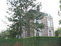
 Villa in Schaesberg
 -
 House in Schaesberg


References
- ^ a b c "Kerncijfers wijken en buurten 2021". Central Bureau of Statistics. Retrieved 24 April 2022.
- ^ "Postcodetool for 6371AA". Actueel Hoogtebestand Nederland (in Dutch). Het Waterschapshuis. Retrieved 24 April 2022.
- ^ "Schaesberg – (geografische naam)". Etymologiebank (in Dutch). Retrieved 24 April 2022.
- ^ a b c Sabine Broekhoven, & Ronald Stenvert (2003). Schaesberg (in Dutch). Zwolle: Waanders. ISBN 90 400 9623 6. Retrieved 24 April 2022.
- ^ a b c "Schaesberg". Plaatsengids (in Dutch). Retrieved 24 April 2022.
- ^ "station Landgraaf". Stationweb (in Dutch). Retrieved 24 April 2022.
- ^ "Overzicht van de spoorlijn Landgraaf- Simpelveld". Stationweb (in Dutch). Retrieved 24 April 2022.
- ^ Ad van der Meer and Onno Boonstra, Repertorium van Nederlandse gemeenten, KNAW, 2011.
External links
 Media related to Schaesberg at Wikimedia Commons
Authority control databases | |
|---|---|
| International |
|
| Geographic |
|


