Putnam County Trailway
| Putnam County Trailway | |
|---|---|
 | |
| Length | 12 mi (19 km) |
| Location | Putnam County New York |
| Trailheads | Baldwin Place, New York Brewster, New York |
| Use | Hiking, Bicycling |
| Website | Putnam County Department of Parks and Recreation |
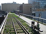
The Putnam County Trailway is a paved 12-mile (19 km) bicycle and pedestrian trail in Putnam County, New York. With few exceptions, it follows the former right-of-way of the New York and Putnam Railroad from the northern end of the North County Trailway at the Putnam County line in Baldwin Place north, then east, to Carmel. In 2011 the trail was extended east to Brewster.[1] In late summer 2018, a final section bypassing portions of Putnam Ave in Brewster, which was formerly closed off with construction barriers and signs, has been opened. The Brewster station of the Metro-North Railroad is a short distance away.
The trail is also a part of the statewide Empire State Trail, connecting the North County Trailway to the Maybrook Trailway.
The Putnam County Trailway features mile markers giving the distance along the original railroad right of way from its former southern terminus in New York City. Marker 42.2 is located at Baldwin place, and marker 53 is visible shortly before the northern end of the trail.
References
- ^ Traillink.com Carmel to Brewster completed
External links
- Putnam Trailway, Putnam County Department of Planning
- Trailways/Shared Use Paths and Greenway Systems
- v
- t
- e
Rail trails in New York by county

- Genesee Valley Greenway
- Lehigh Valley Trail
- Webster Hojack Trail
- Maybrook Trailway
- Putnam County Trailway
- Kings Park Hike and Bike Trail
- Long Pond Greenbelt Trail
- Northport Rail Trail
- North Shore Rail Trail
 | This article about a location in Putnam County, New York is a stub. You can help Wikipedia by expanding it. |
- v
- t
- e
 | This United States trail or long-distance path–related article is a stub. You can help Wikipedia by expanding it. |
- v
- t
- e


