Pulandian, Dalian
You can help expand this article with text translated from the corresponding article in Chinese. (August 2024) Click [show] for important translation instructions.
- View a machine-translated version of the Chinese article.
- Machine translation, like DeepL or Google Translate, is a useful starting point for translations, but translators must revise errors as necessary and confirm that the translation is accurate, rather than simply copy-pasting machine-translated text into the English Wikipedia.
- Do not translate text that appears unreliable or low-quality. If possible, verify the text with references provided in the foreign-language article.
- You must provide copyright attribution in the edit summary accompanying your translation by providing an interlanguage link to the source of your translation. A model attribution edit summary is
Content in this edit is translated from the existing Chinese Wikipedia article at [[:zh:普兰店区]]; see its history for attribution. - You may also add the template
{{Translated|zh|普兰店区}}to the talk page. - For more guidance, see Wikipedia:Translation.
District in Liaoning, People's Republic of China
Pulandian 39°24′32″N 121°58′01″E / 39.409°N 121.967°E / 39.409; 121.967[1] | ||||||||||||||||||||||||||||||||||
|---|---|---|---|---|---|---|---|---|---|---|---|---|---|---|---|---|---|---|---|---|---|---|---|---|---|---|---|---|---|---|---|---|---|---|
| Country | People's Republic of China | |||||||||||||||||||||||||||||||||
| Province | Liaoning | |||||||||||||||||||||||||||||||||
| Sub-provincial city | Dalian | |||||||||||||||||||||||||||||||||
| Seat | No. 12 Fuqian Road (府前路12号) | |||||||||||||||||||||||||||||||||
| Area [2] | ||||||||||||||||||||||||||||||||||
| • Total | 2,769.90 km2 (1,069.46 sq mi) | |||||||||||||||||||||||||||||||||
| Population (2010)[3] | ||||||||||||||||||||||||||||||||||
| • Total | 741,230 | |||||||||||||||||||||||||||||||||
| • Density | 270/km2 (690/sq mi) | |||||||||||||||||||||||||||||||||
| Time zone | UTC+8 (China Standard) | |||||||||||||||||||||||||||||||||
| Postal code | 116200 | |||||||||||||||||||||||||||||||||
| Dalian district map |
| |||||||||||||||||||||||||||||||||
| Division code | 210214 | |||||||||||||||||||||||||||||||||
| Website | www | |||||||||||||||||||||||||||||||||


Pulandian District (simplified Chinese: 普兰店区; traditional Chinese: 普蘭店區; pinyin: Pǔlándiàn Qū) is one of the seven districts under the administration of Dalian, located in the south of Liaoning province, People's Republic of China. Its area is 2,769.90 square kilometres (1,069.46 sq mi) and its permanent population as of 2010[update] is 741,230.[2][3] The district borders the prefecture-level city of Yingkou to the north.
Geography
Pulandian District is located in the northern part of Dalian on the Liaodong Peninsula. It covers an area of 6968 square kilometers. It borders Zhuanghe to the east, Wafangdian to the west, Jinzhou District to the south and Greater Yingkou to the north. Its area is 2923 square kilometres.
Pulandian has a long coast line on the Yellow Sea in its southeastern part and a short coastline on the Bohai Sea in its southwestern part.
Administrative divisions
There are 18 subdistricts under the district's administration.[4]
Subdistricts:
|
|
Climate
| Climate data for Pulandian (1991–2020 normals, extremes 1981–2010) | |||||||||||||
|---|---|---|---|---|---|---|---|---|---|---|---|---|---|
| Month | Jan | Feb | Mar | Apr | May | Jun | Jul | Aug | Sep | Oct | Nov | Dec | Year |
| Record high °C (°F) | 13.0 (55.4) | 13.5 (56.3) | 20.2 (68.4) | 28.0 (82.4) | 35.1 (95.2) | 36.0 (96.8) | 36.1 (97.0) | 35.7 (96.3) | 32.7 (90.9) | 28.9 (84.0) | 22.1 (71.8) | 16.0 (60.8) | 36.1 (97.0) |
| Mean daily maximum °C (°F) | −0.6 (30.9) | 2.6 (36.7) | 8.7 (47.7) | 16.2 (61.2) | 22.5 (72.5) | 26.2 (79.2) | 28.6 (83.5) | 29.1 (84.4) | 25.6 (78.1) | 18.4 (65.1) | 9.3 (48.7) | 1.7 (35.1) | 15.7 (60.3) |
| Daily mean °C (°F) | −6.4 (20.5) | −3.1 (26.4) | 3.1 (37.6) | 10.5 (50.9) | 16.8 (62.2) | 21.2 (70.2) | 24.3 (75.7) | 24.5 (76.1) | 19.7 (67.5) | 12.1 (53.8) | 3.6 (38.5) | −3.8 (25.2) | 10.2 (50.4) |
| Mean daily minimum °C (°F) | −11.0 (12.2) | −7.8 (18.0) | −1.8 (28.8) | 5.5 (41.9) | 11.8 (53.2) | 16.9 (62.4) | 21.0 (69.8) | 20.7 (69.3) | 14.6 (58.3) | 6.7 (44.1) | −1.2 (29.8) | −8.1 (17.4) | 5.6 (42.1) |
| Record low °C (°F) | −24.8 (−12.6) | −21.3 (−6.3) | −12.1 (10.2) | −4.4 (24.1) | 3.2 (37.8) | 9.6 (49.3) | 12.8 (55.0) | 10.1 (50.2) | 1.4 (34.5) | −7.0 (19.4) | −14.3 (6.3) | −21.1 (−6.0) | −24.8 (−12.6) |
| Average precipitation mm (inches) | 3.7 (0.15) | 7.9 (0.31) | 11.4 (0.45) | 34.4 (1.35) | 60.1 (2.37) | 77.7 (3.06) | 134.8 (5.31) | 175.8 (6.92) | 57.7 (2.27) | 32.7 (1.29) | 21.6 (0.85) | 7.1 (0.28) | 624.9 (24.61) |
| Average precipitation days (≥ 0.1 mm) | 2.5 | 2.7 | 3.0 | 5.9 | 7.1 | 9.0 | 10.2 | 9.8 | 6.1 | 5.7 | 4.8 | 3.2 | 70 |
| Average snowy days | 3.9 | 2.8 | 2.0 | 0.4 | 0 | 0 | 0 | 0 | 0 | 0.2 | 2.2 | 4.1 | 15.6 |
| Average relative humidity (%) | 61 | 61 | 59 | 59 | 64 | 75 | 83 | 83 | 75 | 69 | 66 | 64 | 68 |
| Mean monthly sunshine hours | 198.7 | 191.7 | 235.5 | 240.3 | 259.8 | 214.5 | 179.0 | 203.3 | 222.2 | 211.6 | 174.4 | 179.4 | 2,510.4 |
| Percent possible sunshine | 66 | 63 | 63 | 60 | 58 | 48 | 40 | 48 | 60 | 62 | 59 | 62 | 57 |
| Source: China Meteorological Administration[5][6] | |||||||||||||
| Climate data for Pikouzhen, Pulandian (1991–2020 normals, extremes 1981–2010) | |||||||||||||
|---|---|---|---|---|---|---|---|---|---|---|---|---|---|
| Month | Jan | Feb | Mar | Apr | May | Jun | Jul | Aug | Sep | Oct | Nov | Dec | Year |
| Record high °C (°F) | 8.5 (47.3) | 13.6 (56.5) | 18.2 (64.8) | 27.2 (81.0) | 30.6 (87.1) | 34.2 (93.6) | 34.8 (94.6) | 34.9 (94.8) | 31.6 (88.9) | 27.7 (81.9) | 19.4 (66.9) | 12.1 (53.8) | 34.9 (94.8) |
| Mean daily maximum °C (°F) | −0.8 (30.6) | 1.7 (35.1) | 7.0 (44.6) | 14.0 (57.2) | 20.0 (68.0) | 23.0 (73.4) | 26.2 (79.2) | 27.6 (81.7) | 24.3 (75.7) | 17.7 (63.9) | 9.0 (48.2) | 1.0 (33.8) | 14.2 (57.6) |
| Daily mean °C (°F) | −6.0 (21.2) | −3.2 (26.2) | 2.7 (36.9) | 9.6 (49.3) | 15.7 (60.3) | 19.8 (67.6) | 23.4 (74.1) | 24.3 (75.7) | 19.8 (67.6) | 12.6 (54.7) | 4.2 (39.6) | −3.7 (25.3) | 9.9 (49.9) |
| Mean daily minimum °C (°F) | −10.0 (14.0) | −7.1 (19.2) | −1.2 (29.8) | 5.7 (42.3) | 12.0 (53.6) | 17.1 (62.8) | 21.1 (70.0) | 21.2 (70.2) | 15.4 (59.7) | 7.9 (46.2) | −0.1 (31.8) | −7.5 (18.5) | 6.2 (43.2) |
| Record low °C (°F) | −21.5 (−6.7) | −19.9 (−3.8) | −11.2 (11.8) | −2.9 (26.8) | 3.0 (37.4) | 9.6 (49.3) | 15.7 (60.3) | 11.6 (52.9) | 2.5 (36.5) | −5.0 (23.0) | −13.3 (8.1) | −18.7 (−1.7) | −21.5 (−6.7) |
| Average precipitation mm (inches) | 3.3 (0.13) | 11.7 (0.46) | 15.0 (0.59) | 39.3 (1.55) | 67.6 (2.66) | 74.2 (2.92) | 125.5 (4.94) | 180.5 (7.11) | 53.6 (2.11) | 30.6 (1.20) | 29.0 (1.14) | 8.6 (0.34) | 638.9 (25.15) |
| Average precipitation days (≥ 0.1 mm) | 2.6 | 2.7 | 3.4 | 5.9 | 7.5 | 8.8 | 10.8 | 10.0 | 6.8 | 5.3 | 5.4 | 3.3 | 72.5 |
| Average snowy days | 3.3 | 2.5 | 2.0 | 0.5 | 0 | 0 | 0 | 0 | 0 | 0.1 | 1.4 | 3.4 | 13.2 |
| Average relative humidity (%) | 56 | 58 | 60 | 63 | 68 | 82 | 86 | 84 | 74 | 66 | 63 | 60 | 68 |
| Mean monthly sunshine hours | 196.8 | 189.4 | 228.9 | 235.1 | 248.6 | 200.4 | 171.1 | 205.4 | 224.1 | 213.9 | 168.6 | 172.1 | 2,454.4 |
| Percent possible sunshine | 65 | 62 | 62 | 59 | 56 | 45 | 38 | 49 | 61 | 63 | 57 | 59 | 56 |
| Source: China Meteorological Administration[5][7] | |||||||||||||
Demography
Pulandian has a population of 915,595.(est. 2015)
Economy
Pulandian's industries are agriculture, fishing and the three main manufacturing industries: fabrics, electric machinery and food.
Transportation
- Harbin-Shenyang-Dalian Railway
- Harbin-Shenyang-Dalian High Speed Railway (to be completed in 2013)[needs update]
- Shenyang-Dalian Expressway
References
- ^ "Pulandian" (Map). Google Maps. Retrieved 2014-07-02.
- ^ a b Dalian Statistical Yearbook 2012 (《大连统计年鉴2012》). Accessed 8 July 2014.
- ^ a b 2010 Census county-by-county statistics (《中国2010年人口普查分县资料》). Accessed 8 July 2014.
- ^ 大连市-行政区划网
- ^ a b 中国气象数据网 – WeatherBk Data (in Simplified Chinese). China Meteorological Administration. Retrieved 29 July 2023.
- ^ "Experience Template" 中国气象数据网 (in Simplified Chinese). China Meteorological Administration. Retrieved 29 July 2023.
- ^ "Experience Template" 中国气象数据网 (in Simplified Chinese). China Meteorological Administration. Retrieved 29 July 2023.
External links
- Pulandian Government website
- Dalian Government website
- v
- t
- e
| Shenyang | |
|---|---|
| Dalian |
| Anshan | |
|---|---|
| Fushun | |
| Benxi | |
| Dandong | |
| Jinzhou | |
| Yingkou | |
| Fuxin | |
| Liaoyang | |
| Panjin | |
| Tieling | |
| Chaoyang | |
| Huludao |
Sub-provincial City of Dalian | ||
|---|---|---|
| Districts | 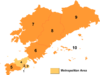 | |
| County-level cities | ||
| Counties | ||
| Landmarks | ||
| Culture & demographics | ||
| Education | ||
| Transport | ||
^* Not a formal subdivision | ||
 | This Liaoning location article is a stub. You can help Wikipedia by expanding it. |
- v
- t
- e


