Ponta do Sinó Lighthouse
Lighthouse
16°35′20.37″N 22°55′17.39″W / 16.5889917°N 22.9214972°W / 16.5889917; -22.92149722014 (second)
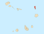
Farol da Ponta do Sinó is a lighthouse near Ponta do Sinó, the southernmost point of the island of Sal, Cape Verde.[2] It is around 2 km southwest of the center of Santa Maria. The tower is quadrangular and is 9 meters tall and is made out of concrete, it has an outer staircase and features a lantern. All of the exterior are painted in white.[2] The lighthouse was built in 1892. In early 2013, a second building with the same style was constructed and was finished before 2014 and became activated as the lighthouse moved to its new location.[citation needed]
See also
References
- ^ a b c d List of Lights, Pub. 113: The West Coasts of Europe and Africa, the Mediterranean Sea, Black Sea and Azovskoye More (Sea of Azov) (PDF). List of Lights. United States National Geospatial-Intelligence Agency. 2018. p. 426.
- ^ a b Rowlett, Russ. "Lighthouses of Cape Verde". The Lighthouse Directory. University of North Carolina at Chapel Hill. Retrieved 15 August 2018.
External links
Wikimedia Commons has media related to Ponta do Sinó Lighthouse.
- "ARLHS World List of Lights (WLOL)". Amateur Radio Lighthouse Society.
Portals:
 Africa
 Engineering


- v
- t
- e
The island of Sal, Cape Verde
- Espargos
- Murdeira
- Palmeira
- Pedra de Lume
- Santa Maria
- Terra Boa
- Morrinho de Açúcar
- Cagarral
- Monte Curral
- Monte Grande
- Rabo de Junco
- Serra Negra
- Ponta da Fragata
- Ponta do Leme Velho
- Ponta Norte
- Ponta Preta (Northern Sal)
- Ponta Preta (Southern Sal)
- Ponta do Sinó
- Ponta de Vera Cruz
| |
|---|---|
| |
 Africa portal Africa portal |
| Authority control databases: Geographic |
|
|---|


