Ouled Sellam
Place in Batna, Algeria
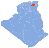
0°49′32″N 5°52′56″E / 0.82556°N 5.88222°E / 0.82556; 5.88222Ouled Sellam council "Commune" is situated in north-eastern Algeria, about 70 km on the RN77 way north-west of Batna province by the borders with "Setif". The main village is called M'cil, where the local council and schools are, also a hospital and a football stadium.
 Algeria portal

- v
- t
- e
 Batna Province
Capital: Batna
- Aïn Djasser
- Aïn Touta
- Arris
- Barika
- Batna
- Bouzina
- Chemora
- Djezar
- El Madher
- Ichmoul
- Menaâ
- Merouana
- N'Gaous
- Ouled Si Slimane
- Ras El Aioun
- Seggana
- Seriana
- T'Kout
- Tazoult
- Théniet El Abed
- Timgad
- Aïn Djasser
- Aïn Touta
- Aïn Yagout
- Amdoukal
- Arris
- Barika
- Batna
- Ben Foudhala El Hakania
- Bitam
- Boulhilat
- Boumagueur
- Boumia
- Bouzina
- Djerma
- Djezar
- Draa Etine
- El Hassi
- El Madher
- Fesdis
- Foum Toub
- Ghassira
- Chemora
- Gosbat
- Guigba
- Hayat
- Hidoussa
- Ichmoul
- Inoughissen
- Kimmel
- Ksar Bellezma
- Larbaa
- Lazrou
- Lemsane
- Maâfa
- Menaâ
- Merouana
- Metkaouak
- N'Gaous
- Chir
- Oued Chaaba
- Oued El Ma
- Oued Taga
- Ouled Ammar
- Ouled Aouf
- Ouled Fadel
- Ouled Sellam
- Ouled Si Slimane
- Ouyoun El Assafir
- Rahbat
- Ras El Aioun
- Sefiane
- Seggana
- Seriana
- Talkhamt
- Taxlent
- Tazoult
- Teniet El Abed
- Tighanimine
- Tigherghar
- Tilatou
- Timgad
- Tkoutt
- Zanat El Beida
35°49′32″N 5°52′56″E / 35.82556°N 5.88222°E / 35.82556; 5.88222
 | This article about a location in Batna Province is a stub. You can help Wikipedia by expanding it. |
- v
- t
- e


