Mount Dom Dom
Mountain in Victoria, Australia


Mount Dom Dom
Victoria, Australia
Mount Dom Dom is a mountain in Victoria, Australia 65 km from Melbourne.
Mount Dom Dom was the site of a plane crash involving a Cessna 210 aircraft on 18 June 1974 during stormy weather.[1]
An extensive search was conducted by Victoria police, emergency services (including the SES and CFA) and volunteers (including BSAR) on and around Mount Dom Dom over five days for a hiker who went missing on Sunday 23 March 2008.[2]
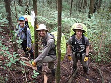
The summit of Mount Dom Dom is most easily accessed by following the Dom Dom Road (a vehicle track) from Dom Dom saddle then ascending an ill-defined walking track north from the Dom Dom Road to the summit.
See also
 Australia portal
 Mountains portal


- Alpine National Park
- List of mountains in Victoria
- List of reduplicated Australian place names
References
- ^ "Mount Dom Dom, Vic: Light Aircraft Crash". Emergency Management Australia. Australian Government. Archived from the original on 20 September 2008. Retrieved 28 February 2010.
{{cite web}}: CS1 maint: unfit URL (link) - ^ "Search continues for lost hiker". The Age. 27 March 2008. Retrieved 28 February 2010.
- v
- t
- e
- William (1,167 m or 3,829 ft)
- Difficult
- Wilson
- Zero (364 m or 1,194 ft)
| Bogong High Plains |
|
|---|---|
| Cathedral Range |
|
| Cobberas Range |
|
| Cobbler Plateau |
|
| Other |
|
mountain ranges
| Central Highlands |
|
|---|---|
| Dandenong Ranges |
|
| Pyrenees Ranges |
|
| Strzelecki Ranges |
|
| Other |
|
 | This article about a location in Victoria, Australia is a stub. You can help Wikipedia by expanding it. |
- v
- t
- e


