List of listed buildings in Edinkillie, Moray
This is a list of listed buildings in the parish of Edinkillie in Moray, Scotland.
Map all coordinates using OpenStreetMap
Download coordinates as:
- KML
- GPX (all coordinates)
- GPX (primary coordinates)
- GPX (secondary coordinates)
List
| Name | Location | Date Listed | Grid Ref. [note 1] | Geo-coordinates | Notes | LB Number [note 2] | Image |
|---|---|---|---|---|---|---|---|
| 43 Conicavel (Dowans) 43B Conicavel (Sharpies) | 57°33′36″N 3°40′48″W / 57.560097°N 3.680082°W / 57.560097; -3.680082 (43 Conicavel (Dowans) 43B Conicavel (Sharpies)) | Category B | 2164 |  Upload Photo | |||
| Dounduff Lodge | 57°31′53″N 3°41′00″W / 57.531503°N 3.683209°W / 57.531503; -3.683209 (Dounduff Lodge) | Category C(S) | 2169 | Upload Photo | |||
| Dunphail Castle | 57°30′44″N 3°39′33″W / 57.512183°N 3.659165°W / 57.512183; -3.659165 (Dunphail Castle) | Category C(S) | 2170 | Upload Photo | |||
| Edinkillie Railway Viaduct (Divie Viaduct) Over River Divie | 57°29′53″N 3°38′01″W / 57.497944°N 3.633621°W / 57.497944; -3.633621 (Edinkillie Railway Viaduct (Divie Viaduct) Over River Divie) | Category B | 2189 | Upload Photo | |||
| Sluie Mains Cottages | 57°33′09″N 3°39′38″W / 57.552366°N 3.660674°W / 57.552366; -3.660674 (Sluie Mains Cottages) | Category B | 2196 | Upload Photo | |||
| Edinkillie, Bantrach Bridge Over River Divie | 57°29′41″N 3°37′31″W / 57.494818°N 3.625272°W / 57.494818; -3.625272 (Edinkillie, Bantrach Bridge Over River Divie) | Category C(S) | 2186 | Upload Photo | |||
| Logie House, Garage (Motor House) | 57°32′03″N 3°39′40″W / 57.534034°N 3.661093°W / 57.534034; -3.661093 (Logie House, Garage (Motor House)) | Category B | 2192 | Upload Photo | |||
| Edinkillie House (Former Edinkillie Church Of Scotland Manse) | 57°29′55″N 3°38′10″W / 57.49855°N 3.636051°W / 57.49855; -3.636051 (Edinkillie House (Former Edinkillie Church Of Scotland Manse)) | Category A | 2188 | 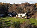 Upload another image | |||
| Logie Bridge Over River Divie | 57°31′38″N 3°39′56″W / 57.527172°N 3.665674°W / 57.527172; -3.665674 (Logie Bridge Over River Divie) | Category B | 2190 | Upload Photo | |||
| Logie House | 57°32′11″N 3°39′40″W / 57.536503°N 3.661206°W / 57.536503; -3.661206 (Logie House) | Category B | 2191 | Upload Photo | |||
| Dunphail House | 57°30′35″N 3°39′14″W / 57.509646°N 3.653925°W / 57.509646; -3.653925 (Dunphail House) | Category A | 2171 | Upload Photo | |||
| Edinkillie Parish Church (Church Of Scotland), Watch House And Burial Ground | 57°29′55″N 3°38′15″W / 57.498739°N 3.637445°W / 57.498739; -3.637445 (Edinkillie Parish Church (Church Of Scotland), Watch House And Burial Ground) | Category B | 2187 | Upload Photo | |||
| Berryley Farmhouse And Steading | 57°35′03″N 3°40′30″W / 57.584171°N 3.674903°W / 57.584171; -3.674903 (Berryley Farmhouse And Steading) | Category C(S) | 2159 | Upload Photo | |||
| 38 Conicavel, Bunties | 57°33′34″N 3°40′51″W / 57.559529°N 3.680892°W / 57.559529; -3.680892 (38 Conicavel, Bunties) | Category C(S) | 2162 | Upload Photo | |||
| Newton Of Darnaway Farmhouse | 57°33′44″N 3°41′32″W / 57.562305°N 3.692321°W / 57.562305; -3.692321 (Newton Of Darnaway Farmhouse) | Category B | 2194 | Upload Photo | |||
| Bridge Of Knocklach Over Knocklach Burn | 57°29′13″N 3°39′22″W / 57.48687°N 3.656065°W / 57.48687; -3.656065 (Bridge Of Knocklach Over Knocklach Burn) | Category C(S) | 2161 | Upload Photo | |||
| 41, 41B Conicavel | 57°33′35″N 3°40′50″W / 57.559813°N 3.680487°W / 57.559813; -3.680487 (41, 41B Conicavel) | Category B | 2163 | Upload Photo | |||
| Dounduff Farmhouse | 57°31′27″N 3°40′57″W / 57.524245°N 3.682457°W / 57.524245; -3.682457 (Dounduff Farmhouse) | Category C(S) | 2168 | Upload Photo | |||
| 44, 45 Conicavel | 57°33′37″N 3°40′47″W / 57.560309°N 3.679674°W / 57.560309; -3.679674 (44, 45 Conicavel) | Category B | 2165 | Upload Photo | |||
| Dunphail Mains Farmhouse And Former Cartshed/Grannary | 57°30′50″N 3°39′22″W / 57.513841°N 3.656035°W / 57.513841; -3.656035 (Dunphail Mains Farmhouse And Former Cartshed/Grannary) | Category B | 2172 | Upload Photo | |||
| Sluie Lodge | 57°33′05″N 3°39′05″W / 57.551311°N 3.651435°W / 57.551311; -3.651435 (Sluie Lodge) | Category B | 2195 | Upload Photo | |||
| Daltullich Bridge Over River Findhorn | 57°31′05″N 3°41′39″W / 57.51816°N 3.694099°W / 57.51816; -3.694099 (Daltullich Bridge Over River Findhorn) | Category B | 2166 | Upload Photo | |||
| Dava Bridge Over Dorback Burn | 57°25′49″N 3°39′34″W / 57.430289°N 3.659404°W / 57.430289; -3.659404 (Dava Bridge Over Dorback Burn) | Category C(S) | 2167 | Upload Photo | |||
| Edinkillie Bridge Over River Divie (Bridge Of Divie) | 57°29′55″N 3°38′18″W / 57.498637°N 3.638408°W / 57.498637; -3.638408 (Edinkillie Bridge Over River Divie (Bridge Of Divie)) | Category B | 2185 | Upload Photo | |||
| Logie House, North Lodge And Gatepiers | 57°32′37″N 3°39′13″W / 57.543653°N 3.653728°W / 57.543653; -3.653728 (Logie House, North Lodge And Gatepiers) | Category C(S) | 2193 | Upload Photo | |||
| Braemoray Lodge | 57°27′53″N 3°40′20″W / 57.464673°N 3.672216°W / 57.464673; -3.672216 (Braemoray Lodge) | Category C(S) | 2160 | Upload Photo |
Key
The scheme for classifying buildings in Scotland is:
- Category A: "buildings of national or international importance, either architectural or historic; or fine, little-altered examples of some particular period, style or building type."[1]
- Category B: "buildings of regional or more than local importance; or major examples of some particular period, style or building type, which may have been altered."[1]
- Category C: "buildings of local importance; lesser examples of any period, style, or building type, as originally constructed or moderately altered; and simple traditional buildings which group well with other listed buildings."[1]
In March 2016 there were 47,288 listed buildings in Scotland. Of these, 8% were Category A, and 50% were Category B, with the remaining 42% being Category C.[2]
See also
Notes
- ^ Sometimes known as OSGB36, the grid reference (where provided) is based on the British national grid reference system used by the Ordnance Survey.
• "Guide to National Grid". Ordnance Survey. Retrieved 12 December 2007.
• "Get-a-map". Ordnance Survey. Retrieved 17 December 2007. - ^ Historic Environment Scotland assign a unique alphanumeric identifier to each designated site in Scotland, for listed buildings this always begins with "LB", for example "LB12345".
References
- All entries, addresses and coordinates are based on data from Historic Scotland. This data falls under the Open Government Licence
- ^ a b c "What is Listing?". Historic Environment Scotland. Retrieved 29 May 2018.
- ^ Scotland's Historic Environment Audit 2016 (PDF). Historic Environment Scotland and the Built Environment Forum Scotland. pp. 15–16. Retrieved 29 May 2018.


