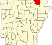
List of lakes of Randolph County, Arkansas
Map all coordinates using OpenStreetMap
Download coordinates as:
- KML
- GPX (all coordinates)
- GPX (primary coordinates)
- GPX (secondary coordinates)
There are at least 33 named lakes and reservoirs in Randolph County, Arkansas.
Lakes
- Brown Lake, 36°10′49″N 091°00′09″W / 36.18028°N 91.00250°W / 36.18028; -91.00250 (Brown Lake), el. 246 feet (75 m) [1]
- Bull Pizzle Lake, 36°11′09″N 091°00′57″W / 36.18583°N 91.01583°W / 36.18583; -91.01583 (Bull Pizzle Lake), el. 249 feet (76 m) [2]
- Dishpan Lake, 36°14′42″N 090°58′17″W / 36.24500°N 90.97139°W / 36.24500; -90.97139 (Dishpan Lake), el. 256 feet (78 m) [3]
- Gas Plant Lake, 36°19′19″N 090°49′59″W / 36.32194°N 90.83306°W / 36.32194; -90.83306 (Gas Plant Lake), el. 262 feet (80 m) [4]
- Horseshoe Lake, 36°13′50″N 090°59′16″W / 36.23056°N 90.98778°W / 36.23056; -90.98778 (Horseshoe Lake), el. 249 feet (76 m) [5]
- Legate Lake, 36°20′36″N 090°48′31″W / 36.34333°N 90.80861°W / 36.34333; -90.80861 (Legate Lake), el. 266 feet (81 m) [6]
- Looney Lake, 36°22′18″N 091°06′37″W / 36.37167°N 91.11028°W / 36.37167; -91.11028 (Looney Lake), el. 318 feet (97 m) [7]
- McGuire Lake, 36°23′31″N 090°45′36″W / 36.39194°N 90.76000°W / 36.39194; -90.76000 (McGuire Lake), el. 269 feet (82 m) [8]
- Old River Island Lake, 36°21′54″N 090°46′22″W / 36.36500°N 90.77278°W / 36.36500; -90.77278 (Old River Island Lake), el. 272 feet (83 m) [9]
- Old River Slough, 36°15′35″N 090°57′12″W / 36.25972°N 90.95333°W / 36.25972; -90.95333 (Old River Slough), el. 249 feet (76 m) [10]
- Peachtree Lake, 36°20′54″N 090°48′04″W / 36.34833°N 90.80111°W / 36.34833; -90.80111 (Peachtree Lake), el. 256 feet (78 m) [11]
- Round Lake, 36°08′16″N 091°04′05″W / 36.13778°N 91.06806°W / 36.13778; -91.06806 (Round Lake), el. 243 feet (74 m) [12]
- Schnabaum Lake, 36°17′18″N 090°51′56″W / 36.28833°N 90.86556°W / 36.28833; -90.86556 (Schnabaum Lake), el. 253 feet (77 m) [13]
- Shakybog Lake, 36°13′30″N 090°59′32″W / 36.22500°N 90.99222°W / 36.22500; -90.99222 (Shakybog Lake), el. 259 feet (79 m) [14]
- Sparkman Lake, 36°18′17″N 090°50′48″W / 36.30472°N 90.84667°W / 36.30472; -90.84667 (Sparkman Lake), el. 272 feet (83 m) [15]
- Straight Lake, 36°08′31″N 091°04′19″W / 36.14194°N 91.07194°W / 36.14194; -91.07194 (Straight Lake), el. 246 feet (75 m) [16]
- Sumac Lake, 36°21′11″N 090°47′36″W / 36.35306°N 90.79333°W / 36.35306; -90.79333 (Sumac Lake), el. 262 feet (80 m) [17]
- Wilson Lake, 36°09′33″N 091°01′42″W / 36.15917°N 91.02833°W / 36.15917; -91.02833 (Wilson Lake), el. 249 feet (76 m) [18]
- Winebaugh Lake, 36°13′55″N 090°58′29″W / 36.23194°N 90.97472°W / 36.23194; -90.97472 (Winebaugh Lake), el. 256 feet (78 m) [19]
Reservoirs
- Allison Lake, 36°12′47″N 091°02′26″W / 36.21306°N 91.04056°W / 36.21306; -91.04056 (Allison Lake), el. 354 feet (108 m) [20]
- Baltz Lake, 36°16′34″N 090°57′42″W / 36.27611°N 90.96167°W / 36.27611; -90.96167 (Baltz Lake), el. 269 feet (82 m) [21]
- Bates Lake, 36°17′10″N 090°58′49″W / 36.28611°N 90.98028°W / 36.28611; -90.98028 (Bates Lake), el. 315 feet (96 m) [22]
- Bibb Fish Pond, 36°11′42″N 091°03′42″W / 36.19500°N 91.06167°W / 36.19500; -91.06167 (Bibb Fish Pond), el. 331 feet (101 m) [23]
- Blue Basin Lake, 36°15′29″N 091°03′19″W / 36.25806°N 91.05528°W / 36.25806; -91.05528 (Blue Basin Lake), el. 335 feet (102 m) [24]
- Fourche Creek Site 16 Reservoir, 36°26′48″N 091°02′18″W / 36.44667°N 91.03833°W / 36.44667; -91.03833 (Fourche Creek Site 16 Reservoir), el. 459 feet (140 m) [25]
- Fourche Creek Site 17 Reservoir, 36°25′37″N 091°00′44″W / 36.42694°N 91.01222°W / 36.42694; -91.01222 (Fourche Creek Site 17 Reservoir), el. 397 feet (121 m) [26]
- Fourche Creek Site 18 Reservoir, 36°24′01″N 091°02′04″W / 36.40028°N 91.03444°W / 36.40028; -91.03444 (Fourche Creek Site 18 Reservoir), el. 351 feet (107 m) [27]
- Kilo-Vista Lake, 36°14′11″N 091°04′57″W / 36.23639°N 91.08250°W / 36.23639; -91.08250 (Kilo-Vista Lake), el. 285 feet (87 m) [28]
- Lemmons Lake, 36°10′45″N 091°04′19″W / 36.17917°N 91.07194°W / 36.17917; -91.07194 (Lemmons Lake), el. 276 feet (84 m) [29]
- Lost Lake, 36°19′57″N 091°04′28″W / 36.33250°N 91.07444°W / 36.33250; -91.07444 (Lost Lake), el. 394 feet (120 m) [30]
- Meadows Lake, 36°29′19″N 091°02′17″W / 36.48861°N 91.03806°W / 36.48861; -91.03806 (Meadows Lake), el. 449 feet (137 m) [31]
- R J Barnett Lake, 36°24′06″N 090°50′30″W / 36.40167°N 90.84167°W / 36.40167; -90.84167 (R J Barnett Lake), el. 308 feet (94 m) [32]
- Wallace Lake, 36°24′53″N 091°02′41″W / 36.41472°N 91.04472°W / 36.41472; -91.04472 (Wallace Lake), el. 420 feet (130 m) [33]
See also
Notes
- ^ "Brown Lake". Geographic Names Information System. United States Geological Survey, United States Department of the Interior.
- ^ "Bull Pizzle Lake". Geographic Names Information System. United States Geological Survey, United States Department of the Interior.
- ^ "Dishpan Lake". Geographic Names Information System. United States Geological Survey, United States Department of the Interior.
- ^ "Gas Plant Lake". Geographic Names Information System. United States Geological Survey, United States Department of the Interior.
- ^ "Horseshoe Lake". Geographic Names Information System. United States Geological Survey, United States Department of the Interior.
- ^ "Legate Lake". Geographic Names Information System. United States Geological Survey, United States Department of the Interior.
- ^ "Looney Lake". Geographic Names Information System. United States Geological Survey, United States Department of the Interior.
- ^ "McGuire Lake". Geographic Names Information System. United States Geological Survey, United States Department of the Interior.
- ^ "Old River Island Lake". Geographic Names Information System. United States Geological Survey, United States Department of the Interior.
- ^ "Old River Slough". Geographic Names Information System. United States Geological Survey, United States Department of the Interior.
- ^ "Peachtree Lake". Geographic Names Information System. United States Geological Survey, United States Department of the Interior.
- ^ "Round Lake". Geographic Names Information System. United States Geological Survey, United States Department of the Interior.
- ^ "Schnabaum Lake". Geographic Names Information System. United States Geological Survey, United States Department of the Interior.
- ^ "Shakybog Lake". Geographic Names Information System. United States Geological Survey, United States Department of the Interior.
- ^ "Sparkman Lake". Geographic Names Information System. United States Geological Survey, United States Department of the Interior.
- ^ "Straight Lake". Geographic Names Information System. United States Geological Survey, United States Department of the Interior.
- ^ "Sumac Lake". Geographic Names Information System. United States Geological Survey, United States Department of the Interior.
- ^ "Wilson Lake". Geographic Names Information System. United States Geological Survey, United States Department of the Interior.
- ^ "Winebaugh Lake". Geographic Names Information System. United States Geological Survey, United States Department of the Interior.
- ^ "Allison Lake". Geographic Names Information System. United States Geological Survey, United States Department of the Interior.
- ^ "Baltz Lake". Geographic Names Information System. United States Geological Survey, United States Department of the Interior.
- ^ "Bates Lake". Geographic Names Information System. United States Geological Survey, United States Department of the Interior.
- ^ "Bibb Fish Pond". Geographic Names Information System. United States Geological Survey, United States Department of the Interior.
- ^ "Blue Basin Lake". Geographic Names Information System. United States Geological Survey, United States Department of the Interior.
- ^ "Fourche Creek Site 16 Reservoir". Geographic Names Information System. United States Geological Survey, United States Department of the Interior.
- ^ "Fourche Creek Site 17 Reservoir". Geographic Names Information System. United States Geological Survey, United States Department of the Interior.
- ^ "Fourche Creek Site 18 Reservoir". Geographic Names Information System. United States Geological Survey, United States Department of the Interior.
- ^ "Kilo-Vista Lake". Geographic Names Information System. United States Geological Survey, United States Department of the Interior.
- ^ "Lemmons Lake". Geographic Names Information System. United States Geological Survey, United States Department of the Interior.
- ^ "Lost Lake". Geographic Names Information System. United States Geological Survey, United States Department of the Interior.
- ^ "Meadows Lake". Geographic Names Information System. United States Geological Survey, United States Department of the Interior.
- ^ "R J Barnett Lake". Geographic Names Information System. United States Geological Survey, United States Department of the Interior.
- ^ "Wallace Lake". Geographic Names Information System. United States Geological Survey, United States Department of the Interior.
- v
- t
- e
Municipalities and communities of Randolph County, Arkansas, United States
County seat: Pocahontas
communities
- Arkansas portal
- United States portal


