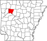
List of lakes of Johnson County, Arkansas
Map all coordinates using OpenStreetMap
Download coordinates as:
- KML
- GPX (all coordinates)
- GPX (primary coordinates)
- GPX (secondary coordinates)
There are at least 6 named lakes and reservoirs in Johnson County, Arkansas.

Lakes
- Hartman Lake, 35°25′01″N 093°38′20″W / 35.41694°N 93.63889°W / 35.41694; -93.63889 (Hartman Lake), el. 344 feet (105 m) [1]
Reservoirs
- Harris Pond, 35°25′10″N 093°22′44″W / 35.41944°N 93.37889°W / 35.41944; -93.37889 (Harris Pond), el. 404 feet (123 m) [2]
- Horsehead Lake, 35°33′36″N 093°37′31″W / 35.56000°N 93.62528°W / 35.56000; -93.62528 (Horsehead Lake), el. 673 feet (205 m) [3]
- Lake Ludwig, 35°32′09″N 093°26′48″W / 35.53583°N 93.44667°W / 35.53583; -93.44667 (Lake Ludwig), el. 551 feet (168 m) [4]
- Lake Dardanelle, 35°21′14″N 093°23′46″W / 35.35389°N 93.39611°W / 35.35389; -93.39611 (Lake Dardanelle), el. 338 feet (103 m) [5]
- Lake Ozone, 35°39′00″N 093°24′37″W / 35.65000°N 93.41028°W / 35.65000; -93.41028 (Lake Ozone), el. 1,850 feet (560 m) [6]
See also
 United States portal

Notes
- ^ "Hartman Lake". Geographic Names Information System. United States Geological Survey, United States Department of the Interior.
- ^ "Harris Pond". Geographic Names Information System. United States Geological Survey, United States Department of the Interior.
- ^ "Horsehead Lake". Geographic Names Information System. United States Geological Survey, United States Department of the Interior.
- ^ "Lake Ludwig". Geographic Names Information System. United States Geological Survey, United States Department of the Interior.
- ^ "Lake Dardanelle". Geographic Names Information System. United States Geological Survey, United States Department of the Interior.
- ^ "Lake Ozone". Geographic Names Information System. United States Geological Survey, United States Department of the Interior.