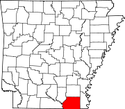
List of lakes of Ashley County, Arkansas
Map all coordinates using OpenStreetMap
Download coordinates as:
- KML
- GPX (all coordinates)
- GPX (primary coordinates)
- GPX (secondary coordinates)
There are at least 23 named lakes and reservoirs in Ashley County, Arkansas.
Lakes
- Anthony Lake, 33°11′02″N 091°34′13″W / 33.18389°N 91.57028°W / 33.18389; -91.57028 (Anthony Lake), el. 112 feet (34 m) [1]
- Clear Lake, 33°18′29″N 091°58′24″W / 33.30806°N 91.97333°W / 33.30806; -91.97333 (Clear Lake), el. 82 feet (25 m) [2]
- Coffee Lake, 33°02′43″N 092°04′06″W / 33.04528°N 92.06833°W / 33.04528; -92.06833 (Coffee Lake), el. 62 feet (19 m) [3]
- Cooley Lake, 33°02′09″N 092°05′26″W / 33.03583°N 92.09056°W / 33.03583; -92.09056 (Cooley Lake), el. 56 feet (17 m) [4]
- Lake Enterprise, 33°03′32″N 091°35′36″W / 33.05889°N 91.59333°W / 33.05889; -91.59333 (Lake Enterprise), el. 102 feet (31 m) [5]
- Lake Georgia Pacific, 33°15′13″N 092°02′42″W / 33.25361°N 92.04500°W / 33.25361; -92.04500 (Lake Georgia Pacific), el. 66 feet (20 m) [6]
- Lake Lingo, 33°16′12″N 091°31′04″W / 33.27000°N 91.51778°W / 33.27000; -91.51778 (Lake Lingo), el. 125 feet (38 m) [7]
- Marais Saline, 33°09′50″N 092°06′46″W / 33.16389°N 92.11278°W / 33.16389; -92.11278 (Marais Saline), el. 69 feet (21 m) [8]
- Mossy Lake, 33°02′33″N 092°04′33″W / 33.04250°N 92.07583°W / 33.04250; -92.07583 (Mossy Lake), el. 62 feet (19 m) [9]
- Mud Lake, 33°15′26″N 092°02′31″W / 33.25722°N 92.04194°W / 33.25722; -92.04194 (Mud Lake), el. 72 feet (22 m) [10]
- Redeye Lake, 33°07′14″N 092°06′33″W / 33.12056°N 92.10917°W / 33.12056; -92.10917 (Redeye Lake), el. 62 feet (19 m) [11]
- Sanders Lake, 33°12′52″N 091°33′47″W / 33.21444°N 91.56306°W / 33.21444; -91.56306 (Sanders Lake), el. 118 feet (36 m) [12]
- Wilson Brake, 33°13′07″N 091°32′00″W / 33.21861°N 91.53333°W / 33.21861; -91.53333 (Wilson Brake), el. 125 feet (38 m) [13]
Reservoirs
- Lake Georgia-Pacific, 33°13′58″N 092°02′04″W / 33.23278°N 92.03444°W / 33.23278; -92.03444 (Lake Georgia-Pacific), el. 85 feet (26 m) [14]
- Lake Granpus, 33°20′24″N 091°33′06″W / 33.34000°N 91.55167°W / 33.34000; -91.55167 (Lake Granpus), el. 125 feet (38 m) [15]
- Lucas Pond, 33°06′55″N 091°58′24″W / 33.11528°N 91.97333°W / 33.11528; -91.97333 (Lucas Pond), el. 141 feet (43 m) [16]
- Mill Pond, 33°06′39″N 092°01′39″W / 33.11083°N 92.02750°W / 33.11083; -92.02750 (Mill Pond), el. 102 feet (31 m) [17]
- Ouachita River Reservoir, 33°01′54″N 092°05′18″W / 33.03167°N 92.08833°W / 33.03167; -92.08833 (Ouachita River Reservoir), el. 69 feet (21 m) [18]
- Riley Lake, 33°21′42″N 091°43′12″W / 33.36167°N 91.72000°W / 33.36167; -91.72000 (Riley Lake), el. 174 feet (53 m) [19]
- Shiloh Lake, 33°20′24″N 091°45′48″W / 33.34000°N 91.76333°W / 33.34000; -91.76333 (Shiloh Lake), el. 197 feet (60 m) [20]
- Stone Lake, 33°18′06″N 091°41′18″W / 33.30167°N 91.68833°W / 33.30167; -91.68833 (Stone Lake), el. 174 feet (53 m) [21]
- Wilson Brake Reservoir, 33°12′58″N 091°32′04″W / 33.21611°N 91.53444°W / 33.21611; -91.53444 (Wilson Brake Reservoir), el. 112 feet (34 m) [22]
- Young Lake, 33°14′00″N 091°37′54″W / 33.23333°N 91.63167°W / 33.23333; -91.63167 (Young Lake), el. 177 feet (54 m) [23]
See also
Notes
- ^ "Anthony Lake". Geographic Names Information System. United States Geological Survey, United States Department of the Interior.
- ^ "Clear Lake". Geographic Names Information System. United States Geological Survey, United States Department of the Interior.
- ^ "Coffee Lake". Geographic Names Information System. United States Geological Survey, United States Department of the Interior.
- ^ "Cooley Lake". Geographic Names Information System. United States Geological Survey, United States Department of the Interior.
- ^ "Lake Enterprise". Geographic Names Information System. United States Geological Survey, United States Department of the Interior.
- ^ "Lake Georgia Pacific". Geographic Names Information System. United States Geological Survey, United States Department of the Interior.
- ^ "Lake Lingo". Geographic Names Information System. United States Geological Survey, United States Department of the Interior.
- ^ "Marais Saline". Geographic Names Information System. United States Geological Survey, United States Department of the Interior.
- ^ "Mossy Lake". Geographic Names Information System. United States Geological Survey, United States Department of the Interior.
- ^ "Mud Lake". Geographic Names Information System. United States Geological Survey, United States Department of the Interior.
- ^ "Redeye Lake". Geographic Names Information System. United States Geological Survey, United States Department of the Interior.
- ^ "Sanders Lake". Geographic Names Information System. United States Geological Survey, United States Department of the Interior.
- ^ "Wilson Brake". Geographic Names Information System. United States Geological Survey, United States Department of the Interior.
- ^ "Lake Georgia-Pacific". Geographic Names Information System. United States Geological Survey, United States Department of the Interior.
- ^ "Lake Granpus". Geographic Names Information System. United States Geological Survey, United States Department of the Interior.
- ^ "Lucas Pond". Geographic Names Information System. United States Geological Survey, United States Department of the Interior.
- ^ "Mill Pond". Geographic Names Information System. United States Geological Survey, United States Department of the Interior.
- ^ "Ouachita River Reservoir". Geographic Names Information System. United States Geological Survey, United States Department of the Interior.
- ^ "Riley Lake". Geographic Names Information System. United States Geological Survey, United States Department of the Interior.
- ^ "Shiloh Lake". Geographic Names Information System. United States Geological Survey, United States Department of the Interior.
- ^ "Stone Lake". Geographic Names Information System. United States Geological Survey, United States Department of the Interior.
- ^ "Wilson Brake Reservoir". Geographic Names Information System. United States Geological Survey, United States Department of the Interior.
- ^ "Young Lake". Geographic Names Information System. United States Geological Survey, United States Department of the Interior.