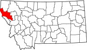
List of lakes of Sanders County, Montana
Map all coordinates using OpenStreetMap
Download coordinates as:
- KML
- GPX (all coordinates)
- GPX (primary coordinates)
- GPX (secondary coordinates)
This list is incomplete; you can help by adding missing items. (February 2011) |
There are at least 66 named lakes and reservoirs in Sanders County, Montana.
Lakes
- Acorn Lake, 47°28′32″N 115°08′53″W / 47.47556°N 115.14806°W / 47.47556; -115.14806 (Acorn Lake), el. 5,991 feet (1,826 m)[1]
- Arrowhead Lake, 47°40′54″N 115°15′42″W / 47.68167°N 115.26167°W / 47.68167; -115.26167 (Arrowhead Lake), el. 5,955 feet (1,815 m)[2]
- Baldy Lake, 47°36′59″N 114°49′09″W / 47.61639°N 114.81917°W / 47.61639; -114.81917 (Baldy Lake), el. 6,729 feet (2,051 m)[3]
- Banana Lake, 47°30′55″N 114°50′26″W / 47.51528°N 114.84056°W / 47.51528; -114.84056 (Banana Lake), el. 3,596 feet (1,096 m)[4]
- Bass Pond, 47°19′02″N 114°48′51″W / 47.31722°N 114.81417°W / 47.31722; -114.81417 (Bass Pond), el. 2,503 feet (763 m)[5]
- Bear Lake, 47°49′39″N 115°22′48″W / 47.82750°N 115.38000°W / 47.82750; -115.38000 (Bear Lake), el. 5,994 feet (1,827 m)[6]
- Beaver Lake, 47°37′37″N 115°41′41″W / 47.62694°N 115.69472°W / 47.62694; -115.69472 (Beaver Lake), el. 5,712 feet (1,741 m)[7]
- Beaver Lake, 47°37′15″N 115°41′28″W / 47.62083°N 115.69111°W / 47.62083; -115.69111 (Beaver Lake), el. 5,797 feet (1,767 m)[8]
- Berry Lake, 47°44′49″N 115°46′50″W / 47.74694°N 115.78056°W / 47.74694; -115.78056 (Berry Lake), el. 5,476 feet (1,669 m)[9]
- Blossom Lakes, 47°33′05″N 115°44′44″W / 47.55139°N 115.74556°W / 47.55139; -115.74556 (Blossom Lakes), el. 5,673 feet (1,729 m)[10]
- Buck Lake, 48°00′28″N 115°34′21″W / 48.00778°N 115.57250°W / 48.00778; -115.57250 (Buck Lake), el. 4,396 feet (1,340 m)[11]
- Burgess Lake, 47°19′59″N 114°39′46″W / 47.33306°N 114.66278°W / 47.33306; -114.66278 (Burgess Lake), el. 2,900 feet (880 m)[12]
- Cabin Lake, 47°42′24″N 115°16′49″W / 47.70667°N 115.28028°W / 47.70667; -115.28028 (Cabin Lake), el. 5,912 feet (1,802 m)[13]
- Carbine Lake, 47°44′03″N 115°16′38″W / 47.73417°N 115.27722°W / 47.73417; -115.27722 (Carbine Lake), el. 6,079 feet (1,853 m)[14]
- Cliff Lake, 48°04′22″N 115°40′41″W / 48.07278°N 115.67806°W / 48.07278; -115.67806 (Cliff Lake), el. 6,713 feet (2,046 m)[15]
- Copper Lake, 48°04′37″N 115°41′04″W / 48.07694°N 115.68444°W / 48.07694; -115.68444 (Copper Lake), el. 6,404 feet (1,952 m)[16]
- Corona Lake, 47°38′25″N 114°51′02″W / 47.64028°N 114.85056°W / 47.64028; -114.85056 (Corona Lake), el. 5,023 feet (1,531 m)[17]
- Crescent Lake, 47°54′15″N 115°12′40″W / 47.90417°N 115.21111°W / 47.90417; -115.21111 (Crescent Lake), el. 4,039 feet (1,231 m)[18]
- Deer Lake, 47°39′21″N 115°15′54″W / 47.65583°N 115.26500°W / 47.65583; -115.26500 (Deer Lake), el. 5,948 feet (1,813 m)[19]
- Duckhead Lake, 47°40′03″N 115°15′59″W / 47.66750°N 115.26639°W / 47.66750; -115.26639 (Duckhead Lake), el. 6,112 feet (1,863 m)[20]
- East Lake, 47°44′13″N 115°46′44″W / 47.73694°N 115.77889°W / 47.73694; -115.77889 (East Lake), el. 5,597 feet (1,706 m)[21]
- Elk Lake, 47°53′58″N 115°23′58″W / 47.89944°N 115.39944°W / 47.89944; -115.39944 (Elk Lake), el. 4,222 feet (1,287 m)[22]
- Engle Lake, 48°00′37″N 115°37′57″W / 48.01028°N 115.63250°W / 48.01028; -115.63250 (Engle Lake), el. 6,092 feet (1,857 m)[23]
- Evans Lake, 47°31′51″N 115°41′19″W / 47.53083°N 115.68861°W / 47.53083; -115.68861 (Evans Lake), el. 5,433 feet (1,656 m)[24]
- Fishtrap Lake, 47°52′07″N 115°11′46″W / 47.86861°N 115.19611°W / 47.86861; -115.19611 (Fishtrap Lake), el. 4,055 feet (1,236 m)[25]
- Frog Lake, 47°41′39″N 115°16′41″W / 47.69417°N 115.27806°W / 47.69417; -115.27806 (Frog Lake), el. 6,040 feet (1,840 m)[26]
- Goat Lakes, 47°38′29″N 115°16′20″W / 47.64139°N 115.27222°W / 47.64139; -115.27222 (Goat Lakes), el. 6,197 feet (1,889 m)[27]
- Grass Lake, 47°41′32″N 115°17′07″W / 47.69222°N 115.28528°W / 47.69222; -115.28528 (Grass Lake), el. 6,152 feet (1,875 m)[28]
- Graves Lake, 47°43′05″N 115°17′22″W / 47.71806°N 115.28944°W / 47.71806; -115.28944 (Graves Lake), el. 6,063 feet (1,848 m)[29]
- Grouse Lake, 47°49′54″N 115°23′09″W / 47.83167°N 115.38583°W / 47.83167; -115.38583 (Grouse Lake), el. 5,709 feet (1,740 m)[30]
- Honeymoon Lake, 47°40′33″N 115°14′53″W / 47.67583°N 115.24806°W / 47.67583; -115.24806 (Honeymoon Lake), el. 5,748 feet (1,752 m)[31]
- Image Lake, 47°45′42″N 115°17′31″W / 47.76167°N 115.29194°W / 47.76167; -115.29194 (Image Lake), el. 5,873 feet (1,790 m)[32]
- Isabella Lake, 48°05′52″N 115°38′24″W / 48.09778°N 115.64000°W / 48.09778; -115.64000 (Isabella Lake), el. 6,795 feet (2,071 m)[33]
- Knowles Lake, 47°41′27″N 115°16′48″W / 47.69083°N 115.28000°W / 47.69083; -115.28000 (Knowles Lake), el. 5,997 feet (1,828 m)[34]
- Lawn Lake, 47°43′21″N 115°17′57″W / 47.72250°N 115.29917°W / 47.72250; -115.29917 (Lawn Lake), el. 6,122 feet (1,866 m)[35]
- Little Ibex Lake, 48°11′58″N 115°44′19″W / 48.19944°N 115.73861°W / 48.19944; -115.73861 (Little Ibex Lake), el. 5,180 feet (1,580 m)[36]
- Lower Thompson Lake, 48°01′11″N 115°02′00″W / 48.01972°N 115.03333°W / 48.01972; -115.03333 (Lower Thompson Lake), el. 3,333 feet (1,016 m)[37]
- Marmot Lakes, 47°49′03″N 115°22′31″W / 47.81750°N 115.37528°W / 47.81750; -115.37528 (Marmot Lakes), el. 5,800 feet (1,800 m)[38]
- Ninetythree Mile Lake, 47°45′35″N 115°49′44″W / 47.75972°N 115.82889°W / 47.75972; -115.82889 (Ninetythree Mile Lake), el. 5,305 feet (1,617 m)[39]
- Outlaw Lake, 47°32′56″N 115°11′21″W / 47.54889°N 115.18917°W / 47.54889; -115.18917 (Outlaw Lake), el. 5,712 feet (1,741 m)[40]
- Pear Lake, 47°32′25″N 115°44′26″W / 47.54028°N 115.74056°W / 47.54028; -115.74056 (Pear Lake), el. 6,188 feet (1,886 m)[41]
- Porcupine Lake, 47°41′50″N 115°16′56″W / 47.69722°N 115.28222°W / 47.69722; -115.28222 (Porcupine Lake), el. 6,001 feet (1,829 m)[42]
- Quail Lake, 47°32′23″N 115°10′59″W / 47.53972°N 115.18306°W / 47.53972; -115.18306 (Quail Lake), el. 5,991 feet (1,826 m)[43]
- Rainbow Lake, 47°31′32″N 114°45′39″W / 47.52556°N 114.76083°W / 47.52556; -114.76083 (Rainbow Lake), el. 3,589 feet (1,094 m)[44]
- Rock Lake, 48°03′50″N 115°37′54″W / 48.06389°N 115.63167°W / 48.06389; -115.63167 (Rock Lake), el. 4,961 feet (1,512 m)[45]
- Rush Lake, 47°49′44″N 115°21′27″W / 47.82889°N 115.35750°W / 47.82889; -115.35750 (Rush Lake), el. 5,358 feet (1,633 m)[46]
- Saint Paul Lake, 48°05′22″N 115°39′36″W / 48.08944°N 115.66000°W / 48.08944; -115.66000 (Saint Paul Lake), el. 4,718 feet (1,438 m)[47]
- Schmitz Lakes, 47°33′24″N 114°35′00″W / 47.55667°N 114.58333°W / 47.55667; -114.58333 (Schmitz Lakes), el. 3,195 feet (974 m)[48]
- Smiley Slough, 47°26′23″N 114°51′51″W / 47.43972°N 114.86417°W / 47.43972; -114.86417 (Smiley Slough), el. 2,457 feet (749 m)[49]
- Snowshoe Lake, 48°13′45″N 115°42′52″W / 48.22917°N 115.71444°W / 48.22917; -115.71444 (Snowshoe Lake), el. 6,148 feet (1,874 m)[50]
- Stony Lake, 47°47′06″N 115°15′38″W / 47.78500°N 115.26056°W / 47.78500; -115.26056 (Stony Lake), el. 5,499 feet (1,676 m)[51]
- Sylvan Lake, 47°48′35″N 115°21′42″W / 47.80972°N 115.36167°W / 47.80972; -115.36167 (Sylvan Lake), el. 5,515 feet (1,681 m)[52]
- Terrace Lake, 47°46′12″N 115°15′27″W / 47.77000°N 115.25750°W / 47.77000; -115.25750 (Terrace Lake), el. 5,774 feet (1,760 m)[53]
- Thompson Lakes, 48°02′13″N 115°05′00″W / 48.03694°N 115.08333°W / 48.03694; -115.08333 (Thompson Lakes), el. 3,333 feet (1,016 m)[54]
- Tuffys Lake, 47°30′55″N 115°09′34″W / 47.51528°N 115.15944°W / 47.51528; -115.15944 (Tuffys Lake), el. 6,509 feet (1,984 m)[55]
- Twin Lakes, 47°58′39″N 115°03′36″W / 47.97750°N 115.06000°W / 47.97750; -115.06000 (Twin Lakes), el. 3,878 feet (1,182 m)[56]
- Upper Fishtrap Lake, 47°52′31″N 115°12′15″W / 47.87528°N 115.20417°W / 47.87528; -115.20417 (Upper Fishtrap Lake), el. 4,078 feet (1,243 m)[57]
- Upper Lake, 48°00′14″N 115°36′00″W / 48.00389°N 115.60000°W / 48.00389; -115.60000 (Upper Lake), el. 5,928 feet (1,807 m)[58]
- Wanless Lake, 48°00′45″N 115°35′22″W / 48.01250°N 115.58944°W / 48.01250; -115.58944 (Wanless Lake), el. 5,095 feet (1,553 m)[59]
- Winniemuck Lake, 47°43′00″N 115°18′09″W / 47.71667°N 115.30250°W / 47.71667; -115.30250 (Winniemuck Lake), el. 6,247 feet (1,904 m)[60]
Reservoirs
- Cabinet Gorge Reservoir, 48°05′08″N 116°03′21″W / 48.08556°N 116.05583°W / 48.08556; -116.05583 (Cabinet Gorge Reservoir), el. 2,178 feet (664 m)[61]
- Dry Fork Reservoir, 47°41′59″N 114°39′59″W / 47.69972°N 114.66639°W / 47.69972; -114.66639 (Dry Fork Reservoir), el. 2,861 feet (872 m)[62]
- Noxon Rapids Reservoir, 47°57′36″N 115°44′04″W / 47.96000°N 115.73444°W / 47.96000; -115.73444 (Noxon Rapids Reservoir), el. 2,264 feet (690 m)[63]
- Noxon Reservoir, 47°57′45″N 115°43′58″W / 47.96250°N 115.73278°W / 47.96250; -115.73278 (Noxon Reservoir), el. 2,326 feet (709 m)[64]
- Thompson Falls Reservoir, 47°36′21″N 115°17′59″W / 47.60583°N 115.29972°W / 47.60583; -115.29972 (Thompson Falls Reservoir), el. 2,972 feet (906 m)[65]
- Upper Dry Fork Reservoir, 47°44′55″N 114°40′58″W / 47.74861°N 114.68278°W / 47.74861; -114.68278 (Upper Dry Fork Reservoir), el. 2,933 feet (894 m)[66]
See also
Notes
- ^ "Acorn Lake". Geographic Names Information System. United States Geological Survey, United States Department of the Interior.
- ^ "Arrowhead Lake". Geographic Names Information System. United States Geological Survey, United States Department of the Interior.
- ^ "Baldy Lake". Geographic Names Information System. United States Geological Survey, United States Department of the Interior.
- ^ "Banana Lake". Geographic Names Information System. United States Geological Survey, United States Department of the Interior.
- ^ "Bass Pond". Geographic Names Information System. United States Geological Survey, United States Department of the Interior.
- ^ "Bear Lake". Geographic Names Information System. United States Geological Survey, United States Department of the Interior.
- ^ "Beaver Lake". Geographic Names Information System. United States Geological Survey, United States Department of the Interior.
- ^ "Beaver Lake". Geographic Names Information System. United States Geological Survey, United States Department of the Interior.
- ^ "Berry Lake". Geographic Names Information System. United States Geological Survey, United States Department of the Interior.
- ^ "Blossom Lakes". Geographic Names Information System. United States Geological Survey, United States Department of the Interior.
- ^ "Buck Lake". Geographic Names Information System. United States Geological Survey, United States Department of the Interior.
- ^ "Burgess Lake". Geographic Names Information System. United States Geological Survey, United States Department of the Interior.
- ^ "Cabin Lake". Geographic Names Information System. United States Geological Survey, United States Department of the Interior.
- ^ "Carbine Lake". Geographic Names Information System. United States Geological Survey, United States Department of the Interior.
- ^ "Cliff Lake". Geographic Names Information System. United States Geological Survey, United States Department of the Interior.
- ^ "Copper Lake". Geographic Names Information System. United States Geological Survey, United States Department of the Interior.
- ^ "Corona Lake". Geographic Names Information System. United States Geological Survey, United States Department of the Interior.
- ^ "Crescent Lake". Geographic Names Information System. United States Geological Survey, United States Department of the Interior.
- ^ "Deer Lake". Geographic Names Information System. United States Geological Survey, United States Department of the Interior.
- ^ "Duckhead Lake". Geographic Names Information System. United States Geological Survey, United States Department of the Interior.
- ^ "East Lake". Geographic Names Information System. United States Geological Survey, United States Department of the Interior.
- ^ "Elk Lake". Geographic Names Information System. United States Geological Survey, United States Department of the Interior.
- ^ "Engle Lake". Geographic Names Information System. United States Geological Survey, United States Department of the Interior.
- ^ "Evans Lake". Geographic Names Information System. United States Geological Survey, United States Department of the Interior.
- ^ "Fishtrap Lake". Geographic Names Information System. United States Geological Survey, United States Department of the Interior.
- ^ "Frog Lake". Geographic Names Information System. United States Geological Survey, United States Department of the Interior.
- ^ "Goat Lakes". Geographic Names Information System. United States Geological Survey, United States Department of the Interior.
- ^ "Grass Lake". Geographic Names Information System. United States Geological Survey, United States Department of the Interior.
- ^ "Graves Lake". Geographic Names Information System. United States Geological Survey, United States Department of the Interior.
- ^ "Grouse Lake". Geographic Names Information System. United States Geological Survey, United States Department of the Interior.
- ^ "Honeymoon Lake". Geographic Names Information System. United States Geological Survey, United States Department of the Interior.
- ^ "Image Lake". Geographic Names Information System. United States Geological Survey, United States Department of the Interior.
- ^ "Isabella Lake". Geographic Names Information System. United States Geological Survey, United States Department of the Interior.
- ^ "Knowles Lake". Geographic Names Information System. United States Geological Survey, United States Department of the Interior.
- ^ "Lawn Lake". Geographic Names Information System. United States Geological Survey, United States Department of the Interior.
- ^ "Little Ibex Lake". Geographic Names Information System. United States Geological Survey, United States Department of the Interior.
- ^ "Lower Thompson Lake". Geographic Names Information System. United States Geological Survey, United States Department of the Interior.
- ^ "Marmot Lakes". Geographic Names Information System. United States Geological Survey, United States Department of the Interior.
- ^ "Ninetythree Mile Lake". Geographic Names Information System. United States Geological Survey, United States Department of the Interior.
- ^ "Outlaw Lake". Geographic Names Information System. United States Geological Survey, United States Department of the Interior.
- ^ "Pear Lake". Geographic Names Information System. United States Geological Survey, United States Department of the Interior.
- ^ "Porcupine Lake". Geographic Names Information System. United States Geological Survey, United States Department of the Interior.
- ^ "Quail Lake". Geographic Names Information System. United States Geological Survey, United States Department of the Interior.
- ^ "Rainbow Lake". Geographic Names Information System. United States Geological Survey, United States Department of the Interior.
- ^ "Rock Lake". Geographic Names Information System. United States Geological Survey, United States Department of the Interior.
- ^ "Rush Lake". Geographic Names Information System. United States Geological Survey, United States Department of the Interior.
- ^ "Saint Paul Lake". Geographic Names Information System. United States Geological Survey, United States Department of the Interior.
- ^ "Schmitz Lakes". Geographic Names Information System. United States Geological Survey, United States Department of the Interior.
- ^ "Smiley Slough". Geographic Names Information System. United States Geological Survey, United States Department of the Interior.
- ^ "Snowshoe Lake". Geographic Names Information System. United States Geological Survey, United States Department of the Interior.
- ^ "Stony Lake". Geographic Names Information System. United States Geological Survey, United States Department of the Interior.
- ^ "Sylvan Lake". Geographic Names Information System. United States Geological Survey, United States Department of the Interior.
- ^ "Terrace Lake". Geographic Names Information System. United States Geological Survey, United States Department of the Interior.
- ^ "Thompson Lakes". Geographic Names Information System. United States Geological Survey, United States Department of the Interior.
- ^ "Tuffys Lake". Geographic Names Information System. United States Geological Survey, United States Department of the Interior.
- ^ "Twin Lakes". Geographic Names Information System. United States Geological Survey, United States Department of the Interior.
- ^ "Upper Fishtrap Lake". Geographic Names Information System. United States Geological Survey, United States Department of the Interior.
- ^ "Upper Lake". Geographic Names Information System. United States Geological Survey, United States Department of the Interior.
- ^ "Wanless Lake". Geographic Names Information System. United States Geological Survey, United States Department of the Interior.
- ^ "Winniemuck Lake". Geographic Names Information System. United States Geological Survey, United States Department of the Interior.
- ^ "Cabinet Gorge Reservoir". Geographic Names Information System. United States Geological Survey, United States Department of the Interior.
- ^ "Dry Fork Reservoir". Geographic Names Information System. United States Geological Survey, United States Department of the Interior.
- ^ "Noxon Rapids Reservoir". Geographic Names Information System. United States Geological Survey, United States Department of the Interior.
- ^ "Noxon Reservoir". Geographic Names Information System. United States Geological Survey, United States Department of the Interior.
- ^ "Thompson Falls Reservoir". Geographic Names Information System. United States Geological Survey, United States Department of the Interior.
- ^ "Upper Dry Fork Reservoir". Geographic Names Information System. United States Geological Survey, United States Department of the Interior.
- v
- t
- e
Municipalities and communities of Sanders County, Montana, United States
County seat: Thompson Falls
‡This populated place also has portions in an adjacent county or counties
- Montana portal
- United States portal


