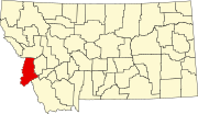
List of lakes of Ravalli County, Montana
Map all coordinates using OpenStreetMap
Download coordinates as:
- KML
- GPX (all coordinates)
- GPX (primary coordinates)
- GPX (secondary coordinates)
This list is incomplete; you can help by adding missing items. (February 2011) |
There are at least 126 named lakes and reservoirs in Ravalli County, Montana.
Lakes
- Aichele Lake, 46°19′46″N 114°21′55″W / 46.32944°N 114.36528°W / 46.32944; -114.36528 (Aichele Lake), el. 7,953 feet (2,424 m)[1]
- Alpine Lakes, 45°52′52″N 113°34′27″W / 45.88111°N 113.57417°W / 45.88111; -113.57417 (Alpine Lakes), el. 7,949 feet (2,423 m)[2]
- Bailey Lake, 46°07′56″N 114°28′27″W / 46.13222°N 114.47417°W / 46.13222; -114.47417 (Bailey Lake), el. 6,470 feet (1,970 m)[3]
- Baker Lake, 45°53′31″N 114°15′46″W / 45.89194°N 114.26278°W / 45.89194; -114.26278 (Baker Lake), el. 7,854 feet (2,394 m)[4]
- Bear Lake, 46°26′10″N 114°21′03″W / 46.43611°N 114.35083°W / 46.43611; -114.35083 (Bear Lake), el. 6,581 feet (2,006 m)[5]
- Big Creek Lakes, 46°29′28″N 114°21′56″W / 46.49111°N 114.36556°W / 46.49111; -114.36556 (Big Creek Lakes), el. 5,869 feet (1,789 m)[6]
- Big Grizzly Lake, 46°02′07″N 114°29′22″W / 46.03528°N 114.48944°W / 46.03528; -114.48944 (Big Grizzly Lake), el. 7,080 feet (2,160 m)[7]
- Boulder Lake, 45°51′42″N 114°23′33″W / 45.86167°N 114.39250°W / 45.86167; -114.39250 (Boulder Lake), el. 7,090 feet (2,160 m)[8]
- Bryan Lake, 46°25′12″N 114°22′41″W / 46.42000°N 114.37806°W / 46.42000; -114.37806 (Bryan Lake), el. 6,778 feet (2,066 m)[9]
- Buck Lake, 45°52′07″N 113°39′48″W / 45.86861°N 113.66333°W / 45.86861; -113.66333 (Buck Lake), el. 6,945 feet (2,117 m)[10]
- Burnt Fork Lake, 46°18′05″N 113°50′24″W / 46.30139°N 113.84000°W / 46.30139; -113.84000 (Burnt Fork Lake), el. 7,247 feet (2,209 m)[11]
- Burrell Lake, 45°35′40″N 114°05′18″W / 45.59444°N 114.08833°W / 45.59444; -114.08833 (Burrell Lake), el. 8,117 feet (2,474 m)[12]
- Camas Lake, 46°09′22″N 114°16′49″W / 46.15611°N 114.28028°W / 46.15611; -114.28028 (Camas Lake), el. 6,936 feet (2,114 m)[13]
- Canyon Lake, 46°14′42″N 114°19′56″W / 46.24500°N 114.33222°W / 46.24500; -114.33222 (Canyon Lake), el. 7,303 feet (2,226 m)[14]
- Capri Lake, 45°43′54″N 114°05′32″W / 45.73167°N 114.09222°W / 45.73167; -114.09222 (Capri Lake), el. 6,614 feet (2,016 m)[15]
- Carmine Lake, 45°50′50″N 113°41′28″W / 45.84722°N 113.69111°W / 45.84722; -113.69111 (Carmine Lake), el. 7,992 feet (2,436 m)[16]
- Cave Lake, 45°54′13″N 114°17′54″W / 45.90361°N 114.29833°W / 45.90361; -114.29833 (Cave Lake), el. 7,539 feet (2,298 m)[17]
- Chaffin Lake, 45°56′27″N 114°20′15″W / 45.94083°N 114.33750°W / 45.94083; -114.33750 (Chaffin Lake), el. 7,510 feet (2,290 m)[18]
- Charity Lake, 46°01′06″N 113°45′30″W / 46.01833°N 113.75833°W / 46.01833; -113.75833 (Charity Lake), el. 7,953 feet (2,424 m)[19]
- Dollar Lake, 45°51′53″N 114°22′38″W / 45.86472°N 114.37722°W / 45.86472; -114.37722 (Dollar Lake), el. 7,237 feet (2,206 m)[20]
- East Lake, 46°14′43″N 114°19′27″W / 46.24528°N 114.32417°W / 46.24528; -114.32417 (East Lake), el. 7,228 feet (2,203 m)[21]
- Elk Lake, 46°02′59″N 114°26′42″W / 46.04972°N 114.44500°W / 46.04972; -114.44500 (Elk Lake), el. 5,689 feet (1,734 m)[22]
- Esplin Lake, 45°47′34″N 114°29′20″W / 45.79278°N 114.48889°W / 45.79278; -114.48889 (Esplin Lake), el. 6,945 feet (2,117 m)[23]
- Faith Lake, 46°00′52″N 113°45′00″W / 46.01444°N 113.75000°W / 46.01444; -113.75000 (Faith Lake), el. 7,749 feet (2,362 m)[24]
- Fish Lake, 46°06′09″N 114°27′27″W / 46.10250°N 114.45750°W / 46.10250; -114.45750 (Fish Lake), el. 6,703 feet (2,043 m)[25]
- Fish Lake, 46°00′20″N 113°44′27″W / 46.00556°N 113.74083°W / 46.00556; -113.74083 (Fish Lake), el. 7,385 feet (2,251 m)[26]
- Fool Hen Lake, 46°16′23″N 113°52′45″W / 46.27306°N 113.87917°W / 46.27306; -113.87917 (Fool Hen Lake), el. 7,356 feet (2,242 m)[27]
- Frog Pond Lake, 45°41′05″N 114°01′05″W / 45.68472°N 114.01806°W / 45.68472; -114.01806 (Frog Pond Lake), el. 7,267 feet (2,215 m)[28]
- Garrard Lake, 46°19′34″N 114°21′15″W / 46.32611°N 114.35417°W / 46.32611; -114.35417 (Garrard Lake), el. 7,195 feet (2,193 m)[29]
- Gem Lake, 45°53′38″N 114°16′42″W / 45.89389°N 114.27833°W / 45.89389; -114.27833 (Gem Lake), el. 8,346 feet (2,544 m)[30]
- Glen Lake, 46°27′10″N 114°17′14″W / 46.45278°N 114.28722°W / 46.45278; -114.28722 (Glen Lake), el. 7,543 feet (2,299 m)[31]
- Goat Lake, 45°59′00″N 114°21′19″W / 45.98333°N 114.35528°W / 45.98333; -114.35528 (Goat Lake), el. 7,090 feet (2,160 m)[32]
- Hackney Lake, 46°04′56″N 114°26′45″W / 46.08222°N 114.44583°W / 46.08222; -114.44583 (Hackney Lake), el. 6,988 feet (2,130 m)[33]
- Hart Lake, 45°56′50″N 114°19′19″W / 45.94722°N 114.32194°W / 45.94722; -114.32194 (Hart Lake), el. 7,339 feet (2,237 m)[34]
- Hauf Lake, 46°17′44″N 114°19′19″W / 46.29556°N 114.32194°W / 46.29556; -114.32194 (Hauf Lake), el. 7,310 feet (2,230 m)[35]
- Heinrich Lake, 46°18′49″N 114°25′12″W / 46.31361°N 114.42000°W / 46.31361; -114.42000 (Heinrich Lake), el. 7,267 feet (2,215 m)[36]
- Hidden Lake, 46°27′59″N 114°18′54″W / 46.46639°N 114.31500°W / 46.46639; -114.31500 (Hidden Lake), el. 7,142 feet (2,177 m)[37]
- Hidden Lake, 45°56′08″N 113°31′38″W / 45.93556°N 113.52722°W / 45.93556; -113.52722 (Hidden Lake), el. 8,225 feet (2,507 m)[38]
- Hope Lake, 45°51′24″N 113°36′15″W / 45.85667°N 113.60417°W / 45.85667; -113.60417 (Hope Lake), el. 7,858 feet (2,395 m)[39]
- Hope Lake, 46°01′00″N 113°45′15″W / 46.01667°N 113.75417°W / 46.01667; -113.75417 (Hope Lake), el. 7,877 feet (2,401 m)[40]
- Ingomar Lake, 46°13′01″N 114°24′14″W / 46.21694°N 114.40389°W / 46.21694; -114.40389 (Ingomar Lake), el. 6,863 feet (2,092 m)[41]
- Jerry Lake, 46°06′37″N 113°46′04″W / 46.11028°N 113.76778°W / 46.11028; -113.76778 (Jerry Lake), el. 7,664 feet (2,336 m)[42]
- Jerusalem Lake, 45°48′46″N 114°27′13″W / 45.81278°N 114.45361°W / 45.81278; -114.45361 (Jerusalem Lake), el. 7,592 feet (2,314 m)[43]
- Kelly Lake, 45°56′25″N 113°33′28″W / 45.94028°N 113.55778°W / 45.94028; -113.55778 (Kelly Lake), el. 8,025 feet (2,446 m)[44]
- Kent Lake, 46°03′33″N 113°48′03″W / 46.05917°N 113.80083°W / 46.05917; -113.80083 (Kent Lake), el. 7,782 feet (2,372 m)[45]
- Kerlee Lake, 45°59′12″N 114°21′38″W / 45.98667°N 114.36056°W / 45.98667; -114.36056 (Kerlee Lake), el. 6,998 feet (2,133 m)[46]
- Kidney Lake, 46°09′03″N 114°17′05″W / 46.15083°N 114.28472°W / 46.15083; -114.28472 (Kidney Lake), el. 7,346 feet (2,239 m)[47]
- Knaack Lake, 46°19′52″N 114°21′41″W / 46.33111°N 114.36139°W / 46.33111; -114.36139 (Knaack Lake), el. 7,513 feet (2,290 m)[48]
- Kneaves Lake, 46°16′39″N 113°52′16″W / 46.27750°N 113.87111°W / 46.27750; -113.87111 (Kneaves Lake), el. 7,392 feet (2,253 m)[49]
- Kock Lake, 46°04′58″N 114°23′18″W / 46.08278°N 114.38833°W / 46.08278; -114.38833 (Kock Lake), el. 7,224 feet (2,202 m)[50]
- Kramis Pond, 46°04′03″N 114°14′45″W / 46.06750°N 114.24583°W / 46.06750; -114.24583 (Kramis Pond), el. 4,298 feet (1,310 m)[51]
- Lake Capitan, 46°00′52″N 114°27′37″W / 46.01444°N 114.46028°W / 46.01444; -114.46028 (Lake Capitan), el. 6,388 feet (1,947 m)[52]
- Lake Crystal, 45°51′34″N 114°22′47″W / 45.85944°N 114.37972°W / 45.85944; -114.37972 (Lake Crystal), el. 7,716 feet (2,352 m)[53]
- Lake of the Rocks, 45°51′19″N 114°20′52″W / 45.85528°N 114.34778°W / 45.85528; -114.34778 (Lake of the Rocks), el. 7,769 feet (2,368 m)[54]
- Lake Turbid, 45°51′30″N 114°22′31″W / 45.85833°N 114.37528°W / 45.85833; -114.37528 (Lake Turbid), el. 7,693 feet (2,345 m)[55]
- Lappi Lake, 46°34′17″N 114°14′25″W / 46.57139°N 114.24028°W / 46.57139; -114.24028 (Lappi Lake), el. 6,991 feet (2,131 m)[56]
- Little Burnt Fork Lakes, 46°17′14″N 113°49′20″W / 46.28722°N 113.82222°W / 46.28722; -113.82222 (Little Burnt Fork Lakes), el. 7,280 feet (2,220 m)[57]
- Little Grizzly Lake, 46°02′15″N 114°29′44″W / 46.03750°N 114.49556°W / 46.03750; -114.49556 (Little Grizzly Lake), el. 7,067 feet (2,154 m)[58]
- Little Rock Creek Lake, 46°01′27″N 114°20′26″W / 46.02417°N 114.34056°W / 46.02417; -114.34056 (Little Rock Creek Lake), el. 6,548 feet (1,996 m)[59]
- Lockwood Lake, 46°19′06″N 114°25′04″W / 46.31833°N 114.41778°W / 46.31833; -114.41778 (Lockwood Lake), el. 7,467 feet (2,276 m)[60]
- Lomo Lake, 46°14′51″N 114°22′46″W / 46.24750°N 114.37944°W / 46.24750; -114.37944 (Lomo Lake), el. 7,018 feet (2,139 m)[61]
- Lookout Lake, 46°04′15″N 114°27′20″W / 46.07083°N 114.45556°W / 46.07083; -114.45556 (Lookout Lake), el. 7,057 feet (2,151 m)[62]
- Lost Horse Lake, 46°05′06″N 114°25′19″W / 46.08500°N 114.42194°W / 46.08500; -114.42194 (Lost Horse Lake), el. 7,129 feet (2,173 m)[63]
- Middle Fork Lakes, 46°33′04″N 114°19′36″W / 46.55111°N 114.32667°W / 46.55111; -114.32667 (Middle Fork Lakes), el. 5,984 feet (1,824 m)[64]
- Middle Lake, 45°53′31″N 114°16′31″W / 45.89194°N 114.27528°W / 45.89194; -114.27528 (Middle Lake), el. 8,179 feet (2,493 m)[65]
- Milepost Lake, 46°02′23″N 114°29′59″W / 46.03972°N 114.49972°W / 46.03972; -114.49972 (Milepost Lake), el. 6,991 feet (2,131 m)[66]
- Mills Lake, 46°38′14″N 114°15′57″W / 46.63722°N 114.26583°W / 46.63722; -114.26583 (Mills Lake), el. 7,812 feet (2,381 m)[67]
- Mink Lake, 45°53′14″N 114°20′02″W / 45.88722°N 114.33389°W / 45.88722; -114.33389 (Mink Lake), el. 7,798 feet (2,377 m)[68]
- Mud Lake, 46°09′43″N 114°28′25″W / 46.16194°N 114.47361°W / 46.16194; -114.47361 (Mud Lake), el. 8,307 feet (2,532 m)[69]
- Mudhole Lake, 45°46′43″N 114°26′34″W / 45.77861°N 114.44278°W / 45.77861; -114.44278 (Mudhole Lake), el. 5,748 feet (1,752 m)[70]
- Nelson Lake, 45°49′55″N 114°21′25″W / 45.83194°N 114.35694°W / 45.83194; -114.35694 (Nelson Lake), el. 7,264 feet (2,214 m)[71]
- North Kootenai Lake, 46°33′28″N 114°19′34″W / 46.55778°N 114.32611°W / 46.55778; -114.32611 (North Kootenai Lake), el. 6,306 feet (1,922 m)[72]
- North Totem Lake, 46°22′50″N 114°24′07″W / 46.38056°N 114.40194°W / 46.38056; -114.40194 (North Totem Lake), el. 7,316 feet (2,230 m)[73]
- Park Lake, 45°53′21″N 113°33′31″W / 45.88917°N 113.55861°W / 45.88917; -113.55861 (Park Lake), el. 7,756 feet (2,364 m)[74]
- Pass Lake, 45°43′17″N 114°04′53″W / 45.72139°N 114.08139°W / 45.72139; -114.08139 (Pass Lake), el. 6,690 feet (2,040 m)[75]
- Pearl Lake, 46°27′27″N 114°22′33″W / 46.45750°N 114.37583°W / 46.45750; -114.37583 (Pearl Lake), el. 7,103 feet (2,165 m)[76]
- Peterson Lake, 46°38′05″N 114°14′00″W / 46.63472°N 114.23333°W / 46.63472; -114.23333 (Peterson Lake), el. 6,503 feet (1,982 m)[77]
- Piquett Lake, 45°44′17″N 114°11′22″W / 45.73806°N 114.18944°W / 45.73806; -114.18944 (Piquett Lake), el. 8,005 feet (2,440 m)[78]
- Ripple Lake, 45°55′54″N 113°33′31″W / 45.93167°N 113.55861°W / 45.93167; -113.55861 (Ripple Lake), el. 7,831 feet (2,387 m)[79]
- Saint Mary Lake, 46°30′20″N 114°16′48″W / 46.50556°N 114.28000°W / 46.50556; -114.28000 (Saint Mary Lake), el. 7,785 feet (2,373 m)[80]
- Shadow Lake, 46°01′54″N 113°45′08″W / 46.03167°N 113.75222°W / 46.03167; -113.75222 (Shadow Lake), el. 7,703 feet (2,348 m)[81]
- Shannon Lake, 46°03′17″N 114°13′42″W / 46.05472°N 114.22833°W / 46.05472; -114.22833 (Shannon Lake), el. 4,560 feet (1,390 m)[82]
- Shelf Lake, 45°44′26″N 114°10′58″W / 45.74056°N 114.18278°W / 45.74056; -114.18278 (Shelf Lake), el. 7,690 feet (2,340 m)[83]
- Slate Lake, 45°44′03″N 114°11′03″W / 45.73417°N 114.18417°W / 45.73417; -114.18417 (Slate Lake), el. 8,041 feet (2,451 m)[84]
- South Bear Lake, 46°22′16″N 114°24′34″W / 46.37111°N 114.40944°W / 46.37111; -114.40944 (South Bear Lake), el. 7,359 feet (2,243 m)[85]
- South Fork Lake, 46°26′59″N 114°22′12″W / 46.44972°N 114.37000°W / 46.44972; -114.37000 (South Fork Lake), el. 6,785 feet (2,068 m)[86]
- South Fork Lakes, 46°35′00″N 114°19′42″W / 46.58333°N 114.32833°W / 46.58333; -114.32833 (South Fork Lakes), el. 7,192 feet (2,192 m)[87]
- South Kootenai Lake, 46°32′20″N 114°19′13″W / 46.53889°N 114.32028°W / 46.53889; -114.32028 (South Kootenai Lake), el. 6,260 feet (1,910 m)[88]
- Sweeney Lake, 46°36′43″N 114°16′22″W / 46.61194°N 114.27278°W / 46.61194; -114.27278 (Sweeney Lake), el. 7,342 feet (2,238 m)[89]
- Tag Alder Lake, 46°17′39″N 114°16′05″W / 46.29417°N 114.26806°W / 46.29417; -114.26806 (Tag Alder Lake), el. 7,214 feet (2,199 m)[90]
- Tamarack Lake, 45°56′33″N 114°19′31″W / 45.94250°N 114.32528°W / 45.94250; -114.32528 (Tamarack Lake), el. 7,428 feet (2,264 m)[91]
- Tenmile Lake, 46°10′28″N 114°26′12″W / 46.17444°N 114.43667°W / 46.17444; -114.43667 (Tenmile Lake), el. 6,942 feet (2,116 m)[92]
- Totem Peak Lake, 46°22′37″N 114°23′14″W / 46.37694°N 114.38722°W / 46.37694; -114.38722 (Totem Peak Lake), el. 7,782 feet (2,372 m)[93]
- Trapper Lake, 45°54′34″N 114°21′31″W / 45.90944°N 114.35861°W / 45.90944; -114.35861 (Trapper Lake), el. 7,254 feet (2,211 m)[94]
- Trout Lake, 46°03′25″N 113°48′27″W / 46.05694°N 113.80750°W / 46.05694; -113.80750 (Trout Lake), el. 7,703 feet (2,348 m)[95]
- Twelvemile Lake, 46°09′48″N 114°27′22″W / 46.16333°N 114.45611°W / 46.16333; -114.45611 (Twelvemile Lake), el. 6,663 feet (2,031 m)[96]
- Twin Lakes, 46°09′26″N 114°29′48″W / 46.15722°N 114.49667°W / 46.15722; -114.49667 (Twin Lakes), el. 6,545 feet (1,995 m)[97]
- Two Lakes, 46°24′23″N 114°23′15″W / 46.40639°N 114.38750°W / 46.40639; -114.38750 (Two Lakes), el. 7,218 feet (2,200 m)[98]
- Watchtower Lake, 45°50′44″N 114°29′13″W / 45.84556°N 114.48694°W / 45.84556; -114.48694 (Watchtower Lake), el. 7,543 feet (2,299 m)[99]
- White Lake, 46°05′11″N 114°24′05″W / 46.08639°N 114.40139°W / 46.08639; -114.40139 (White Lake), el. 6,959 feet (2,121 m)[100]
Reservoirs
- Bass Lake, 46°35′35″N 114°16′57″W / 46.59306°N 114.28250°W / 46.59306; -114.28250 (Bass Lake), el. 6,801 feet (2,073 m)[101]
- Big Creek Lake, 46°29′42″N 114°21′15″W / 46.49500°N 114.35417°W / 46.49500; -114.35417 (Big Creek Lake), el. 5,869 feet (1,789 m)[102]
- Blodgett Lake, 46°15′08″N 114°27′18″W / 46.25222°N 114.45500°W / 46.25222; -114.45500 (Blodgett Lake), el. 6,788 feet (2,069 m)[103]
- Burnt Fork Lake, 46°18′12″N 113°50′09″W / 46.30333°N 113.83583°W / 46.30333; -113.83583 (Burnt Fork Lake), el. 7,316 feet (2,230 m)[104]
- Canyon Lake, 46°14′42″N 114°19′45″W / 46.24500°N 114.32917°W / 46.24500; -114.32917 (Canyon Lake), el. 7,303 feet (2,226 m)[105]
- Dam Creek Lake, 46°15′56″N 113°48′01″W / 46.26556°N 113.80028°W / 46.26556; -113.80028 (Dam Creek Lake), el. 7,303 feet (2,226 m)[106]
- Duffy Lake, 46°38′33″N 114°15′27″W / 46.64250°N 114.25750°W / 46.64250; -114.25750 (Duffy Lake), el. 7,333 feet (2,235 m)[107]
- Fish Lake, 46°05′54″N 114°27′15″W / 46.09833°N 114.45417°W / 46.09833; -114.45417 (Fish Lake), el. 6,693 feet (2,040 m)[108]
- Fred Burr Lake, 46°19′46″N 114°25′02″W / 46.32944°N 114.41722°W / 46.32944; -114.41722 (Fred Burr Lake), el. 7,467 feet (2,276 m)[109]
- Fred Burr Reservoir, 46°21′27″N 114°19′02″W / 46.35750°N 114.31722°W / 46.35750; -114.31722 (Fred Burr Reservoir), el. 5,141 feet (1,567 m)[110]
- Gleason Lake, 46°17′57″N 113°53′49″W / 46.29917°N 113.89694°W / 46.29917; -113.89694 (Gleason Lake), el. 6,624 feet (2,019 m)[111]
- Hauf Lake, 46°17′42″N 114°19′27″W / 46.29500°N 114.32417°W / 46.29500; -114.32417 (Hauf Lake), el. 7,523 feet (2,293 m)[112]
- High Lake, 46°15′24″N 114°21′45″W / 46.25667°N 114.36250°W / 46.25667; -114.36250 (High Lake), el. 7,382 feet (2,250 m)[113]
- Holloway Lake, 46°38′11″N 114°15′44″W / 46.63639°N 114.26222°W / 46.63639; -114.26222 (Holloway Lake), el. 7,798 feet (2,377 m)[114]
- Lake Como, 46°03′55″N 114°14′09″W / 46.06528°N 114.23583°W / 46.06528; -114.23583 (Lake Como), el. 4,245 feet (1,294 m)[115]
- Lower Twin Lake, 46°09′12″N 114°29′45″W / 46.15333°N 114.49583°W / 46.15333; -114.49583 (Lower Twin Lake), el. 6,545 feet (1,995 m)[116]
- Mill Lake, 46°17′51″N 114°25′14″W / 46.29750°N 114.42056°W / 46.29750; -114.42056 (Mill Lake), el. 6,545 feet (1,995 m)[117]
- Painted Rocks Lake, 45°43′06″N 114°16′51″W / 45.71833°N 114.28083°W / 45.71833; -114.28083 (Painted Rocks Lake), el. 4,626 feet (1,410 m)[118]
- Schoolmarm Lake, 45°54′47″N 113°56′47″W / 45.91306°N 113.94639°W / 45.91306; -113.94639 (Schoolmarm Lake), el. 4,685 feet (1,428 m)[119]
- Sears Lake, 46°17′58″N 114°22′16″W / 46.29944°N 114.37111°W / 46.29944; -114.37111 (Sears Lake), el. 6,706 feet (2,044 m)[120]
- Stevensville Reservoir, 46°30′03″N 114°02′44″W / 46.50083°N 114.04556°W / 46.50083; -114.04556 (Stevensville Reservoir), el. 3,556 feet (1,084 m)[121]
- Tamarack Lake, 45°56′30″N 114°19′21″W / 45.94167°N 114.32250°W / 45.94167; -114.32250 (Tamarack Lake), el. 7,487 feet (2,282 m)[122]
- Tin Cup Lake, 45°56′54″N 114°23′33″W / 45.94833°N 114.39250°W / 45.94833; -114.39250 (Tin Cup Lake), el. 6,283 feet (1,915 m)[123]
- Tin Cup Lake, 45°56′36″N 114°23′57″W / 45.94333°N 114.39917°W / 45.94333; -114.39917 (Tin Cup Lake), el. 6,299 feet (1,920 m)[124]
- Upper Twin Lake, 46°09′42″N 114°29′57″W / 46.16167°N 114.49917°W / 46.16167; -114.49917 (Upper Twin Lake), el. 6,545 feet (1,995 m)[125]
- Wyant Lake, 46°14′38″N 114°20′27″W / 46.24389°N 114.34083°W / 46.24389; -114.34083 (Wyant Lake), el. 7,661 feet (2,335 m)[126]
See also
Notes
- ^ "Aichele Lake". Geographic Names Information System. United States Geological Survey, United States Department of the Interior.
- ^ "Alpine Lakes". Geographic Names Information System. United States Geological Survey, United States Department of the Interior.
- ^ "Bailey Lake". Geographic Names Information System. United States Geological Survey, United States Department of the Interior.
- ^ "Baker Lake". Geographic Names Information System. United States Geological Survey, United States Department of the Interior.
- ^ "Bear Lake". Geographic Names Information System. United States Geological Survey, United States Department of the Interior.
- ^ "Big Creek Lakes". Geographic Names Information System. United States Geological Survey, United States Department of the Interior.
- ^ "Big Grizzly Lake". Geographic Names Information System. United States Geological Survey, United States Department of the Interior.
- ^ "Boulder Lake". Geographic Names Information System. United States Geological Survey, United States Department of the Interior.
- ^ "Bryan Lake". Geographic Names Information System. United States Geological Survey, United States Department of the Interior.
- ^ "Buck Lake". Geographic Names Information System. United States Geological Survey, United States Department of the Interior.
- ^ "Burnt Fork Lake". Geographic Names Information System. United States Geological Survey, United States Department of the Interior.
- ^ "Burrell Lake". Geographic Names Information System. United States Geological Survey, United States Department of the Interior.
- ^ "Camas Lake". Geographic Names Information System. United States Geological Survey, United States Department of the Interior.
- ^ "Canyon Lake". Geographic Names Information System. United States Geological Survey, United States Department of the Interior.
- ^ "Capri Lake". Geographic Names Information System. United States Geological Survey, United States Department of the Interior.
- ^ "Carmine Lake". Geographic Names Information System. United States Geological Survey, United States Department of the Interior.
- ^ "Cave Lake". Geographic Names Information System. United States Geological Survey, United States Department of the Interior.
- ^ "Chaffin Lake". Geographic Names Information System. United States Geological Survey, United States Department of the Interior.
- ^ "Charity Lake". Geographic Names Information System. United States Geological Survey, United States Department of the Interior.
- ^ "Dollar Lake". Geographic Names Information System. United States Geological Survey, United States Department of the Interior.
- ^ "East Lake". Geographic Names Information System. United States Geological Survey, United States Department of the Interior.
- ^ "Elk Lake". Geographic Names Information System. United States Geological Survey, United States Department of the Interior.
- ^ "Esplin Lake". Geographic Names Information System. United States Geological Survey, United States Department of the Interior.
- ^ "Faith Lake". Geographic Names Information System. United States Geological Survey, United States Department of the Interior.
- ^ "Fish Lake". Geographic Names Information System. United States Geological Survey, United States Department of the Interior.
- ^ "Fish Lake". Geographic Names Information System. United States Geological Survey, United States Department of the Interior.
- ^ "Fool Hen Lake". Geographic Names Information System. United States Geological Survey, United States Department of the Interior.
- ^ "Frog Pond Lake". Geographic Names Information System. United States Geological Survey, United States Department of the Interior.
- ^ "Garrard Lake". Geographic Names Information System. United States Geological Survey, United States Department of the Interior.
- ^ "Gem Lake". Geographic Names Information System. United States Geological Survey, United States Department of the Interior.
- ^ "Glen Lake". Geographic Names Information System. United States Geological Survey, United States Department of the Interior.
- ^ "Goat Lake". Geographic Names Information System. United States Geological Survey, United States Department of the Interior.
- ^ "Hackney Lake". Geographic Names Information System. United States Geological Survey, United States Department of the Interior.
- ^ "Hart Lake". Geographic Names Information System. United States Geological Survey, United States Department of the Interior.
- ^ "Hauf Lake". Geographic Names Information System. United States Geological Survey, United States Department of the Interior.
- ^ "Heinrich Lake". Geographic Names Information System. United States Geological Survey, United States Department of the Interior.
- ^ "Hidden Lake". Geographic Names Information System. United States Geological Survey, United States Department of the Interior.
- ^ "Hidden Lake". Geographic Names Information System. United States Geological Survey, United States Department of the Interior.
- ^ "Hope Lake". Geographic Names Information System. United States Geological Survey, United States Department of the Interior.
- ^ "Hope Lake". Geographic Names Information System. United States Geological Survey, United States Department of the Interior.
- ^ "Ingomar Lake". Geographic Names Information System. United States Geological Survey, United States Department of the Interior.
- ^ "Jerry Lake". Geographic Names Information System. United States Geological Survey, United States Department of the Interior.
- ^ "Jerusalem Lake". Geographic Names Information System. United States Geological Survey, United States Department of the Interior.
- ^ "Kelly Lake". Geographic Names Information System. United States Geological Survey, United States Department of the Interior.
- ^ "Kent Lake". Geographic Names Information System. United States Geological Survey, United States Department of the Interior.
- ^ "Kerlee Lake". Geographic Names Information System. United States Geological Survey, United States Department of the Interior.
- ^ "Kidney Lake". Geographic Names Information System. United States Geological Survey, United States Department of the Interior.
- ^ "Knaack Lake". Geographic Names Information System. United States Geological Survey, United States Department of the Interior.
- ^ "Kneaves Lake". Geographic Names Information System. United States Geological Survey, United States Department of the Interior.
- ^ "Kock Lake". Geographic Names Information System. United States Geological Survey, United States Department of the Interior.
- ^ "Kramis Pond". Geographic Names Information System. United States Geological Survey, United States Department of the Interior.
- ^ "Lake Capitan". Geographic Names Information System. United States Geological Survey, United States Department of the Interior.
- ^ "Lake Crystal". Geographic Names Information System. United States Geological Survey, United States Department of the Interior.
- ^ "Lake of the Rocks". Geographic Names Information System. United States Geological Survey, United States Department of the Interior.
- ^ "Lake Turbid". Geographic Names Information System. United States Geological Survey, United States Department of the Interior.
- ^ "Lappi Lake". Geographic Names Information System. United States Geological Survey, United States Department of the Interior.
- ^ "Little Burnt Fork Lakes". Geographic Names Information System. United States Geological Survey, United States Department of the Interior.
- ^ "Little Grizzly Lake". Geographic Names Information System. United States Geological Survey, United States Department of the Interior.
- ^ "Little Rock Creek Lake". Geographic Names Information System. United States Geological Survey, United States Department of the Interior.
- ^ "Lockwood Lake". Geographic Names Information System. United States Geological Survey, United States Department of the Interior.
- ^ "Lomo Lake". Geographic Names Information System. United States Geological Survey, United States Department of the Interior.
- ^ "Lookout Lake". Geographic Names Information System. United States Geological Survey, United States Department of the Interior.
- ^ "Lost Horse Lake". Geographic Names Information System. United States Geological Survey, United States Department of the Interior.
- ^ "Middle Fork Lakes". Geographic Names Information System. United States Geological Survey, United States Department of the Interior.
- ^ "Middle Lake". Geographic Names Information System. United States Geological Survey, United States Department of the Interior.
- ^ "Milepost Lake". Geographic Names Information System. United States Geological Survey, United States Department of the Interior.
- ^ "Mills Lake". Geographic Names Information System. United States Geological Survey, United States Department of the Interior.
- ^ "Mink Lake". Geographic Names Information System. United States Geological Survey, United States Department of the Interior.
- ^ "Mud Lake". Geographic Names Information System. United States Geological Survey, United States Department of the Interior.
- ^ "Mudhole Lake". Geographic Names Information System. United States Geological Survey, United States Department of the Interior.
- ^ "Nelson Lake". Geographic Names Information System. United States Geological Survey, United States Department of the Interior.
- ^ "North Kootenai Lake". Geographic Names Information System. United States Geological Survey, United States Department of the Interior.
- ^ "North Totem Lake". Geographic Names Information System. United States Geological Survey, United States Department of the Interior.
- ^ "Park Lake". Geographic Names Information System. United States Geological Survey, United States Department of the Interior.
- ^ "Pass Lake". Geographic Names Information System. United States Geological Survey, United States Department of the Interior.
- ^ "Pearl Lake". Geographic Names Information System. United States Geological Survey, United States Department of the Interior.
- ^ "Peterson Lake". Geographic Names Information System. United States Geological Survey, United States Department of the Interior.
- ^ "Piquett Lake". Geographic Names Information System. United States Geological Survey, United States Department of the Interior.
- ^ "Ripple Lake". Geographic Names Information System. United States Geological Survey, United States Department of the Interior.
- ^ "Saint Mary Lake". Geographic Names Information System. United States Geological Survey, United States Department of the Interior.
- ^ "Shadow Lake". Geographic Names Information System. United States Geological Survey, United States Department of the Interior.
- ^ "Shannon Lake". Geographic Names Information System. United States Geological Survey, United States Department of the Interior.
- ^ "Shelf Lake". Geographic Names Information System. United States Geological Survey, United States Department of the Interior.
- ^ "Slate Lake". Geographic Names Information System. United States Geological Survey, United States Department of the Interior.
- ^ "South Bear Lake". Geographic Names Information System. United States Geological Survey, United States Department of the Interior.
- ^ "South Fork Lake". Geographic Names Information System. United States Geological Survey, United States Department of the Interior.
- ^ "South Fork Lakes". Geographic Names Information System. United States Geological Survey, United States Department of the Interior.
- ^ "South Kootenai Lake". Geographic Names Information System. United States Geological Survey, United States Department of the Interior.
- ^ "Sweeney Lake". Geographic Names Information System. United States Geological Survey, United States Department of the Interior.
- ^ "Tag Alder Lake". Geographic Names Information System. United States Geological Survey, United States Department of the Interior.
- ^ "Tamarack Lake". Geographic Names Information System. United States Geological Survey, United States Department of the Interior.
- ^ "Tenmile Lake". Geographic Names Information System. United States Geological Survey, United States Department of the Interior.
- ^ "Totem Peak Lake". Geographic Names Information System. United States Geological Survey, United States Department of the Interior.
- ^ "Trapper Lake". Geographic Names Information System. United States Geological Survey, United States Department of the Interior.
- ^ "Trout Lake". Geographic Names Information System. United States Geological Survey, United States Department of the Interior.
- ^ "Twelvemile Lake". Geographic Names Information System. United States Geological Survey, United States Department of the Interior.
- ^ "Twin Lakes". Geographic Names Information System. United States Geological Survey, United States Department of the Interior.
- ^ "Two Lakes". Geographic Names Information System. United States Geological Survey, United States Department of the Interior.
- ^ "Watchtower Lake". Geographic Names Information System. United States Geological Survey, United States Department of the Interior.
- ^ "White Lake". Geographic Names Information System. United States Geological Survey, United States Department of the Interior.
- ^ "Bass Lake". Geographic Names Information System. United States Geological Survey, United States Department of the Interior.
- ^ "Big Creek Lake". Geographic Names Information System. United States Geological Survey, United States Department of the Interior.
- ^ "Blodgett Lake". Geographic Names Information System. United States Geological Survey, United States Department of the Interior.
- ^ "Burnt Fork Lake". Geographic Names Information System. United States Geological Survey, United States Department of the Interior.
- ^ "Canyon Lake". Geographic Names Information System. United States Geological Survey, United States Department of the Interior.
- ^ "Dam Creek Lake". Geographic Names Information System. United States Geological Survey, United States Department of the Interior.
- ^ "Duffy Lake". Geographic Names Information System. United States Geological Survey, United States Department of the Interior.
- ^ "Fish Lake". Geographic Names Information System. United States Geological Survey, United States Department of the Interior.
- ^ "Fred Burr Lake". Geographic Names Information System. United States Geological Survey, United States Department of the Interior.
- ^ "Fred Burr Reservoir". Geographic Names Information System. United States Geological Survey, United States Department of the Interior.
- ^ "Gleason Lake". Geographic Names Information System. United States Geological Survey, United States Department of the Interior.
- ^ "Hauf Lake". Geographic Names Information System. United States Geological Survey, United States Department of the Interior.
- ^ "High Lake". Geographic Names Information System. United States Geological Survey, United States Department of the Interior.
- ^ "Holloway Lake". Geographic Names Information System. United States Geological Survey, United States Department of the Interior.
- ^ "Lake Como". Geographic Names Information System. United States Geological Survey, United States Department of the Interior.
- ^ "Lower Twin Lake". Geographic Names Information System. United States Geological Survey, United States Department of the Interior.
- ^ "Mill Lake". Geographic Names Information System. United States Geological Survey, United States Department of the Interior.
- ^ "Painted Rocks Lake". Geographic Names Information System. United States Geological Survey, United States Department of the Interior.
- ^ "Schoolmarm Lake". Geographic Names Information System. United States Geological Survey, United States Department of the Interior.
- ^ "Sears Lake". Geographic Names Information System. United States Geological Survey, United States Department of the Interior.
- ^ "Stevensville Reservoir". Geographic Names Information System. United States Geological Survey, United States Department of the Interior.
- ^ "Tamarack Lake". Geographic Names Information System. United States Geological Survey, United States Department of the Interior.
- ^ "Tin Cup Lake". Geographic Names Information System. United States Geological Survey, United States Department of the Interior.
- ^ "Tin Cup Lake". Geographic Names Information System. United States Geological Survey, United States Department of the Interior.
- ^ "Upper Twin Lake". Geographic Names Information System. United States Geological Survey, United States Department of the Interior.
- ^ "Wyant Lake". Geographic Names Information System. United States Geological Survey, United States Department of the Interior.