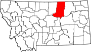
List of lakes of Phillips County, Montana
Map all coordinates using OpenStreetMap
Download coordinates as:
- KML
- GPX (all coordinates)
- GPX (primary coordinates)
- GPX (secondary coordinates)
This list is incomplete; you can help by adding missing items. (February 2011) |
There are at least 147 named lakes and reservoirs in Phillips County, Montana.
Lakes
- Austin Lake, 48°42′37″N 107°38′59″W / 48.71028°N 107.64972°W / 48.71028; -107.64972 (Austin Lake), el. 2,441 feet (744 m)[1]
- Beam Lake, 47°52′06″N 108°05′49″W / 47.86833°N 108.09694°W / 47.86833; -108.09694 (Beam Lake), el. 2,782 feet (848 m)[2]
- Bennett Lake, 48°12′56″N 107°47′40″W / 48.21556°N 107.79444°W / 48.21556; -107.79444 (Bennett Lake), el. 2,589 feet (789 m)[3]
- Buckley Lake, 47°56′34″N 107°32′47″W / 47.94278°N 107.54639°W / 47.94278; -107.54639 (Buckley Lake), el. 2,520 feet (770 m)[4]
- Carter Lake, 48°36′02″N 107°27′27″W / 48.60056°N 107.45750°W / 48.60056; -107.45750 (Carter Lake), el. 2,411 feet (735 m)[5]
- Drumbo Unit, 48°22′27″N 107°40′19″W / 48.37417°N 107.67194°W / 48.37417; -107.67194 (Drumbo Unit), el. 2,208 feet (673 m)[6]
- Dry Lake, 47°34′02″N 107°51′42″W / 47.56722°N 107.86167°W / 47.56722; -107.86167 (Dry Lake), el. 2,356 feet (718 m)[7]
- Dry Lake, 47°45′57″N 107°51′27″W / 47.76583°N 107.85750°W / 47.76583; -107.85750 (Dry Lake), el. 2,549 feet (777 m)[8]
- Dry Lake Unit, 48°24′15″N 107°36′25″W / 48.40417°N 107.60694°W / 48.40417; -107.60694 (Dry Lake Unit), el. 2,208 feet (673 m)[9]
- Erphit Lake, 48°28′50″N 107°39′45″W / 48.48056°N 107.66250°W / 48.48056; -107.66250 (Erphit Lake), el. 2,254 feet (687 m)[10]
- Ester Lake, 48°05′52″N 108°15′29″W / 48.09778°N 108.25806°W / 48.09778; -108.25806 (Ester Lake), el. 2,634 feet (803 m)[11]
- Horse Shoe Lake, 48°50′09″N 108°00′43″W / 48.83583°N 108.01194°W / 48.83583; -108.01194 (Horse Shoe Lake), el. 2,694 feet (821 m)[12]
- Horseshoe Lake, 48°50′07″N 108°00′38″W / 48.83528°N 108.01056°W / 48.83528; -108.01056 (Horseshoe Lake), el. 2,694 feet (821 m)[13]
- Indian Lake, 47°44′25″N 107°51′31″W / 47.74028°N 107.85861°W / 47.74028; -107.85861 (Indian Lake), el. 2,566 feet (782 m)[14]
- Lake Bowdoin, 48°24′46″N 107°41′00″W / 48.41278°N 107.68333°W / 48.41278; -107.68333 (Lake Bowdoin), el. 2,208 feet (673 m)[15]
- Lakeside Unit, 48°25′47″N 107°38′43″W / 48.42972°N 107.64528°W / 48.42972; -107.64528 (Lakeside Unit), el. 2,221 feet (677 m)[16]
- Lone Tree Lake (historical), 48°29′26″N 107°38′14″W / 48.49056°N 107.63722°W / 48.49056; -107.63722 (Lone Tree Lake (historical)), el. 2,224 feet (678 m)[17]
- McNeil Slough, 48°31′56″N 107°33′04″W / 48.53222°N 107.55111°W / 48.53222; -107.55111 (McNeil Slough), el. 2,195 feet (669 m)[18]
- Mud Lake, 48°26′44″N 107°38′15″W / 48.44556°N 107.63750°W / 48.44556; -107.63750 (Mud Lake), el. 2,244 feet (684 m)[19]
- Mud Lake (historical), 48°28′58″N 107°34′29″W / 48.48278°N 107.57472°W / 48.48278; -107.57472 (Mud Lake (historical)), el. 2,224 feet (678 m)[20]
- Parrot Lake, 48°00′40″N 108°15′01″W / 48.01111°N 108.25028°W / 48.01111; -108.25028 (Parrot Lake), el. 2,776 feet (846 m)[21]
- Pea Lake, 48°55′16″N 107°36′55″W / 48.92111°N 107.61528°W / 48.92111; -107.61528 (Pea Lake), el. 2,454 feet (748 m)[22]
- Shed Lake, 47°52′21″N 108°06′53″W / 47.87250°N 108.11472°W / 47.87250; -108.11472 (Shed Lake), el. 2,789 feet (850 m)[23]
- Solberg Slough, 48°13′18″N 107°49′08″W / 48.22167°N 107.81889°W / 48.22167; -107.81889 (Solberg Slough), el. 2,589 feet (789 m)[24]
- The Plunge, 47°50′34″N 108°35′58″W / 47.84278°N 108.59944°W / 47.84278; -108.59944 (The Plunge), el. 3,383 feet (1,031 m)[25]
- Whitcomb Lake, 47°59′30″N 107°50′02″W / 47.99167°N 107.83389°W / 47.99167; -107.83389 (Whitcomb Lake), el. 2,490 feet (760 m)[26]
Reservoirs
- 3 Way Number 2 Reservoir, 48°56′08″N 107°40′42″W / 48.93556°N 107.67833°W / 48.93556; -107.67833 (3 Way Number 2 Reservoir), el. 2,677 feet (816 m)[27]
- Ada Reservoir, 48°53′14″N 107°40′09″W / 48.88722°N 107.66917°W / 48.88722; -107.66917 (Ada Reservoir), el. 2,562 feet (781 m)[28]
- Adair Reservoir, 48°38′21″N 107°39′44″W / 48.63917°N 107.66222°W / 48.63917; -107.66222 (Adair Reservoir), el. 2,461 feet (750 m)[29]
- Archie Reservoir, 47°45′48″N 107°59′04″W / 47.76333°N 107.98444°W / 47.76333; -107.98444 (Archie Reservoir), el. 2,634 feet (803 m)[30]
- Artie Reservoir, 48°58′20″N 107°35′42″W / 48.97222°N 107.59500°W / 48.97222; -107.59500 (Artie Reservoir), el. 2,644 feet (806 m)[31]
- Ashfield Reservoir, 48°25′54″N 107°29′03″W / 48.43167°N 107.48417°W / 48.43167; -107.48417 (Ashfield Reservoir), el. 2,333 feet (711 m)[32]
- Badger Reservoir, 47°42′30″N 108°12′40″W / 47.70833°N 108.21111°W / 47.70833; -108.21111 (Badger Reservoir), el. 2,815 feet (858 m)[33]
- Bass Reservoir, 48°03′02″N 108°01′14″W / 48.05056°N 108.02056°W / 48.05056; -108.02056 (Bass Reservoir), el. 2,602 feet (793 m)[34]
- Bauer Reservoir, 48°21′31″N 107°30′51″W / 48.35861°N 107.51417°W / 48.35861; -107.51417 (Bauer Reservoir), el. 2,392 feet (729 m)[35]
- Bell Reservoir, 47°41′32″N 108°38′44″W / 47.69222°N 108.64556°W / 47.69222; -108.64556 (Bell Reservoir), el. 2,894 feet (882 m)[36]
- Big McNeil Slough, 48°32′21″N 107°31′49″W / 48.53917°N 107.53028°W / 48.53917; -107.53028 (Big McNeil Slough), el. 2,178 feet (664 m)[37]
- Big Reservoir, 48°48′15″N 107°24′09″W / 48.80417°N 107.40250°W / 48.80417; -107.40250 (Big Reservoir), el. 2,851 feet (869 m)[38]
- Big Rock Reservoir, 47°37′04″N 108°10′33″W / 47.61778°N 108.17583°W / 47.61778; -108.17583 (Big Rock Reservoir), el. 2,703 feet (824 m)[39]
- Big Sage Reservoir, 47°45′55″N 108°26′52″W / 47.76528°N 108.44778°W / 47.76528; -108.44778 (Big Sage Reservoir), el. 3,031 feet (924 m)[40]
- Big Snowy Reservoir, 47°39′32″N 108°20′17″W / 47.65889°N 108.33806°W / 47.65889; -108.33806 (Big Snowy Reservoir), el. 2,838 feet (865 m)[41]
- Bison Bone Reservoir, 47°48′03″N 108°16′48″W / 47.80083°N 108.28000°W / 47.80083; -108.28000 (Bison Bone Reservoir), el. 2,848 feet (868 m)[42]
- Black Coulee Pond, 48°23′08″N 107°43′43″W / 48.38556°N 107.72861°W / 48.38556; -107.72861 (Black Coulee Pond), el. 2,221 feet (677 m)[43]
- Black Cow Reservoir, 48°05′09″N 107°37′41″W / 48.08583°N 107.62806°W / 48.08583; -107.62806 (Black Cow Reservoir), el. 2,402 feet (732 m)[44]
- Blizzard Reservoir, 47°44′02″N 108°20′05″W / 47.73389°N 108.33472°W / 47.73389; -108.33472 (Blizzard Reservoir), el. 2,956 feet (901 m)[45]
- Blue Stem Reservoir, 48°44′10″N 108°08′42″W / 48.73611°N 108.14500°W / 48.73611; -108.14500 (Blue Stem Reservoir), el. 2,723 feet (830 m)[46]
- Bog Reservoir, 47°46′49″N 108°08′37″W / 47.78028°N 108.14361°W / 47.78028; -108.14361 (Bog Reservoir), el. 2,825 feet (861 m)[47]
- Buckskin Reservoir, 47°38′40″N 108°08′05″W / 47.64444°N 108.13472°W / 47.64444; -108.13472 (Buckskin Reservoir), el. 2,762 feet (842 m)[48]
- Carberry Reservoir, 47°45′40″N 107°57′05″W / 47.76111°N 107.95139°W / 47.76111; -107.95139 (Carberry Reservoir), el. 2,651 feet (808 m)[49]
- Carter Reservoir, 47°50′01″N 107°52′40″W / 47.83361°N 107.87778°W / 47.83361; -107.87778 (Carter Reservoir), el. 2,503 feet (763 m)[50]
- Charley Reservoir, 48°51′57″N 107°26′46″W / 48.86583°N 107.44611°W / 48.86583; -107.44611 (Charley Reservoir), el. 2,825 feet (861 m)[51]
- Cole Ponds, 48°32′28″N 107°28′00″W / 48.54111°N 107.46667°W / 48.54111; -107.46667 (Cole Ponds), el. 2,198 feet (670 m)[52]
- Converse Reservoir, 48°17′27″N 107°24′55″W / 48.29083°N 107.41528°W / 48.29083; -107.41528 (Converse Reservoir), el. 2,684 feet (818 m)[53]
- Dan Reservoir, 47°41′32″N 108°12′26″W / 47.69222°N 108.20722°W / 47.69222; -108.20722 (Dan Reservoir), el. 2,789 feet (850 m)[54]
- Dead Cedar Reservoir, 47°47′31″N 108°51′00″W / 47.79194°N 108.85000°W / 47.79194; -108.85000 (Dead Cedar Reservoir), el. 3,058 feet (932 m)[55]
- Deep Reservoir, 47°43′35″N 108°28′52″W / 47.72639°N 108.48111°W / 47.72639; -108.48111 (Deep Reservoir), el. 3,025 feet (922 m)[56]
- Detail Reservoir, 47°44′14″N 108°26′39″W / 47.73722°N 108.44417°W / 47.73722; -108.44417 (Detail Reservoir), el. 2,949 feet (899 m)[57]
- Dione Reservoir, 47°47′34″N 107°58′01″W / 47.79278°N 107.96694°W / 47.79278; -107.96694 (Dione Reservoir), el. 2,615 feet (797 m)[58]
- Drabbels Reservoir, 48°17′34″N 107°46′10″W / 48.29278°N 107.76944°W / 48.29278; -107.76944 (Drabbels Reservoir), el. 2,510 feet (770 m)[59]
- Dry Lake Reservoir, 47°39′41″N 108°11′14″W / 47.66139°N 108.18722°W / 47.66139; -108.18722 (Dry Lake Reservoir), el. 2,828 feet (862 m)[60]
- Dusky Reservoir, 47°49′38″N 108°12′50″W / 47.82722°N 108.21389°W / 47.82722; -108.21389 (Dusky Reservoir), el. 2,904 feet (885 m)[61]
- Ethel Reservoir, 48°57′30″N 107°36′33″W / 48.95833°N 107.60917°W / 48.95833; -107.60917 (Ethel Reservoir), el. 2,533 feet (772 m)[62]
- Eva May Reservoir, 47°36′34″N 107°47′21″W / 47.60944°N 107.78917°W / 47.60944; -107.78917 (Eva May Reservoir), el. 2,516 feet (767 m)[63]
- Express Reservoir, 47°46′07″N 108°09′09″W / 47.76861°N 108.15250°W / 47.76861; -108.15250 (Express Reservoir), el. 2,821 feet (860 m)[64]
- Farm Pond, 48°25′04″N 107°39′34″W / 48.41778°N 107.65944°W / 48.41778; -107.65944 (Farm Pond), el. 2,215 feet (675 m)[65]
- First Creek Reservoir, 47°52′35″N 107°46′35″W / 47.87639°N 107.77639°W / 47.87639; -107.77639 (First Creek Reservoir), el. 2,379 feet (725 m)[66]
- First Creek Reservoir, 45°52′42″N 109°46′51″W / 45.87833°N 109.78083°W / 45.87833; -109.78083 (First Creek Reservoir), el. 4,367 feet (1,331 m)[67]
- Fish Fossil Reservoir, 47°38′41″N 107°55′27″W / 47.64472°N 107.92417°W / 47.64472; -107.92417 (Fish Fossil Reservoir), el. 2,625 feet (800 m)[68]
- Fjeldheim Reservoir, 48°46′25″N 107°23′49″W / 48.77361°N 107.39694°W / 48.77361; -107.39694 (Fjeldheim Reservoir), el. 2,762 feet (842 m)[69]
- Fort Peck Lake, 48°00′10″N 106°24′58″W / 48.00278°N 106.41611°W / 48.00278; -106.41611 (Fort Peck Lake), el. 2,313 feet (705 m)[70]
- Fowler Reservoir, 47°40′03″N 107°47′53″W / 47.66750°N 107.79806°W / 47.66750; -107.79806 (Fowler Reservoir), el. 2,395 feet (730 m)[71]
- Frenchman Reservoir, 48°41′40″N 107°14′19″W / 48.69444°N 107.23861°W / 48.69444; -107.23861 (Frenchman Reservoir), el. 2,264 feet (690 m)[72]
- Goose Island Pond, 48°21′57″N 107°40′59″W / 48.36583°N 107.68306°W / 48.36583; -107.68306 (Goose Island Pond), el. 2,211 feet (674 m)[73]
- Government Field Reservoir, 48°04′58″N 108°22′51″W / 48.08278°N 108.38083°W / 48.08278; -108.38083 (Government Field Reservoir), el. 2,815 feet (858 m)[74]
- Grag Reservoir, 48°54′32″N 107°29′33″W / 48.90889°N 107.49250°W / 48.90889; -107.49250 (Grag Reservoir), el. 2,707 feet (825 m)[75]
- Gullwing Reservoir, 47°43′14″N 108°27′38″W / 47.72056°N 108.46056°W / 47.72056; -108.46056 (Gullwing Reservoir), el. 2,943 feet (897 m)[76]
- Happy Gang Reservoir, 47°48′06″N 108°14′08″W / 47.80167°N 108.23556°W / 47.80167; -108.23556 (Happy Gang Reservoir), el. 2,884 feet (879 m)[77]
- Hewitt Lake, 48°32′22″N 107°34′58″W / 48.53944°N 107.58278°W / 48.53944; -107.58278 (Hewitt Lake), el. 2,198 feet (670 m)[78]
- Hilo Reservoir, 48°58′56″N 107°40′47″W / 48.98222°N 107.67972°W / 48.98222; -107.67972 (Hilo Reservoir), el. 2,631 feet (802 m)[79]
- Holzhey Reservoir, 47°54′21″N 108°04′37″W / 47.90583°N 108.07694°W / 47.90583; -108.07694 (Holzhey Reservoir), el. 2,753 feet (839 m)[80]
- Holzhey Reservoir, 47°54′12″N 108°04′32″W / 47.90333°N 108.07556°W / 47.90333; -108.07556 (Holzhey Reservoir), el. 2,762 feet (842 m)[81]
- Hoverson Reservoir, 47°47′26″N 108°10′25″W / 47.79056°N 108.17361°W / 47.79056; -108.17361 (Hoverson Reservoir), el. 2,900 feet (880 m)[82]
- J D Reservoir, 47°47′54″N 108°33′50″W / 47.79833°N 108.56389°W / 47.79833; -108.56389 (J D Reservoir), el. 3,077 feet (938 m)[83]
- Jones Reservoir, 47°41′13″N 107°46′09″W / 47.68694°N 107.76917°W / 47.68694; -107.76917 (Jones Reservoir), el. 2,310 feet (700 m)[84]
- King Reservoir, 47°50′46″N 107°51′21″W / 47.84611°N 107.85583°W / 47.84611; -107.85583 (King Reservoir), el. 2,539 feet (774 m)[85]
- Kohola Reservoir, 48°59′32″N 107°37′37″W / 48.99222°N 107.62694°W / 48.99222; -107.62694 (Kohola Reservoir), el. 2,602 feet (793 m)[86]
- Lake PR-19, 47°58′23″N 107°31′09″W / 47.97306°N 107.51917°W / 47.97306; -107.51917 (Lake PR-19), el. 2,513 feet (766 m)[87]
- Lake Reservoir, 47°43′12″N 108°11′44″W / 47.72000°N 108.19556°W / 47.72000; -108.19556 (Lake Reservoir), el. 2,756 feet (840 m)[88]
- LeNoir Reservoir, 48°20′08″N 107°37′19″W / 48.33556°N 107.62194°W / 48.33556; -107.62194 (LeNoir Reservoir), el. 2,228 feet (679 m)[89]
- Lester Reservoir, 48°58′49″N 107°30′44″W / 48.98028°N 107.51222°W / 48.98028; -107.51222 (Lester Reservoir), el. 2,628 feet (801 m)[90]
- Little Warm Reservoir, 48°04′09″N 108°08′48″W / 48.06917°N 108.14667°W / 48.06917; -108.14667 (Little Warm Reservoir), el. 2,575 feet (785 m)[91]
- Louie Reservoir, 48°51′35″N 107°26′52″W / 48.85972°N 107.44778°W / 48.85972; -107.44778 (Louie Reservoir), el. 2,805 feet (855 m)[92]
- Manning Corral Reservoir, 47°40′51″N 108°26′55″W / 47.68083°N 108.44861°W / 47.68083; -108.44861 (Manning Corral Reservoir), el. 2,969 feet (905 m)[93]
- Martin Lake, 48°47′31″N 107°54′43″W / 48.79194°N 107.91194°W / 48.79194; -107.91194 (Martin Lake), el. 2,651 feet (808 m)[94]
- Martin Retaining Pit, 47°39′48″N 107°46′51″W / 47.66333°N 107.78083°W / 47.66333; -107.78083 (Martin Retaining Pit), el. 2,388 feet (728 m)[95]
- Mary Reservoir, 47°37′18″N 107°46′40″W / 47.62167°N 107.77778°W / 47.62167; -107.77778 (Mary Reservoir), el. 2,526 feet (770 m)[96]
- McChesney Reservoir, 48°32′00″N 107°14′40″W / 48.53333°N 107.24444°W / 48.53333; -107.24444 (McChesney Reservoir), el. 2,182 feet (665 m)[97]
- McChesney Reservoir, 47°45′52″N 108°30′10″W / 47.76444°N 108.50278°W / 47.76444; -108.50278 (McChesney Reservoir), el. 3,123 feet (952 m)[98]
- McNeil Reservoir, 47°46′18″N 107°50′28″W / 47.77167°N 107.84111°W / 47.77167; -107.84111 (McNeil Reservoir), el. 2,510 feet (770 m)[99]
- Monster Reservoir, 47°43′44″N 108°13′56″W / 47.72889°N 108.23222°W / 47.72889; -108.23222 (Monster Reservoir), el. 2,776 feet (846 m)[100]
- Morgan Reservoir, 48°51′51″N 107°13′34″W / 48.86417°N 107.22611°W / 48.86417; -107.22611 (Morgan Reservoir), el. 2,415 feet (736 m)[101]
- Nelson Reservoir, 48°29′43″N 107°33′01″W / 48.49528°N 107.55028°W / 48.49528; -107.55028 (Nelson Reservoir), el. 2,224 feet (678 m)[102]
- Nelson Reservoir, 48°03′23″N 107°52′30″W / 48.05639°N 107.87500°W / 48.05639; -107.87500 (Nelson Reservoir), el. 2,415 feet (736 m)[103]
- Nerve Reservoir, 48°53′33″N 107°34′01″W / 48.89250°N 107.56694°W / 48.89250; -107.56694 (Nerve Reservoir), el. 2,562 feet (781 m)[104]
- Number Twenty Reservoir, 47°47′20″N 107°47′53″W / 47.78889°N 107.79806°W / 47.78889; -107.79806 (Number Twenty Reservoir), el. 2,395 feet (730 m)[105]
- Palea Reservoir, 48°59′06″N 107°39′05″W / 48.98500°N 107.65139°W / 48.98500; -107.65139 (Palea Reservoir), el. 2,549 feet (777 m)[106]
- Paleface Reservoir, 47°44′16″N 108°24′19″W / 47.73778°N 108.40528°W / 47.73778; -108.40528 (Paleface Reservoir), el. 2,943 feet (897 m)[107]
- Partnership Reservoir, 48°10′05″N 108°01′23″W / 48.16806°N 108.02306°W / 48.16806; -108.02306 (Partnership Reservoir), el. 2,500 feet (760 m)[108]
- Patrol Road Pond, 48°22′53″N 107°43′16″W / 48.38139°N 107.72111°W / 48.38139; -107.72111 (Patrol Road Pond), el. 2,221 feet (677 m)[109]
- Pearl Reservoir, 47°46′18″N 108°34′13″W / 47.77167°N 108.57028°W / 47.77167; -108.57028 (Pearl Reservoir), el. 3,061 feet (933 m)[110]
- Pep Reservoir, 47°45′20″N 108°16′28″W / 47.75556°N 108.27444°W / 47.75556; -108.27444 (Pep Reservoir), el. 2,874 feet (876 m)[111]
- Phillips Reservoir, 47°49′35″N 108°38′03″W / 47.82639°N 108.63417°W / 47.82639; -108.63417 (Phillips Reservoir), el. 3,294 feet (1,004 m)[112]
- Plum Reservoir, 48°38′05″N 107°40′19″W / 48.63472°N 107.67194°W / 48.63472; -107.67194 (Plum Reservoir), el. 2,346 feet (715 m)[113]
- Point of Rocks Reservoir, 48°21′24″N 108°11′28″W / 48.35667°N 108.19111°W / 48.35667; -108.19111 (Point of Rocks Reservoir), el. 2,280 feet (690 m)[114]
- PR 40 Reservoir, 48°26′12″N 107°26′29″W / 48.43667°N 107.44139°W / 48.43667; -107.44139 (PR 40 Reservoir), el. 2,497 feet (761 m)[115]
- Private Reservoir, 47°45′56″N 108°17′20″W / 47.76556°N 108.28889°W / 47.76556; -108.28889 (Private Reservoir), el. 2,884 feet (879 m)[116]
- Puckett Reservoir, 48°00′22″N 107°50′05″W / 48.00611°N 107.83472°W / 48.00611; -107.83472 (Puckett Reservoir), el. 2,543 feet (775 m)[117]
- Rock Creek Reservoir, 47°36′47″N 108°28′28″W / 47.61306°N 108.47444°W / 47.61306; -108.47444 (Rock Creek Reservoir), el. 2,300 feet (700 m)[118]
- Sagebrush Reservoir, 47°42′23″N 108°25′17″W / 47.70639°N 108.42139°W / 47.70639; -108.42139 (Sagebrush Reservoir), el. 2,864 feet (873 m)[119]
- Salene Reservoir, 47°50′04″N 107°48′46″W / 47.83444°N 107.81278°W / 47.83444; -107.81278 (Salene Reservoir), el. 2,523 feet (769 m)[120]
- Salsbery Reservoir, 48°50′48″N 107°27′02″W / 48.84667°N 107.45056°W / 48.84667; -107.45056 (Salsbery Reservoir), el. 2,815 feet (858 m)[121]
- Sarm Reservoir, 48°53′48″N 107°31′48″W / 48.89667°N 107.53000°W / 48.89667; -107.53000 (Sarm Reservoir), el. 2,641 feet (805 m)[122]
- Schmittou Reservoir, 48°50′56″N 107°28′57″W / 48.84889°N 107.48250°W / 48.84889; -107.48250 (Schmittou Reservoir), el. 2,759 feet (841 m)[123]
- Seven-Up Reservoir, 47°45′05″N 108°28′37″W / 47.75139°N 108.47694°W / 47.75139; -108.47694 (Seven-Up Reservoir), el. 3,041 feet (927 m)[124]
- Seymour Reservoir, 48°05′09″N 108°00′52″W / 48.08583°N 108.01444°W / 48.08583; -108.01444 (Seymour Reservoir), el. 2,562 feet (781 m)[125]
- Shale Reservoir, 47°40′37″N 107°59′45″W / 47.67694°N 107.99583°W / 47.67694; -107.99583 (Shale Reservoir), el. 2,687 feet (819 m)[126]
- Siwash Reservoir, 47°44′51″N 107°56′01″W / 47.74750°N 107.93361°W / 47.74750; -107.93361 (Siwash Reservoir), el. 2,654 feet (809 m)[127]
- Skull Reservoir, 47°51′00″N 107°49′51″W / 47.85000°N 107.83083°W / 47.85000; -107.83083 (Skull Reservoir), el. 2,556 feet (779 m)[128]
- Sorrell Reservoir, 47°45′47″N 108°10′53″W / 47.76306°N 108.18139°W / 47.76306; -108.18139 (Sorrell Reservoir), el. 2,785 feet (849 m)[129]
- Starter Pond, 48°23′11″N 107°43′19″W / 48.38639°N 107.72194°W / 48.38639; -107.72194 (Starter Pond), el. 2,218 feet (676 m)[130]
- Stratton Reservoir, 47°48′50″N 107°46′46″W / 47.81389°N 107.77944°W / 47.81389; -107.77944 (Stratton Reservoir), el. 2,362 feet (720 m)[131]
- Taint Reservoir, 47°42′21″N 108°23′49″W / 47.70583°N 108.39694°W / 47.70583; -108.39694 (Taint Reservoir), el. 2,861 feet (872 m)[132]
- Timber Pit Reservoir, 47°36′34″N 108°13′05″W / 47.60944°N 108.21806°W / 47.60944; -108.21806 (Timber Pit Reservoir), el. 2,726 feet (831 m)[133]
- Titan Reservoir, 48°59′54″N 107°40′31″W / 48.99833°N 107.67528°W / 48.99833; -107.67528 (Titan Reservoir), el. 2,582 feet (787 m)[134]
- Tondra Reservoir, 48°57′20″N 107°40′17″W / 48.95556°N 107.67139°W / 48.95556; -107.67139 (Tondra Reservoir), el. 2,654 feet (809 m)[135]
- Twin Snag Reservoir, 47°46′01″N 108°50′26″W / 47.76694°N 108.84056°W / 47.76694; -108.84056 (Twin Snag Reservoir), el. 3,087 feet (941 m)[136]
- Veseth Reservoir, 47°55′05″N 108°10′15″W / 47.91806°N 108.17083°W / 47.91806; -108.17083 (Veseth Reservoir), el. 2,703 feet (824 m)[137]
- Waterfowl Reservoir, 48°57′51″N 107°41′02″W / 48.96417°N 107.68389°W / 48.96417; -107.68389 (Waterfowl Reservoir), el. 2,657 feet (810 m)[138]
- Waydown Reservoir, 47°47′44″N 108°34′57″W / 47.79556°N 108.58250°W / 47.79556; -108.58250 (Waydown Reservoir), el. 3,166 feet (965 m)[139]
- Weigand Reservoir, 48°15′37″N 108°24′57″W / 48.26028°N 108.41583°W / 48.26028; -108.41583 (Weigand Reservoir), el. 2,543 feet (775 m)[140]
- West Alkali Reservoir, 48°12′05″N 108°04′35″W / 48.20139°N 108.07639°W / 48.20139; -108.07639 (West Alkali Reservoir), el. 2,510 feet (770 m)[141]
- Whiteface Reservoir, 47°42′41″N 108°25′55″W / 47.71139°N 108.43194°W / 47.71139; -108.43194 (Whiteface Reservoir), el. 2,897 feet (883 m)[142]
- Wild Horse Reservoir, 48°07′49″N 108°10′51″W / 48.13028°N 108.18083°W / 48.13028; -108.18083 (Wild Horse Reservoir), el. 2,523 feet (769 m)[143]
- Wildlife Reservoir, 47°38′40″N 108°10′53″W / 47.64444°N 108.18139°W / 47.64444; -108.18139 (Wildlife Reservoir), el. 2,762 feet (842 m)[144]
- Williams Coulee Reservoir, 48°11′44″N 108°01′00″W / 48.19556°N 108.01667°W / 48.19556; -108.01667 (Williams Coulee Reservoir), el. 2,454 feet (748 m)[145]
- Wilson Reservoir, 47°49′40″N 107°50′12″W / 47.82778°N 107.83667°W / 47.82778; -107.83667 (Wilson Reservoir), el. 2,425 feet (739 m)[146]
- Wrangler Reservoir, 47°46′32″N 108°12′09″W / 47.77556°N 108.20250°W / 47.77556; -108.20250 (Wrangler Reservoir), el. 2,821 feet (860 m)[147]
See also
 Lakes portal

Notes
- ^ "Austin Lake". Geographic Names Information System. United States Geological Survey, United States Department of the Interior.
- ^ "Beam Lake". Geographic Names Information System. United States Geological Survey, United States Department of the Interior.
- ^ "Bennett Lake". Geographic Names Information System. United States Geological Survey, United States Department of the Interior.
- ^ "Buckley Lake". Geographic Names Information System. United States Geological Survey, United States Department of the Interior.
- ^ "Carter Lake". Geographic Names Information System. United States Geological Survey, United States Department of the Interior.
- ^ "Drumbo Unit". Geographic Names Information System. United States Geological Survey, United States Department of the Interior.
- ^ "Dry Lake". Geographic Names Information System. United States Geological Survey, United States Department of the Interior.
- ^ "Dry Lake". Geographic Names Information System. United States Geological Survey, United States Department of the Interior.
- ^ "Dry Lake Unit". Geographic Names Information System. United States Geological Survey, United States Department of the Interior.
- ^ "Erphit Lake". Geographic Names Information System. United States Geological Survey, United States Department of the Interior.
- ^ "Ester Lake". Geographic Names Information System. United States Geological Survey, United States Department of the Interior.
- ^ "Horse Shoe Lake". Geographic Names Information System. United States Geological Survey, United States Department of the Interior.
- ^ "Horseshoe Lake". Geographic Names Information System. United States Geological Survey, United States Department of the Interior.
- ^ "Indian Lake". Geographic Names Information System. United States Geological Survey, United States Department of the Interior.
- ^ "Lake Bowdoin". Geographic Names Information System. United States Geological Survey, United States Department of the Interior.
- ^ "Lakeside Unit". Geographic Names Information System. United States Geological Survey, United States Department of the Interior.
- ^ "Lone Tree Lake (historical)". Geographic Names Information System. United States Geological Survey, United States Department of the Interior.
- ^ "McNeil Slough". Geographic Names Information System. United States Geological Survey, United States Department of the Interior.
- ^ "Mud Lake". Geographic Names Information System. United States Geological Survey, United States Department of the Interior.
- ^ "Mud Lake (historical)". Geographic Names Information System. United States Geological Survey, United States Department of the Interior.
- ^ "Parrot Lake". Geographic Names Information System. United States Geological Survey, United States Department of the Interior.
- ^ "Pea Lake". Geographic Names Information System. United States Geological Survey, United States Department of the Interior.
- ^ "Shed Lake". Geographic Names Information System. United States Geological Survey, United States Department of the Interior.
- ^ "Solberg Slough". Geographic Names Information System. United States Geological Survey, United States Department of the Interior.
- ^ "The Plunge". Geographic Names Information System. United States Geological Survey, United States Department of the Interior.
- ^ "Whitcomb Lake". Geographic Names Information System. United States Geological Survey, United States Department of the Interior.
- ^ "3 Way Number 2 Reservoir". Geographic Names Information System. United States Geological Survey, United States Department of the Interior.
- ^ "Ada Reservoir". Geographic Names Information System. United States Geological Survey, United States Department of the Interior.
- ^ "Adair Reservoir". Geographic Names Information System. United States Geological Survey, United States Department of the Interior.
- ^ "Archie Reservoir". Geographic Names Information System. United States Geological Survey, United States Department of the Interior.
- ^ "Artie Reservoir". Geographic Names Information System. United States Geological Survey, United States Department of the Interior.
- ^ "Ashfield Reservoir". Geographic Names Information System. United States Geological Survey, United States Department of the Interior.
- ^ "Badger Reservoir". Geographic Names Information System. United States Geological Survey, United States Department of the Interior.
- ^ "Bass Reservoir". Geographic Names Information System. United States Geological Survey, United States Department of the Interior.
- ^ "Bauer Reservoir". Geographic Names Information System. United States Geological Survey, United States Department of the Interior.
- ^ "Bell Reservoir". Geographic Names Information System. United States Geological Survey, United States Department of the Interior.
- ^ "Big McNeil Slough". Geographic Names Information System. United States Geological Survey, United States Department of the Interior.
- ^ "Big Reservoir". Geographic Names Information System. United States Geological Survey, United States Department of the Interior.
- ^ "Big Rock Reservoir". Geographic Names Information System. United States Geological Survey, United States Department of the Interior.
- ^ "Big Sage Reservoir". Geographic Names Information System. United States Geological Survey, United States Department of the Interior.
- ^ "Big Snowy Reservoir". Geographic Names Information System. United States Geological Survey, United States Department of the Interior.
- ^ "Bison Bone Reservoir". Geographic Names Information System. United States Geological Survey, United States Department of the Interior.
- ^ "Black Coulee Pond". Geographic Names Information System. United States Geological Survey, United States Department of the Interior.
- ^ "Black Cow Reservoir". Geographic Names Information System. United States Geological Survey, United States Department of the Interior.
- ^ "Blizzard Reservoir". Geographic Names Information System. United States Geological Survey, United States Department of the Interior.
- ^ "Blue Stem Reservoir". Geographic Names Information System. United States Geological Survey, United States Department of the Interior.
- ^ "Bog Reservoir". Geographic Names Information System. United States Geological Survey, United States Department of the Interior.
- ^ "Buckskin Reservoir". Geographic Names Information System. United States Geological Survey, United States Department of the Interior.
- ^ "Carberry Reservoir". Geographic Names Information System. United States Geological Survey, United States Department of the Interior.
- ^ "Carter Reservoir". Geographic Names Information System. United States Geological Survey, United States Department of the Interior.
- ^ "Charley Reservoir". Geographic Names Information System. United States Geological Survey, United States Department of the Interior.
- ^ "Cole Ponds". Geographic Names Information System. United States Geological Survey, United States Department of the Interior.
- ^ "Converse Reservoir". Geographic Names Information System. United States Geological Survey, United States Department of the Interior.
- ^ "Dan Reservoir". Geographic Names Information System. United States Geological Survey, United States Department of the Interior.
- ^ "Dead Cedar Reservoir". Geographic Names Information System. United States Geological Survey, United States Department of the Interior.
- ^ "Deep Reservoir". Geographic Names Information System. United States Geological Survey, United States Department of the Interior.
- ^ "Detail Reservoir". Geographic Names Information System. United States Geological Survey, United States Department of the Interior.
- ^ "Dione Reservoir". Geographic Names Information System. United States Geological Survey, United States Department of the Interior.
- ^ "Drabbels Reservoir". Geographic Names Information System. United States Geological Survey, United States Department of the Interior.
- ^ "Dry Lake Reservoir". Geographic Names Information System. United States Geological Survey, United States Department of the Interior.
- ^ "Dusky Reservoir". Geographic Names Information System. United States Geological Survey, United States Department of the Interior.
- ^ "Ethel Reservoir". Geographic Names Information System. United States Geological Survey, United States Department of the Interior.
- ^ "Eva May Reservoir". Geographic Names Information System. United States Geological Survey, United States Department of the Interior.
- ^ "Express Reservoir". Geographic Names Information System. United States Geological Survey, United States Department of the Interior.
- ^ "Farm Pond". Geographic Names Information System. United States Geological Survey, United States Department of the Interior.
- ^ "First Creek Reservoir". Geographic Names Information System. United States Geological Survey, United States Department of the Interior.
- ^ "First Creek Reservoir". Geographic Names Information System. United States Geological Survey, United States Department of the Interior.
- ^ "Fish Fossil Reservoir". Geographic Names Information System. United States Geological Survey, United States Department of the Interior.
- ^ "Fjeldheim Reservoir". Geographic Names Information System. United States Geological Survey, United States Department of the Interior.
- ^ "Fort Peck Lake". Geographic Names Information System. United States Geological Survey, United States Department of the Interior.
- ^ "Fowler Reservoir". Geographic Names Information System. United States Geological Survey, United States Department of the Interior.
- ^ "Frenchman Reservoir". Geographic Names Information System. United States Geological Survey, United States Department of the Interior.
- ^ "Goose Island Pond". Geographic Names Information System. United States Geological Survey, United States Department of the Interior.
- ^ "Government Field Reservoir". Geographic Names Information System. United States Geological Survey, United States Department of the Interior.
- ^ "Grag Reservoir". Geographic Names Information System. United States Geological Survey, United States Department of the Interior.
- ^ "Gullwing Reservoir". Geographic Names Information System. United States Geological Survey, United States Department of the Interior.
- ^ "Happy Gang Reservoir". Geographic Names Information System. United States Geological Survey, United States Department of the Interior.
- ^ "Hewitt Lake". Geographic Names Information System. United States Geological Survey, United States Department of the Interior.
- ^ "Hilo Reservoir". Geographic Names Information System. United States Geological Survey, United States Department of the Interior.
- ^ "Holzhey Reservoir". Geographic Names Information System. United States Geological Survey, United States Department of the Interior.
- ^ "Holzhey Reservoir". Geographic Names Information System. United States Geological Survey, United States Department of the Interior.
- ^ "Hoverson Reservoir". Geographic Names Information System. United States Geological Survey, United States Department of the Interior.
- ^ "J D Reservoir". Geographic Names Information System. United States Geological Survey, United States Department of the Interior.
- ^ "Jones Reservoir". Geographic Names Information System. United States Geological Survey, United States Department of the Interior.
- ^ "King Reservoir". Geographic Names Information System. United States Geological Survey, United States Department of the Interior.
- ^ "Kohola Reservoir". Geographic Names Information System. United States Geological Survey, United States Department of the Interior.
- ^ "Lake PR-19". Geographic Names Information System. United States Geological Survey, United States Department of the Interior.
- ^ "Lake Reservoir". Geographic Names Information System. United States Geological Survey, United States Department of the Interior.
- ^ "LeNoir Reservoir". Geographic Names Information System. United States Geological Survey, United States Department of the Interior.
- ^ "Lester Reservoir". Geographic Names Information System. United States Geological Survey, United States Department of the Interior.
- ^ "Little Warm Reservoir". Geographic Names Information System. United States Geological Survey, United States Department of the Interior.
- ^ "Louie Reservoir". Geographic Names Information System. United States Geological Survey, United States Department of the Interior.
- ^ "Manning Corral Reservoir". Geographic Names Information System. United States Geological Survey, United States Department of the Interior.
- ^ "Martin Lake". Geographic Names Information System. United States Geological Survey, United States Department of the Interior.
- ^ "Martin Retaining Pit". Geographic Names Information System. United States Geological Survey, United States Department of the Interior.
- ^ "Mary Reservoir". Geographic Names Information System. United States Geological Survey, United States Department of the Interior.
- ^ "McChesney Reservoir". Geographic Names Information System. United States Geological Survey, United States Department of the Interior.
- ^ "McChesney Reservoir". Geographic Names Information System. United States Geological Survey, United States Department of the Interior.
- ^ "McNeil Reservoir". Geographic Names Information System. United States Geological Survey, United States Department of the Interior.
- ^ "Monster Reservoir". Geographic Names Information System. United States Geological Survey, United States Department of the Interior.
- ^ "Morgan Reservoir". Geographic Names Information System. United States Geological Survey, United States Department of the Interior.
- ^ "Nelson Reservoir". Geographic Names Information System. United States Geological Survey, United States Department of the Interior.
- ^ "Nelson Reservoir". Geographic Names Information System. United States Geological Survey, United States Department of the Interior.
- ^ "Nerve Reservoir". Geographic Names Information System. United States Geological Survey, United States Department of the Interior.
- ^ "Number Twenty Reservoir". Geographic Names Information System. United States Geological Survey, United States Department of the Interior.
- ^ "Palea Reservoir". Geographic Names Information System. United States Geological Survey, United States Department of the Interior.
- ^ "Paleface Reservoir". Geographic Names Information System. United States Geological Survey, United States Department of the Interior.
- ^ "Partnership Reservoir". Geographic Names Information System. United States Geological Survey, United States Department of the Interior.
- ^ "Patrol Road Pond". Geographic Names Information System. United States Geological Survey, United States Department of the Interior.
- ^ "Pearl Reservoir". Geographic Names Information System. United States Geological Survey, United States Department of the Interior.
- ^ "Pep Reservoir". Geographic Names Information System. United States Geological Survey, United States Department of the Interior.
- ^ "Phillips Reservoir". Geographic Names Information System. United States Geological Survey, United States Department of the Interior.
- ^ "Plum Reservoir". Geographic Names Information System. United States Geological Survey, United States Department of the Interior.
- ^ "Point of Rocks Reservoir". Geographic Names Information System. United States Geological Survey, United States Department of the Interior.
- ^ "PR 40 Reservoir". Geographic Names Information System. United States Geological Survey, United States Department of the Interior.
- ^ "Private Reservoir". Geographic Names Information System. United States Geological Survey, United States Department of the Interior.
- ^ "Puckett Reservoir". Geographic Names Information System. United States Geological Survey, United States Department of the Interior.
- ^ "Rock Creek Reservoir". Geographic Names Information System. United States Geological Survey, United States Department of the Interior.
- ^ "Sagebrush Reservoir". Geographic Names Information System. United States Geological Survey, United States Department of the Interior.
- ^ "Salene Reservoir". Geographic Names Information System. United States Geological Survey, United States Department of the Interior.
- ^ "Salsbery Reservoir". Geographic Names Information System. United States Geological Survey, United States Department of the Interior.
- ^ "Sarm Reservoir". Geographic Names Information System. United States Geological Survey, United States Department of the Interior.
- ^ "Schmittou Reservoir". Geographic Names Information System. United States Geological Survey, United States Department of the Interior.
- ^ "Seven-Up Reservoir". Geographic Names Information System. United States Geological Survey, United States Department of the Interior.
- ^ "Seymour Reservoir". Geographic Names Information System. United States Geological Survey, United States Department of the Interior.
- ^ "Shale Reservoir". Geographic Names Information System. United States Geological Survey, United States Department of the Interior.
- ^ "Siwash Reservoir". Geographic Names Information System. United States Geological Survey, United States Department of the Interior.
- ^ "Skull Reservoir". Geographic Names Information System. United States Geological Survey, United States Department of the Interior.
- ^ "Sorrell Reservoir". Geographic Names Information System. United States Geological Survey, United States Department of the Interior.
- ^ "Starter Pond". Geographic Names Information System. United States Geological Survey, United States Department of the Interior.
- ^ "Stratton Reservoir". Geographic Names Information System. United States Geological Survey, United States Department of the Interior.
- ^ "Taint Reservoir". Geographic Names Information System. United States Geological Survey, United States Department of the Interior.
- ^ "Timber Pit Reservoir". Geographic Names Information System. United States Geological Survey, United States Department of the Interior.
- ^ "Titan Reservoir". Geographic Names Information System. United States Geological Survey, United States Department of the Interior.
- ^ "Tondra Reservoir". Geographic Names Information System. United States Geological Survey, United States Department of the Interior.
- ^ "Twin Snag Reservoir". Geographic Names Information System. United States Geological Survey, United States Department of the Interior.
- ^ "Veseth Reservoir". Geographic Names Information System. United States Geological Survey, United States Department of the Interior.
- ^ "Waterfowl Reservoir". Geographic Names Information System. United States Geological Survey, United States Department of the Interior.
- ^ "Waydown Reservoir". Geographic Names Information System. United States Geological Survey, United States Department of the Interior.
- ^ "Weigand Reservoir". Geographic Names Information System. United States Geological Survey, United States Department of the Interior.
- ^ "West Alkali Reservoir". Geographic Names Information System. United States Geological Survey, United States Department of the Interior.
- ^ "Whiteface Reservoir". Geographic Names Information System. United States Geological Survey, United States Department of the Interior.
- ^ "Wild Horse Reservoir". Geographic Names Information System. United States Geological Survey, United States Department of the Interior.
- ^ "Wildlife Reservoir". Geographic Names Information System. United States Geological Survey, United States Department of the Interior.
- ^ "Williams Coulee Reservoir". Geographic Names Information System. United States Geological Survey, United States Department of the Interior.
- ^ "Wilson Reservoir". Geographic Names Information System. United States Geological Survey, United States Department of the Interior.
- ^ "Wrangler Reservoir". Geographic Names Information System. United States Geological Survey, United States Department of the Interior.
- v
- t
- e
Municipalities and communities of Phillips County, Montana, United States
County seat: Malta
communities
‡This populated place also has portions in an adjacent county or counties
- Montana portal
- United States portal


