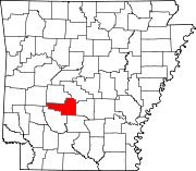
List of lakes of Hot Spring County, Arkansas
Map all coordinates using OpenStreetMap
Download coordinates as:
- KML
- GPX (all coordinates)
- GPX (primary coordinates)
- GPX (secondary coordinates)
There are at least 9 named lakes and reservoirs in Hot Spring County, Arkansas.

Lakes
According to the United States Geological Survey, there are no named lakes in Hot Spring County.
Reservoirs
- Clearwater Lake, 34°28′27″N 092°47′50″W / 34.47417°N 92.79722°W / 34.47417; -92.79722 (Clearwater Lake), el. 525 feet (160 m) [1]
- Crouchwood Lake, 34°28′00″N 092°54′55″W / 34.46667°N 92.91528°W / 34.46667; -92.91528 (Crouchwood Lake), el. 423 feet (129 m) [2]
- DeGray Lake, 34°15′07″N 093°11′57″W / 34.25194°N 93.19917°W / 34.25194; -93.19917 (De Gray Lake), el. 400 feet (120 m) [3]
- Jones Lake, 34°29′00″N 092°46′01″W / 34.48333°N 92.76694°W / 34.48333; -92.76694 (Jones Lake), el. 449 feet (137 m) [4]
- Kinzey Lake, 34°28′54″N 092°48′37″W / 34.48167°N 92.81028°W / 34.48167; -92.81028 (Kinzey Lake), el. 614 feet (187 m) [5]
- Lake Bobbie, 34°23′33″N 093°10′16″W / 34.39250°N 93.17111°W / 34.39250; -93.17111 (Lake Bobbie), el. 591 feet (180 m) [6]
- Lake Catherine, 34°25′36″N 092°53′13″W / 34.42667°N 92.88694°W / 34.42667; -92.88694 (Lake Catherine), el. 266 feet (81 m) [7]
- Lower Lake, 34°29′10″N 092°46′12″W / 34.48611°N 92.77000°W / 34.48611; -92.77000 (Lower Lake), el. 486 feet (148 m) [8]
- Lucinda Lake, 34°29′09″N 092°48′33″W / 34.48583°N 92.80917°W / 34.48583; -92.80917 (Lucinda Lake), el. 531 feet (162 m) [9]
See also
 United States portal

Notes
- ^ "Clearwater Lake". Geographic Names Information System. United States Geological Survey, United States Department of the Interior.
- ^ "Crouchwood Lake". Geographic Names Information System. United States Geological Survey, United States Department of the Interior.
- ^ "De Gray Lake". Geographic Names Information System. United States Geological Survey, United States Department of the Interior.
- ^ "Jones Lake". Geographic Names Information System. United States Geological Survey, United States Department of the Interior.
- ^ "Kinzey Lake". Geographic Names Information System. United States Geological Survey, United States Department of the Interior.
- ^ "Lake Bobbie". Geographic Names Information System. United States Geological Survey, United States Department of the Interior.
- ^ "Lake Catherine". Geographic Names Information System. United States Geological Survey, United States Department of the Interior.
- ^ "Lower Lake". Geographic Names Information System. United States Geological Survey, United States Department of the Interior.
- ^ "Lucinda Lake". Geographic Names Information System. United States Geological Survey, United States Department of the Interior.
- v
- t
- e
Municipalities and communities of Hot Spring County, Arkansas, United States
County seat: Malvern
- Antioch
- Big Creek
- Bismarck
- Brown Springs
- Butterfield
- Clear Creek
- De Roche
- Dover
- Fenter
- Gifford
- Harrison
- Henderson
- Lone Hill
- Magnet
- Midway
- Montgomery
- Ouachita
- Prairie
- Saline
- Valley
communities
- Arkansas portal
- United States portal


