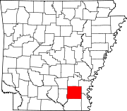
List of lakes of Drew County, Arkansas
Map all coordinates using OpenStreetMap
Download coordinates as:
- KML
- GPX (all coordinates)
- GPX (primary coordinates)
- GPX (secondary coordinates)
There are at least 11 named lakes and reservoirs in Drew County, Arkansas.
Lakes
- Austin Brake, 33°40′00″N 091°27′15″W / 33.66667°N 91.45417°W / 33.66667; -91.45417 (Austin Brake), el. 141 feet (43 m) [1]
- Big Lake, 33°34′52″N 091°36′18″W / 33.58111°N 91.60500°W / 33.58111; -91.60500 (=Big Lake), el. 118 feet (36 m) [2]
Reservoirs
- Bynum Lake, 33°30′20″N 091°33′56″W / 33.50556°N 91.56556°W / 33.50556; -91.56556 (Bynum Lake), el. 161 feet (49 m) [3]
- Byrd Lake, 33°41′53″N 091°40′49″W / 33.69806°N 91.68028°W / 33.69806; -91.68028 (Byrd Lake), el. 180 feet (55 m) [4]
- Dura Craft Lake, 33°37′55″N 091°49′49″W / 33.63194°N 91.83028°W / 33.63194; -91.83028 (Dura Craft Lake), el. 217 feet (66 m) [5]
- Hopper Pond, 33°43′00″N 091°54′00″W / 33.71667°N 91.90000°W / 33.71667; -91.90000 (Hopper Pond), el. 161 feet (49 m) [6]
- Lake Wallace, 33°27′09″N 091°27′09″W / 33.45250°N 91.45250°W / 33.45250; -91.45250 (Lake Wallace), el. 125 feet (38 m) [7]
- Marsh Lake, 33°44′46″N 091°57′46″W / 33.74611°N 91.96278°W / 33.74611; -91.96278 (Marsh Lake), el. 148 feet (45 m) [8]
- Seven Devils Lake, 33°33′13″N 091°34′29″W / 33.55361°N 91.57472°W / 33.55361; -91.57472 (Seven Devils Lake), el. 131 feet (40 m) [9]
- Seven Devils Swamp, 33°33′12″N 091°34′30″W / 33.55333°N 91.57500°W / 33.55333; -91.57500 (Seven Devils Swamp), el. 131 feet (40 m) [10]
- Wells Lake, 33°42′12″N 091°35′12″W / 33.70333°N 91.58667°W / 33.70333; -91.58667 (Wells Lake), el. 164 feet (50 m) [11]
See also
 United States portal

Notes
- ^ "Austin Brake". Geographic Names Information System. United States Geological Survey, United States Department of the Interior.
- ^ "Big Lake". Geographic Names Information System. United States Geological Survey, United States Department of the Interior.
- ^ "Bynum Lake". Geographic Names Information System. United States Geological Survey, United States Department of the Interior.
- ^ "Byrd Lake". Geographic Names Information System. United States Geological Survey, United States Department of the Interior.
- ^ "Dura Craft Lake". Geographic Names Information System. United States Geological Survey, United States Department of the Interior.
- ^ "Hopper Pond". Geographic Names Information System. United States Geological Survey, United States Department of the Interior.
- ^ "Lake Wallace". Geographic Names Information System. United States Geological Survey, United States Department of the Interior.
- ^ "Marsh Lake". Geographic Names Information System. United States Geological Survey, United States Department of the Interior.
- ^ "Seven Devils Lake". Geographic Names Information System. United States Geological Survey, United States Department of the Interior.
- ^ "Seven Devils Swamp". Geographic Names Information System. United States Geological Survey, United States Department of the Interior.
- ^ "Wells Lake". Geographic Names Information System. United States Geological Survey, United States Department of the Interior.
- v
- t
- e
Municipalities and communities of Drew County, Arkansas, United States
County seat: Monticello
communities
‡This populated place also has portions in an adjacent county or counties
- Arkansas portal
- United States portal


