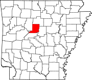
List of lakes of Conway County, Arkansas
Map all coordinates using OpenStreetMap
Download coordinates as:
- KML
- GPX (all coordinates)
- GPX (primary coordinates)
- GPX (secondary coordinates)
There are at least 38 named lakes and reservoirs in Conway County, Arkansas.
Lakes
- Old River Lake, 33°59′16″N 092°36′02″W / 33.98778°N 92.60056°W / 33.98778; -92.60056 (Old River Lake), el. 266 feet (81 m) [1]
- Tank Lake, 35°08′40″N 092°34′16″W / 35.14444°N 92.57111°W / 35.14444; -92.57111 (Tank Lake), el. 266 feet (81 m) [2]
Reservoirs
- Cargile Lake, 35°16′30″N 092°48′53″W / 35.27500°N 92.81472°W / 35.27500; -92.81472 (Cargile Lake), el. 328 feet (100 m) [3]
- East Fork Point Remove Site Three Reservoir, 35°25′49″N 092°37′55″W / 35.43028°N 92.63194°W / 35.43028; -92.63194 (East Fork Point Remove Site Three Reservoir), el. 489 feet (149 m) [4]
- East Fork Point Remove Site Four Reservoir, 35°24′16″N 092°40′43″W / 35.40444°N 92.67861°W / 35.40444; -92.67861 (East Fork Point Remove Site Four Reservoir), el. 472 feet (144 m) [5]
- East Fork Point Remove Site Five Reservoir, 35°24′05″N 092°38′07″W / 35.40139°N 92.63528°W / 35.40139; -92.63528 (East Fork Point Remove Site Five Reservoir), el. 466 feet (142 m) [6]
- East Fork Point Remove Site Six Reservoir, 35°22′57″N 092°38′58″W / 35.38250°N 92.64944°W / 35.38250; -92.64944 (East Fork Point Remove Site Six Reservoir), el. 430 feet (130 m) [7]
- East Fork Point Remove Site Seven Reservoir, 35°21′54″N 092°39′45″W / 35.36500°N 92.66250°W / 35.36500; -92.66250 (East Fork Point Remove Site Seven Reservoir), el. 430 feet (130 m) [8]
- East Fork Point Remove Site Eight Reservoir, 35°21′01″N 092°41′36″W / 35.35028°N 92.69333°W / 35.35028; -92.69333 (East Fork Point Remove Site Eight Reservoir), el. 430 feet (130 m) [9]
- East Fork Point Remove Site Nine Reservoir, 35°17′31″N 092°41′11″W / 35.29194°N 92.68639°W / 35.29194; -92.68639 (East Fork Point Remove Site Nine Reservoir), el. 331 feet (101 m) [10]
- East Fork Point Remove Site Ten Reservoir, 35°15′31″N 092°43′31″W / 35.25861°N 92.72528°W / 35.25861; -92.72528 (East Fork Point Remove Site Ten Reservoir), el. 305 feet (93 m) [11]
- East Fork Point Remove Site 11 Reservoir, 35°16′55″N 092°45′39″W / 35.28194°N 92.76083°W / 35.28194; -92.76083 (East Fork Point Remove Site 11 Reservoir), el. 351 feet (107 m) [12]
- Fish Lake, 35°13′23″N 092°47′54″W / 35.22306°N 92.79833°W / 35.22306; -92.79833 (Fish Lake), el. 292 feet (89 m) [13]
- Fowler Lake, 35°19′00″N 092°40′19″W / 35.31667°N 92.67194°W / 35.31667; -92.67194 (Fowler Lake), el. 420 feet (130 m) [14]
- Lake Abby, 35°08′28″N 092°56′35″W / 35.14111°N 92.94306°W / 35.14111; -92.94306 (Lake Abby), el. 1,053 feet (321 m) [15]
- Lake Amanda, 35°08′46″N 092°55′21″W / 35.14611°N 92.92250°W / 35.14611; -92.92250 (Lake Amanda), el. 968 feet (295 m) [16]
- Lake Bailey, 35°07′48″N 092°55′31″W / 35.13000°N 92.92528°W / 35.13000; -92.92528 (Lake Bailey), el. 889 feet (271 m) [17]
- Lake Elsie, 35°08′13″N 092°56′49″W / 35.13694°N 92.94694°W / 35.13694; -92.94694 (Lake Elsie), el. 1,027 feet (313 m) [18]
- Lake George, 35°08′38″N 092°55′27″W / 35.14389°N 92.92417°W / 35.14389; -92.92417 (Lake George), el. 961 feet (293 m) [19]
- Lake Jeannette, 35°08′05″N 092°55′48″W / 35.13472°N 92.93000°W / 35.13472; -92.93000 (Lake Jeannette), el. 945 feet (288 m) [20]
- Lake Lucy, 35°08′40″N 092°56′01″W / 35.14444°N 92.93361°W / 35.14444; -92.93361 (Lake Lucy), el. 1,014 feet (309 m) [21]
- Lake Overcup, 35°12′11″N 092°43′14″W / 35.20306°N 92.72056°W / 35.20306; -92.72056 (Lake Overcup), el. 305 feet (93 m) [22]
- Morrilton Sewage Lake, 35°10′48″N 092°44′31″W / 35.18000°N 92.74194°W / 35.18000; -92.74194 (Morrilton Sewage Lake), el. 308 feet (94 m) [23]
- Payne Lake, 35°06′13″N 092°46′54″W / 35.10361°N 92.78167°W / 35.10361; -92.78167 (Payne Lake), el. 302 feet (92 m) [24]
- Petit Jean State Park Lake, 35°07′30″N 092°55′15″W / 35.12500°N 92.92083°W / 35.12500; -92.92083 (Petit Jean State Park Lake), el. 932 feet (284 m) [25]
- Pool Nine, 35°07′30″N 092°47′13″W / 35.12500°N 92.78694°W / 35.12500; -92.78694 (Pool Nine), el. 282 feet (86 m) [26]
- Roosevelt Lake, 35°07′45″N 092°55′29″W / 35.12917°N 92.92472°W / 35.12917; -92.92472 (Roosevelt Lake), el. 892 feet (272 m) [27]
- Timberlake Reservoir, 35°04′57″N 092°48′12″W / 35.08250°N 92.80333°W / 35.08250; -92.80333 (Timberlake Reservoir), el. 295 feet (90 m) [28]
- West Fork Point Remove Creek Site Four Reservoir, 35°27′17″N 092°41′54″W / 35.45472°N 92.69833°W / 35.45472; -92.69833 (West Fork Point Remove Creek Site Four Reservoir), el. 584 feet (178 m) [29]
- West Fork Point Remove Creek Site Five Reservoir, 35°27′16″N 092°45′10″W / 35.45444°N 92.75278°W / 35.45444; -92.75278 (West Fork Point Remove Creek Site Five Reservoir), el. 610 feet (190 m) [30]
- West Fork Point Remove Creek Site Six Reservoir, 35°25′06″N 092°47′07″W / 35.41833°N 92.78528°W / 35.41833; -92.78528 (West Fork Point Remove Creek Site Six Reservoir), el. 607 feet (185 m) [31]
- West Fork Point Remove Creek Site Seven Reservoir, 35°25′45″N 092°50′56″W / 35.42917°N 92.84889°W / 35.42917; -92.84889 (West Fork Point Remove Creek Site Seven Reservoir), el. 531 feet (162 m) [32]
- West Fork Point Remove Creek Site 12 Reservoir, 35°21′02″N 092°48′42″W / 35.35056°N 92.81167°W / 35.35056; -92.81167 (West Fork Point Remove Creek Site 12 Reservoir), el. 371 feet (113 m) [33]
- West Fork Point Remove Creek Site 13 Reservoir, 35°21′02″N 092°45′47″W / 35.35056°N 92.76306°W / 35.35056; -92.76306 (West Fork Point Remove Creek Site 13 Reservoir), el. 410 feet (120 m) [34]
- West Fork Point Remove Creek Site 14 Reservoir, 35°20′43″N 092°45′26″W / 35.34528°N 92.75722°W / 35.34528; -92.75722 (West Fork Point Remove Creek Site 14 Reservoir), el. 410 feet (120 m) [35]
- West Fork Point Remove Creek Site 15 Reservoir, 35°19′55″N 092°46′37″W / 35.33194°N 92.77694°W / 35.33194; -92.77694 (West Fork Point Remove Creek Site 15 Reservoir), el. 407 feet (124 m) [36]
- West Fork Point Remove Creek Site 16 Reservoir, 35°18′20″N 092°51′09″W / 35.30556°N 92.85250°W / 35.30556; -92.85250 (West Fork Point Remove Creek Site 16 Reservoir), el. 308 feet (94 m) [37]
- Winrock Farms Lake, 35°38′24″N 092°55′43″W / 35.64000°N 92.92861°W / 35.64000; -92.92861 (Winrock Farms Lake), el. 1,263 feet (385 m) [38]
See also
 United States portal

Notes
- ^ "Old River Lake". Geographic Names Information System. United States Geological Survey, United States Department of the Interior.
- ^ "Tank Lake". Geographic Names Information System. United States Geological Survey, United States Department of the Interior.
- ^ "Cargile Lake". Geographic Names Information System. United States Geological Survey, United States Department of the Interior.
- ^ "East Fork Point Remove Site Three Reservoir". Geographic Names Information System. United States Geological Survey, United States Department of the Interior.
- ^ "East Fork Point Remove Site Four Reservoir". Geographic Names Information System. United States Geological Survey, United States Department of the Interior.
- ^ "East Fork Point Remove Site Five Reservoir". Geographic Names Information System. United States Geological Survey, United States Department of the Interior.
- ^ "East Fork Point Remove Site Six Reservoir". Geographic Names Information System. United States Geological Survey, United States Department of the Interior.
- ^ "East Fork Point Remove Site Seven Reservoir". Geographic Names Information System. United States Geological Survey, United States Department of the Interior.
- ^ "East Fork Point Remove Site Eight Reservoir". Geographic Names Information System. United States Geological Survey, United States Department of the Interior.
- ^ "East Fork Point Remove Site Nine Reservoir". Geographic Names Information System. United States Geological Survey, United States Department of the Interior.
- ^ "East Fork Point Remove Site Ten Reservoir". Geographic Names Information System. United States Geological Survey, United States Department of the Interior.
- ^ "East Fork Point Remove Site 11 Reservoir". Geographic Names Information System. United States Geological Survey, United States Department of the Interior.
- ^ "Fish Lake". Geographic Names Information System. United States Geological Survey, United States Department of the Interior.
- ^ "Fowler Lake". Geographic Names Information System. United States Geological Survey, United States Department of the Interior.
- ^ "Lake Abby". Geographic Names Information System. United States Geological Survey, United States Department of the Interior.
- ^ "Lake Amanda". Geographic Names Information System. United States Geological Survey, United States Department of the Interior.
- ^ "Lake Bailey". Geographic Names Information System. United States Geological Survey, United States Department of the Interior.
- ^ "Lake Elsie". Geographic Names Information System. United States Geological Survey, United States Department of the Interior.
- ^ "Lake George". Geographic Names Information System. United States Geological Survey, United States Department of the Interior.
- ^ "Lake Jeannette". Geographic Names Information System. United States Geological Survey, United States Department of the Interior.
- ^ "Lake Lucy". Geographic Names Information System. United States Geological Survey, United States Department of the Interior.
- ^ "Lake Overcup". Geographic Names Information System. United States Geological Survey, United States Department of the Interior.
- ^ "Morrilton Sewage Lake". Geographic Names Information System. United States Geological Survey, United States Department of the Interior.
- ^ "Payne Lake". Geographic Names Information System. United States Geological Survey, United States Department of the Interior.
- ^ "Petit Jean State Park Lake". Geographic Names Information System. United States Geological Survey, United States Department of the Interior.
- ^ "Pool Nine". Geographic Names Information System. United States Geological Survey, United States Department of the Interior.
- ^ "Roosevelt Lake". Geographic Names Information System. United States Geological Survey, United States Department of the Interior.
- ^ "Timberlake Reservoir". Geographic Names Information System. United States Geological Survey, United States Department of the Interior.
- ^ "West Fork Point Remove Creek Site Four Reservoir". Geographic Names Information System. United States Geological Survey, United States Department of the Interior.
- ^ "West Fork Point Remove Creek Site Five Reservoir". Geographic Names Information System. United States Geological Survey, United States Department of the Interior.
- ^ "West Fork Point Remove Creek Site Six Reservoir". Geographic Names Information System. United States Geological Survey, United States Department of the Interior.
- ^ "West Fork Point Remove Creek Site Seven Reservoir". Geographic Names Information System. United States Geological Survey, United States Department of the Interior.
- ^ "West Fork Point Remove Creek Site 12 Reservoir". Geographic Names Information System. United States Geological Survey, United States Department of the Interior.
- ^ "West Fork Point Remove Creek Site 13 Reservoir". Geographic Names Information System. United States Geological Survey, United States Department of the Interior.
- ^ "West Fork Point Remove Creek Site 14 Reservoir". Geographic Names Information System. United States Geological Survey, United States Department of the Interior.
- ^ "West Fork Point Remove Creek Site 15 Reservoir". Geographic Names Information System. United States Geological Survey, United States Department of the Interior.
- ^ "West Fork Point Remove Creek Site 16 Reservoir". Geographic Names Information System. United States Geological Survey, United States Department of the Interior.
- ^ "Winrock Farms Lake". Geographic Names Information System. United States Geological Survey, United States Department of the Interior.