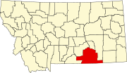
List of lakes of Big Horn County, Montana
Map all coordinates using OpenStreetMap
Download coordinates as:
- KML
- GPX (all coordinates)
- GPX (primary coordinates)
- GPX (secondary coordinates)
This list is incomplete; you can help by adding missing items. (February 2011) |
There are at least 18 named lakes and reservoirs in Big Horn County, Montana.
Lakes
- Arapooish Pond, 45°45′17″N 107°34′02″W / 45.75472°N 107.56722°W / 45.75472; -107.56722 (Arapooish Pond), el. 2,874 feet (876 m)[1]
- Crater Lake (Big Horn County, Montana), 45°17′46″N 108°24′40″W / 45.29611°N 108.41111°W / 45.29611; -108.41111 (Crater Lake), el. 7,313 feet (2,229 m)[2]
- Little Hawk Lake, 45°35′51″N 106°55′25″W / 45.59750°N 106.92361°W / 45.59750; -106.92361 (Little Hawk Lake), el. 3,428 feet (1,045 m)[3]
- Muddy Lake, 45°25′07″N 106°49′58″W / 45.41861°N 106.83278°W / 45.41861; -106.83278 (Muddy Lake), el. 4,459 feet (1,359 m)[4]
Reservoirs
- Bighorn Reservoirs, 45°18′24″N 107°57′29″W / 45.30667°N 107.95806°W / 45.30667; -107.95806 (Bighorn Lake), el. 3,642 feet (1,110 m)[5]
- Brown Reservoir, 45°10′03″N 107°18′47″W / 45.16750°N 107.31306°W / 45.16750; -107.31306 (Brown Reservoir), el. 3,747 feet (1,142 m)[6]
- Chalk Butte Reservoir, 45°11′40″N 107°18′38″W / 45.19444°N 107.31056°W / 45.19444; -107.31056 (Chalk Butte Reservoir), el. 3,655 feet (1,114 m)[7]
- Halfway Reservoir, 45°09′43″N 107°21′04″W / 45.16194°N 107.35111°W / 45.16194; -107.35111 (Halfway Reservoir), el. 3,743 feet (1,141 m)[8]
- Liming Reservoir, 45°12′50″N 107°18′33″W / 45.21389°N 107.30917°W / 45.21389; -107.30917 (Liming Reservoir), el. 3,586 feet (1,093 m)[9]
- Lodge Grass Reservoir, 45°10′00″N 107°36′02″W / 45.16667°N 107.60056°W / 45.16667; -107.60056 (Lodge Grass Reservoir), el. 4,144 feet (1,263 m)[10]
- Lodge Grass Storage Reservoir, 45°09′50″N 107°35′49″W / 45.16389°N 107.59694°W / 45.16389; -107.59694 (Lodge Grass Storage Reservoir), el. 4,144 feet (1,263 m)[11]
- Lower Indian Creek Reservoir, 45°16′21″N 107°00′48″W / 45.27250°N 107.01333°W / 45.27250; -107.01333 (Lower Indian Creek Reservoir), el. 4,108 feet (1,252 m)[12]
- Rednose Reservoir, 45°32′10″N 106°59′28″W / 45.53611°N 106.99111°W / 45.53611; -106.99111 (Rednose Reservoir), el. 3,448 feet (1,051 m)[13]
- Steinhilber Reservoir, 45°12′39″N 107°15′06″W / 45.21083°N 107.25167°W / 45.21083; -107.25167 (Steinhilber Reservoir), el. 3,701 feet (1,128 m)[14]
- Tongue River Reservoir, 45°07′50″N 106°45′58″W / 45.13056°N 106.76611°W / 45.13056; -106.76611 (Tongue River Reservoir), el. 3,442 feet (1,049 m)[15]
- Two Moon Reservoir, 45°33′59″N 106°52′11″W / 45.56639°N 106.86972°W / 45.56639; -106.86972 (Two Moon Reservoir), el. 3,415 feet (1,041 m)[16]
- Upper Indian Creek Reservoir, 45°16′13″N 107°01′18″W / 45.27028°N 107.02167°W / 45.27028; -107.02167 (Upper Indian Creek Reservoir), el. 4,121 feet (1,256 m)[17]
- Yellowtail Afterbay Reservoir, 45°19′06″N 107°55′26″W / 45.31833°N 107.92389°W / 45.31833; -107.92389 (Yellowtail Afterbay Reservoir), el. 3,209 feet (978 m)[18]
See also
Notes
- ^ "Arapooish Pond". Geographic Names Information System. United States Geological Survey, United States Department of the Interior.
- ^ "Crater Lake". Geographic Names Information System. United States Geological Survey, United States Department of the Interior.
- ^ "Little Hawk Lake". Geographic Names Information System. United States Geological Survey, United States Department of the Interior.
- ^ "Muddy Lake". Geographic Names Information System. United States Geological Survey, United States Department of the Interior.
- ^ "Bighorn Lake". Geographic Names Information System. United States Geological Survey, United States Department of the Interior.
- ^ "Brown Reservoir". Geographic Names Information System. United States Geological Survey, United States Department of the Interior.
- ^ "Chalk Butte Reservoir". Geographic Names Information System. United States Geological Survey, United States Department of the Interior.
- ^ "Halfway Reservoir". Geographic Names Information System. United States Geological Survey, United States Department of the Interior.
- ^ "Liming Reservoir". Geographic Names Information System. United States Geological Survey, United States Department of the Interior.
- ^ "Lodge Grass Reservoir". Geographic Names Information System. United States Geological Survey, United States Department of the Interior.
- ^ "Lodge Grass Storage Reservoir". Geographic Names Information System. United States Geological Survey, United States Department of the Interior.
- ^ "Lower Indian Creek Reservoir". Geographic Names Information System. United States Geological Survey, United States Department of the Interior.
- ^ "Rednose Reservoir". Geographic Names Information System. United States Geological Survey, United States Department of the Interior.
- ^ "Steinhilber Reservoir". Geographic Names Information System. United States Geological Survey, United States Department of the Interior.
- ^ "Tongue River Reservoir". Geographic Names Information System. United States Geological Survey, United States Department of the Interior.
- ^ "Two Moon Reservoir". Geographic Names Information System. United States Geological Survey, United States Department of the Interior.
- ^ "Upper Indian Creek Reservoir". Geographic Names Information System. United States Geological Survey, United States Department of the Interior.
- ^ "Yellowtail Afterbay Reservoir". Geographic Names Information System. United States Geological Survey, United States Department of the Interior.
- v
- t
- e
Municipalities and communities of Big Horn County, Montana, United States
County seat: Hardin
communities
‡This populated place also has portions in an adjacent county or counties
- Montana portal
- United States portal


