List of crossings of the Fraser River
This is a list of bridges, tunnels, and other crossings of the Fraser River in the Canadian province of British Columbia. It includes both functional crossings and historic crossings which no longer exist, and lists them in sequence from the South Arm of the Fraser River at the Strait of Georgia upstream to its source. Listed separately on this page are the crossings on the Fraser River's North and Middle Arms.
This transport-related list is incomplete; you can help by adding missing items. (August 2008) |
Fraser River Delta (Strait of Georgia to New Westminster)
South Arm
This is a list of crossings of the South Arm of the Fraser River from the Strait of Georgia to the North Arm of the Fraser River at approximately mile 16.5. The South Arm is the primary outflow branch of the Fraser River.
Map this section's coordinates using OpenStreetMap
Download coordinates as:
- KML
- GPX (all coordinates)
- GPX (primary coordinates)
- GPX (secondary coordinates)
| Crossing | Image | Carries | Location | Coordinates | Completed | Notes |
|---|---|---|---|---|---|---|
| Westham Island Bridge |  | Westham Island Road | Delta and Westham Island | 49°04′50″N 123°07′44″W / 49.08056°N 123.12889°W / 49.08056; -123.12889 (Westham Island Bridge) | 1910 | One of the few remaining Howe truss bridges in the world. |
| Ladner Ferry (1913–1959) | 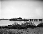 | Passengers and vehicles | Delta and Richmond | 49°07′03″N 123°05′12″W / 49.11750°N 123.08667°W / 49.11750; -123.08667 (Ladner Ferry (1914-1959)) | 1914 | Replaced by George Massey Tunnel in 1959. |
| George Massey Tunnel |  |  Highway 99 Highway 99 | Delta and Richmond | 49°07′19″N 123°04′32″W / 49.12194°N 123.07556°W / 49.12194; -123.07556 (George Massey Tunnel) | 1959 | The only vehicular tunnel crossing of the Fraser River. |
| Alex Fraser Bridge |  |  Highway 91 Highway 91 | Annacis Island and Delta | 49°09′36″N 122°56′35″W / 49.16000°N 122.94306°W / 49.16000; -122.94306 (Alex Fraser Bridge) | 1986 | |
| Annacis Island Swing Bridge | Derwent Way | Annacis Island and New Westminster | 49°11′11″N 122°55′57″W / 49.18639°N 122.93250°W / 49.18639; -122.93250 (Annacis Island Swing Bridge) | 1986 |
Middle Arm
This is a list of crossings of the Middle Arm of the Fraser River from the Strait of Georgia to the North Arm of the Fraser River at approximately mile 4.6.
Map this section's coordinates using OpenStreetMap
Download coordinates as:
- KML
- GPX (all coordinates)
- GPX (primary coordinates)
- GPX (secondary coordinates)
| Crossing | Image | Carries | Location | Coordinates | Completed | Notes |
|---|---|---|---|---|---|---|
| No. 2 Road Bridge |  | No. 2 Road / Russ Baker Way | Richmond and Sea Island | 49°10′34.74″N 123°9′25.03″W / 49.1763167°N 123.1569528°W / 49.1763167; -123.1569528 (No. 2 Road Bridge) | 1993 | |
| Dinsmore Bridge |  | Gilbert Road | Richmond and Sea Island | 49°10′44″N 123°08′56″W / 49.178831°N 123.14882°W / 49.178831; -123.14882 (Dinsmore Bridge) | 1969 | Weight restrictions were added in October 2006. |
| Moray Bridge |  | Sea Island Way | Richmond and Sea Island | 49°11′31″N 123°08′13″W / 49.19194°N 123.13694°W / 49.19194; -123.13694 (Moray Bridge) | 1957 | a.k.a. the Moray Channel Bridge, and formerly the Middle Arm Bridge |
| Sea Island Connector |  | Bridgeport Road | Richmond and Sea Island | 49°11′33″N 123°08′12″W / 49.19250°N 123.13667°W / 49.19250; -123.13667 (Sea Island Connector) | 2002 | a.k.a. the Airport Connector Bridge |
| Middle Arm Canada Line Bridge |  | SkyTrain Canada Line | Richmond and Sea Island | 49°11′45″N 123°08′06″W / 49.19583°N 123.13500°W / 49.19583; -123.13500 (Middle Arm Bridge) | 2009 | a.k.a. Middle Arm or Airport SkyTrain Bridge |
| Marpole Bridge (1889–1957) |  | Hudson Street / Woodward Highway | Richmond and Sea Island | 49°11′47″N 123°08′05″W / 49.19639°N 123.13472°W / 49.19639; -123.13472 (Marpole Bridge) | 1889 | a.k.a. Eburne Bridge, North Arm Bridge, or Sea Island Bridge |
North Arm
This is a list of crossings of the North Arm of the Fraser River from the Strait of Georgia to the main body of the Fraser River at approximately mile 16.5. The North Arm is the secondary outflow branch of the Fraser River.
Map this section's coordinates using OpenStreetMap
Download coordinates as:
- KML
- GPX (all coordinates)
- GPX (primary coordinates)
- GPX (secondary coordinates)
| Crossing | Image | Carries | Location | Coordinates | Completed | Notes |
|---|---|---|---|---|---|---|
| Marpole Bridge (1889–1957) | Hudson Street / Woodward Highway | Sea Island and Vancouver | 49°11′57″N 123°08′09″W / 49.19917°N 123.13583°W / 49.19917; -123.13583 (Marpole Bridge) | 1889 | a.k.a. Eburne Bridge, Sea Island Bridge, or Middle Arm Bridge | |
| Arthur Laing Bridge |  | Grant McConachie Way | Sea Island and Vancouver | 49°11′57″N 123°08′09″W / 49.19917°N 123.13583°W / 49.19917; -123.13583 (Arthur Laing Bridge) | 1975 | |
| Marpole CP Rail Bridge |  | CP Railway (low-level in foreground) | Richmond and Vancouver | 49°11′59″N 123°07′37″W / 49.19972°N 123.12694°W / 49.19972; -123.12694 (Marpole Bridge) | 1902; Span rebuilt 1967 | Swing span removed following barge collision in 2016. |
| Oak Street Bridge |  | Highway 99 | Richmond and Vancouver | 49°11′59″N 123°07′32″W / 49.19972°N 123.12556°W / 49.19972; -123.12556 (Oak Street Bridge) | 1957 | |
| North Arm Canada Line Bridge |  | SkyTrain Canada Line cyclists and pedestrians | Richmond and Vancouver | 49°12′09″N 123°6′57″W / 49.20250°N 123.11583°W / 49.20250; -123.11583 (North Arm Bridge) | 2009 | a.k.a. Canada Line Bridge (Richmond-Vancouver), or various identifying descriptives |
| Fraser Street Bridge (1894–1974) |  | Fraser Street / No. 5 Road | Richmond and Vancouver | 49°11′53″N 123°05′28″W / 49.19806°N 123.09111°W / 49.19806; -123.09111 (Fraser Street Bridge (1905-1974)) | 1894 | a.k.a. Fraser Ave. Bridge, North Arm Bridge, No. 5 Rd. Bridge, or Twigg Island Bridge |
| Knight Street Bridge |  | Knight Street | Richmond and Vancouver | 49°12′08″N 123°04′39″W / 49.20222°N 123.07750°W / 49.20222; -123.07750 (Knight Street Bridge) | 1974 | |
| CNR Bridge |  | Canadian National Railway | Burnaby and Richmond | 49°10′59″N 122°59′17″W / 49.18306°N 122.98806°W / 49.18306; -122.98806 (CNR Bridge) | 1931 | |
| Queensborough Bridge |  |  Highway 91A Highway 91A | New Westminster and Queensborough | 49°11′46″N 122°56′49″W / 49.19611°N 122.94694°W / 49.19611; -122.94694 (Queensborough Bridge) | 1960 | |
| Queensborough Railway Bridge |  | SRY Rail Link | New Westminster and Queensborough | 49°11′50″N 122°55′24″W / 49.19722°N 122.92333°W / 49.19722; -122.92333 (Queensborough Railway Bridge) | 1910 | |
| Q to Q Ferry | Passengers | New Westminster and Queensborough | 49°11′45″N 122°55′1″W / 49.19583°N 122.91694°W / 49.19583; -122.91694 (Q to Q Ferry) | 2017 |
Main Watercourse (New Westminster to Yellowhead Pass)
Map this section's coordinates using OpenStreetMap
Download coordinates as:
- KML
- GPX (all coordinates)
- GPX (primary coordinates)
- GPX (secondary coordinates)
| Crossing | Image | Carries | Location | Coordinates | Completed | Notes |
|---|---|---|---|---|---|---|
| SkyBridge |  | SkyTrain Expo Line | New Westminster and Surrey | 49°12′20″N 122°53′48″W / 49.20556°N 122.89667°W / 49.20556; -122.89667 (SkyBridge) | 1990 | Until 2019 it was the longest cable-supported transit-only bridge in the world. |
| Pattullo Bridge |  |  Highway 1A Highway 1A Highway 99A Highway 99A | New Westminster and Surrey | 49°12′27″N 122°53′40″W / 49.20750°N 122.89444°W / 49.20750; -122.89444 (Pattullo Bridge (1937)) | 1937 | |
| New Westminster Bridge |  | Railway | New Westminster and Surrey | 49°12′29″N 122°53′38″W / 49.20806°N 122.89389°W / 49.20806; -122.89389 (New Westminster Bridge) | 1904 | Oldest bridge in the Lower Mainland of British Columbia. Served automobile traffic from 1904 to 1937. |
| Port Mann Bridge |  |  Highway 1 (TCH) Highway 1 (TCH) | Coquitlam and Surrey | 49°13′14″N 122°48′45″W / 49.22056°N 122.81250°W / 49.22056; -122.81250 (Port Mann Bridge (2015)) | 1964 (original) 2012 (current) | |
| Barnston Island Ferry |  | Passengers and vehicles | Barnston Island and Surrey | 49°11′31″N 122°43′30″W / 49.19194°N 122.72500°W / 49.19194; -122.72500 (Barnston Island Ferry) | 1916 | |
| Golden Ears Bridge |  | Golden Ears Way | Langley and Maple Ridge | 49°11′47″N 122°39′56″W / 49.19639°N 122.66556°W / 49.19639; -122.66556 (Golden Ears Bridge) (Approx) | 2009 | Longest extradosed bridge in the Western Hemisphere. |
| Jacob Haldi Bridge | Glover Road | Langley and McMillan Island | 49°10′18″N 122°34′34″W / 49.17167°N 122.57611°W / 49.17167; -122.57611 (Jacob Haldi Bridge) | 1932 (original) 1994 (current) | ||
| Albion Ferry (1957–2009) |  | Passengers and Vehicles | Langley and Maple Ridge | 49°10′52″N 122°33′50″W / 49.18111°N 122.56389°W / 49.18111; -122.56389 (Albion Ferry (1957-2009)) | 1957 | Replaced by Golden Ears Bridge in 2009. |
| Mission Bridge |  |  Highway 11 Highway 11 | Abbotsford and Mission | 49°07′25″N 122°18′21″W / 49.12361°N 122.30583°W / 49.12361; -122.30583 (Mission Bridge) | 1973 | |
| Mission Railway Bridge |  | CPR | Abbotsford and Mission | 49°07′34″N 122°18′02″W / 49.12611°N 122.30056°W / 49.12611; -122.30056 (Mission Railway Bridge) | 1909 | Served automobile traffic from 1909 to 1972. |
| Agassiz-Rosedale Bridge |  Highway 9 Highway 9 | South of Agassiz | 49°12′22″N 121°46′37″W / 49.20611°N 121.77694°W / 49.20611; -121.77694 (Agassiz-Rosedale Bridge) | 1956 | ||
| Water Avenue Bridge |  | Highway 1 (TCH) | Haig and Hope | 49°23′10″N 121°27′08″W / 49.38611°N 121.45222°W / 49.38611; -121.45222 (Water Avenue Bridge) | 1916 | |
| Alexandra Bridge (1964) |  | Highway 1 (TCH) | Alexandra Lodge-Spuzzum | 49°42′06″N 121°24′36″W / 49.7016°N 121.4101°W / 49.7016; -121.4101 (Alexandra Bridge (1964)) | 1964 | |
| Alexandra Bridge (1926) |  | Cariboo Road (not in use, heritage site) Pedestrians | Alexandra Lodge-Spuzzum | 49°42′27″N 121°25′00″W / 49.70750°N 121.41667°W / 49.70750; -121.41667 (Alexandra Bridge (1863)) | 1926 | The original crossing was built by Joseph Trutch in 1861 and was completely rebuilt in 1863 and 1926. It was later replaced by the modern Alexandra Bridge in 1964. |
| Hells Gate Suspension Bridge |  | Pedestrians | Hells Gate | 49°46′48″N 121°26′49″W / 49.78000°N 121.44694°W / 49.78000; -121.44694 (Hells Gate Suspension Bridge) | 1948 | Original suspension bridge was destroyed in May 1948 due to a localized flood event. The new bridge was built 3 metres higher than the original. |
| Hells Gate Airtram |  | Passengers | Hells Gate | 49°46′50″N 121°26′59″W / 49.78056°N 121.44972°W / 49.78056; -121.44972 (Hells Gate Airtram) | 1970 | |
| North Bend Aerial Ferry (1940–1986) |  | Passengers and vehicles | Boston Bar and North Bend | 49°52′37″N 121°26′37″W / 49.877°N 121.4436°W / 49.877; -121.4436 (North Bend Aerial Ferry (1940-1986)) | 1940 | Replaced by Cog Harrington Bridge in 1986.[1] The aerial tramway is unique given that it transported passengers and automobiles across the Fraser River. |
| Cog Harrington Bridge |  | Chaumox Road | Boston Bar and North Bend | 49°52′37″N 121°26′37″W / 49.877°N 121.4436°W / 49.877; -121.4436 (Cog Harrington Bridge) | 1986 | |
| Siska CPR Bridge |  | Canadian Pacific Railway | Siska | 50°08′55″N 121°34′42″W / 50.1485°N 121.5784°W / 50.1485; -121.5784 (Siska CPR Bridge) | 1883 | The original truss span was replaced in 1910. |
| Siska CNR Bridge | | Canadian National Railway | Siska | 50°09′05″N 121°34′52″W / 50.1515°N 121.5811°W / 50.1515; -121.5811 (Siska CNR Bridge) | 1914 | |
| Lytton CNR Fraser Bridge |  | Canadian National Railway and pedestrians | Lytton | 50°13′27″N 121°35′06″W / 50.2243°N 121.5849°W / 50.2243; -121.5849 (Lytton CNR Fraser Bridge) | 1914 | |
| Lytton Ferry |  | Passengers and vehicles | Lytton | 50°14′51″N 121°35′30″W / 50.2474°N 121.5918°W / 50.2474; -121.5918 (Lytton Ferry) | 1940 | |
| Fraser River Suspension Bridge | Pedestrians | North of Lytton | 50°16′59″N 121°37′23″W / 50.28306°N 121.62306°W / 50.28306; -121.62306 (Fraser River Suspension Bridge) | 1997 | ||
| Lillooet PGE Bridge (1915–1948) | Pacific Great Eastern Railway | Lillooet | 50°40′48″N 121°55′25″W / 50.68000°N 121.92361°W / 50.68000; -121.92361 (Lillooet PGE Bridge) | 1915 | Demolished in 1948. | |
| Bridge of the Twenty-Three Camels |  | Highway 99 | Lillooet | 50°41′02″N 121°55′44″W / 50.6838°N 121.9289°W / 50.6838; -121.9289 (Bridge of the Twenty-Three Camels) | 1981 | |
| Lillooet ferries (c.1859–c.1891) | Old Cariboo Road | Lillooet | 50°42′40″N 121°54′41″W / 50.71111°N 121.91139°W / 50.71111; -121.91139 (Lillooet ferries (1859-c.1891)) | c.1859 | Superseded by Lillooet truss bridge in 1889. | |
| Lillooet Suspension Bridge |  | Old Highway 12 (not in use) Pedestrians | Lillooet | 50°42′41″N 121°54′41″W / 50.7115°N 121.9114°W / 50.7115; -121.9114 (Lillooet Suspension Bridge) | 1913 | Replaced by the Bridge of the Twenty-Three Camels in 1981. Restored as a pedestrian-only crossing in 2003. |
| Lillooet PGE Bridge (second) |  | Pacific Great Eastern Railway but Canadian National Railway since 2004 | Lillooet | 50°43′04″N 121°54′50″W / 50.7178°N 121.9139°W / 50.7178; -121.9139 (Lillooet Railway Bridge) | 1931 | |
| Bridge River Bridge (1858–c.1870s) | Old Cariboo Road | Lillooet | 50°45′02″N 121°55′51″W / 50.75056°N 121.93083°W / 50.75056; -121.93083 (Bridge River Bridge (1858-1870s)) | 1858 | The bridge was in use until the 1870s. | |
| Pavilion Ferry (1897–c.1964) | Passengers | northwest of Pavilion | 50°52′58″N 121°51′45″W / 50.8828°N 121.8626°W / 50.8828; -121.8626 (Pavilion Ferry) | 1897 | ||
| Big Bar Ferry |  | Unnumbered Ranch Road | Big Bar Creek (Kostering) | 51°11′00″N 122°07′59″W / 51.18333°N 122.13306°W / 51.18333; -122.13306 (Big Bar Ferry) | Reaction-cable ferry (year-round) | |
| Dog Creek Bridge | Unnumbered Ranch Road | Gang Ranch-Dog Creek | 51°31′39″N 122°17′05″W / 51.5275°N 122.2848°W / 51.5275; -122.2848 (Dog Creek Bridge) | |||
| Sheep Creek Bridge |  |  Highway 20 Highway 20 | Riske Creek (18 km SW of Williams Lake | 51°59′02″N 122°16′32″W / 51.9838°N 122.2755°W / 51.9838; -122.2755 (Sheep Creek Bridge) | ||
| Chimney Creek Bridge | Chimney Creek Indian Reserve No. 5 (NW of Williams Lake | 52°04′00″N 122°16′00″W / 52.06667°N 122.26667°W / 52.06667; -122.26667 (Chimney Creek Bridge) | ||||
| Rudy Johnson Bridge | Buckskin Road | Near Soda Creek | 52°15′37″N 122°15′51″W / 52.2602°N 122.2643°W / 52.2602; -122.2643 (Rudy Johnston Bridge) | 1968 | ||
| Marguerite Ferry (1917–2002) | Passengers and vehicles | Castle Rock and Marguerite | 52°31′47″N 122°26′43″W / 52.5297°N 122.4454°W / 52.5297; -122.4454 (Marguerite Ferry) | 1917 | ||
| Fort Alexandria Ferry (1821–1895) | Passengers | Fort Alexandria | 52°33′45″N 122°28′33″W / 52.5624°N 122.4758°W / 52.5624; -122.4758 (Fort Alexandria Ferry) | 1821 | ||
| Alexandria Ferry (1913–1950) | Passengers and vehicles | Alexandria | 52°39′00″N 122°29′32″W / 52.6499°N 122.4922°W / 52.6499; -122.4922 (Alexandria Ferry) | 1913 | ||
| Moffat Bridge | Moffat Bridge Approach/Marsh Drive | Quesnel | 52°58′29″N 122°30′00″W / 52.9746°N 122.5°W / 52.9746; -122.5 (Moffat Bridge) | |||
| Quesnel Fraser River Foot Bridge |  | Pedestrians | Quesnel | 52°58′32″N 122°30′01″W / 52.9755°N 122.5003°W / 52.9755; -122.5003 (Quesnel Fraser River Bridge) | 1929 | Resurfaced for pedestrian use in 1974. |
| Simon Fraser Bridge |  Highway 97 Highway 97 | Prince George | 53°53′25″N 122°44′52″W / 53.8904°N 122.7478°W / 53.8904; -122.7478 (Simon Fraser Bridge) | 1963 (southbound) 2009 (northbound) | ||
| Yellowhead Bridge |  Highway 16 Highway 16 | Prince George | 53°54′37″N 122°43′24″W / 53.9102°N 122.7234°W / 53.9102; -122.7234 (Yellowhead Bridge) | 1988 | ||
| Prince George CNR Bridge |  | Canadian National Railway | Prince George | 53°54′49″N 122°43′06″W / 53.9136°N 122.7183°W / 53.9136; -122.7183 (Prince George CNR Bridge) | 1914 | |
| Prince George BCR-CNR Bridge | BC Rail and Canadian National Railway | Prince George | 53°54′54″N 122°41′27″W / 53.915°N 122.69074°W / 53.915; -122.69074 (Prince George BCR-CNR Bridge) | |||
| Road Bridge | Loopol Road | Near Prince George | 53°58′45″N 122°40′33″W / 53.9792°N 122.6759°W / 53.9792; -122.6759 | Shelley: Northwood road/rail bridge in "Railway" section, and former ferry upstream in "Roads". | ||
| Road Bridge | Upper Fraser Road | Near McGregor | 54°04′58″N 121°50′56″W / 54.0829°N 121.8489°W / 54.0829; -121.8489 | Hansard: Bridge in "Road Transport" section, and former ferry downstream in "Ferry & Loading Areas". | ||
| Hansard CNR Bridge | Canadian National Railway | Near McGregor | 54°04′37″N 121°50′55″W / 54.0770°N 121.8485°W / 54.0770; -121.8485 (Hansard CNR Bridge) | McGregor in first section. | ||
| Dome Creek CNR Bridge | Canadian National Railway | Near Dome Creek | 53°45′14″N 121°02′42″W / 53.7540°N 121.0450°W / 53.7540; -121.0450 (Dome Creek CNR Bridge) | Dome Creek in first section. | ||
| Road Bridge | Morkil Forest Service Road | Near Loos | 53°35′27″N 120°41′20″W / 53.5907°N 120.689°W / 53.5907; -120.689 | |||
| Highway Bridge | Highway 16 | McBride | 53°18′07″N 120°08′24″W / 53.3019°N 120.1399°W / 53.3019; -120.1399 | |||
| Road Bridge | Dunster Station Road | Dunster | 53°08′35″N 119°50′06″W / 53.1431°N 119.8349°W / 53.1431; -119.8349 | |||
| Road Bridge | Blackman Road | Near Tete Jaune Cache | 52°58′29″N 119°26′13″W / 52.9747°N 119.4369°W / 52.9747; -119.4369 | 1953 | ||
| Highway Bridge |  |  Highway 5 Highway 5 | Near Tete Jaune Cache | 52°58′27″N 119°25′30″W / 52.9743°N 119.425°W / 52.9743; -119.425 | ||
| Railway Bridge | Canadian National Railway | Mount Robson Provincial Park | 53°00′03″N 119°03′18″W / 53.0009°N 119.0551°W / 53.0009; -119.0551 | |||
| Railway Bridge | Canadian National Railway | Mount Robson Provincial Park | 52°59′16″N 119°00′36″W / 52.9878°N 119.0101°W / 52.9878; -119.0101 | |||
| Highway Bridge | Highway 16 | Mount Robson Provincial Park | 52°52′02″N 118°40′24″W / 52.8673°N 118.6734°W / 52.8673; -118.6734 | |||
| Highway Bridge | Highway 16 | Mount Robson Provincial Park | 52°51′10″N 118°36′23″W / 52.8527°N 118.6065°W / 52.8527; -118.6065 |
See also
Map all coordinates using OpenStreetMap
Download coordinates as:
- KML
- GPX (all coordinates)
- GPX (primary coordinates)
- GPX (secondary coordinates)
References
- ^ Philcovex (2013-08-25). "Postal History Corner: North Bend Aerial Ferry". Postal History Corner. Retrieved 2019-12-27.


