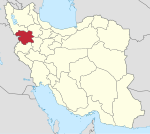
Kowleh
Village in Kurdistan province, Iran
Village in Kurdistan, Iran
Kowleh Persian: كوله | |
|---|---|
Village | |
35°47′23″N 47°03′10″E / 35.78972°N 47.05278°E / 35.78972; 47.05278[1] | |
| Country | Iran |
| Province | Kurdistan |
| County | Divandarreh |
| District | Saral |
| Rural District | Kowleh |
| Population (2016)[2] | |
| • Total | 309 |
| Time zone | UTC+3:30 (IRST) |
Kowleh (Persian: كوله)[a] is a village in, and the capital of, Kowleh Rural District[4] of Saral District, Divandarreh County, Kurdistan province, Iran.
Demographics
Ethnicity
The village is populated by Kurds.[5]
Population
At the time of the 2006 National Census, the village's population was 309 in 76 households.[6] The following census in 2011 counted 373 people in 80 households.[7] The 2016 census measured the population of the village as 309 people in 74 households.[2]
See also
 Iran portal
Notes
References
- ^ OpenStreetMap contributors (3 March 2024). "Kowleh, Divandarreh County" (Map). OpenStreetMap (in Persian). Retrieved 3 March 2024.
- ^ a b "Census of the Islamic Republic of Iran, 1395 (2016)". AMAR (in Persian). The Statistical Center of Iran. p. 12. Archived from the original (Excel) on 8 May 2022. Retrieved 19 December 2022.
- ^ Kowleh can be found at GEOnet Names Server, at this link, by opening the Advanced Search box, entering "-3072418" in the "Unique Feature Id" form, and clicking on "Search Database".
- ^ "Creation and formation of 21 rural districts including villages, farms and places in Sanandaj County under Kurdistan province". Islamic Parliament Research Center (in Persian). Ministry of Interior, Council of Ministers. 18 May 1366. Archived from the original on 10 May 2015. Retrieved 23 January 2024.
- ^ Mohammadirad, Masoud; Anonby, Erik; et al. "Language distribution in Kordestan Province, Iran". Atlas of the languages of Iran (ALI). Geomatics and Cartographic Research Centre, Carleton University. Archived from the original on 28 May 2023.
- ^ "Census of the Islamic Republic of Iran, 1385 (2006)". AMAR (in Persian). The Statistical Center of Iran. p. 12. Archived from the original (Excel) on 20 September 2011. Retrieved 25 September 2022.
- ^ "Census of the Islamic Republic of Iran, 1390 (2011)". Syracuse University (in Persian). The Statistical Center of Iran. p. 12. Archived from the original (Excel) on 19 January 2023. Retrieved 19 December 2022.
- v
- t
- e
Kurdistan Province, Iran

| Baneh County | |
|---|---|
| Bijar County |
|
| Dehgolan County | |
| Divandarreh County | |
| Kamyaran County | |
| Marivan County | |
| Qorveh County | |
| Sanandaj County | |
| Saqqez County | |
| Sarvabad County |
- Abidar
- Zarivar Lake
- Hawraman
- Pir Shalyar
- Old bazaars of Sanandaj
- Hajar Khatoon Mosque
- Garden of ayatollah Mardokh
- Baba Gurgur's mausoleum
- Mount Chlchama
- Lake of Vahdat dam (Sanandaj)
- Tengiwer inscription of Sargon II(Kamyaran)
- Garus ancient city
- Ahmadzadeh house
- House of Kurds (Asef's house)
- Khosroabad building
- Karaftu
- Bazaar of Saqqez
- Domenareh Mosque
- Haj Saleh Hammam
- Ziwiyeh
- Sakez
- Grand mosque of Sanandaj(Dar-al ehsan)
- Avihang mosque
- Historic Quran of Negel
- Sanandaj museum of natural history
- Sanandaj museum
- Hajij
 | This Divandarreh County location article is a stub. You can help Wikipedia by expanding it. |
- v
- t
- e


