Kolderwolde
Village in Friesland, Netherlands
Kolderwolde Kolderwâlde | |
|---|---|
Village | |
 Sietske statue in Kolderwolde | |
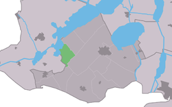 Location in former Gaasterlân Sleat municipality | |
52°53′50″N 5°30′36″E / 52.89722°N 5.51000°E / 52.89722; 5.51000 | |
| Country |  Netherlands Netherlands |
| Province |  Friesland Friesland |
| Municipality |  De Fryske Marren De Fryske Marren |
| Area | |
| • Total | 4.76 km2 (1.84 sq mi) |
| Elevation | −0.1 m (−0.3 ft) |
| Population (2021)[1] | |
| • Total | 50 |
| • Density | 11/km2 (27/sq mi) |
| Postal code | 8583[1] |
| Dialing code | 0514 |
Kolderwolde (West Frisian: Kolderwâlde) is a village in De Fryske Marren municipality in the province of Friesland, the Netherlands. It had a population of around 55 in (2017).[3]
History
It was first mentioned in 1398 as Kolderwout, and means forest belonging to Koudum.[4] Between 1830 and 1860, there was peat excavation in Kolderwolde. In 1840, it was home to 51 people. The church was demolished in the same year, and not rebuilt. 11 statutes are scatter through the village.[5]
Before 2014, Kolderwolde was part of the Gaasterlân-Sleat municipality and before 1984 it belonged to Hemelumer Oldeferd which was named Hemelumer Oldephaert & Noordwolde (H.O.N.). before 1956.[5]
References
- ^ a b c "Kerncijfers wijken en buurten 2021". Central Bureau of Statistics. Retrieved 29 March 2022.
- ^ "Postcodetool for 8583KL". Actueel Hoogtebestand Nederland (in Dutch). Het Waterschapshuis. Retrieved 29 March 2022.
- ^ Kerncijfers wijken en buurten 2017 - CBS
- ^ "Kolderwolde - (geografische naam)". Etymologiebank (in Dutch). Retrieved 29 March 2022.
- ^ a b "Kolderwolde". Plaatsengids (in Dutch). Retrieved 29 March 2022.
Wikimedia Commons has media related to Kolderwolde.
- v
- t
- e
Populated places in the municipality of De Fryske Marren
- Joure
- Lemmer
- Sloten
- Former municipalities: Gaasterlân-Sleat
- Lemsterland
- Skarsterlân
- Akmarijp
- Bakhuizen
- Balk
- Bantega
- Boornzwaag
- Broek
- Delfstrahuizen
- Dijken
- Doniaga
- Echten
- Echtenerbrug
- Eesterga
- Elahuizen
- Follega
- Goingarijp
- Harich
- Haskerhorne
- Idskenhuizen
- Kolderwolde
- Langweer
- Legemeer
- Mirns
- Nijehaske
- Nijemirdum
- Oldeouwer
- Oosterzee
- Oudega
- Oudehaske
- Oudemirdum
- Ouwster-Nijega
- Ouwsterhaule
- Rijs
- Rohel
- Rotstergaast
- Rotsterhaule
- Rottum
- Ruigahuizen
- Scharsterbrug
- Sint Nicolaasga
- Sintjohannesga
- Snikzwaag
- Sondel
- Terherne
- Terkaple
- Teroele
- Tjerkgaast
- Vegelinsoord
- Wijckel
 | This Friesland location article is a stub. You can help Wikipedia by expanding it. |
- v
- t
- e


