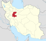
Khondab
Khondab Persian: خنداب | |
|---|---|
City | |
| 34°23′31″N 49°11′02″E / 34.39194°N 49.18389°E / 34.39194; 49.18389[1] | |
| Country | Iran |
| Province | Markazi |
| County | Khondab |
| District | Central |
| Population (2016)[2] | |
| • Total | 7,810 |
| Time zone | UTC+3:30 (IRST) |
Khondab (Persian: خنداب[a] is a city in the Central District of Khondab County, Markazi province, Iran, serving as capital of both the county and the district.[4] It is also the administrative center for Khondab Rural District.[5] The heavy water reactor IR-40 is nearby.[citation needed]
At the 2006 National Census, its population was 6,982 in 1,787 households, when it was in the former Khondab District of Arak County.[6] The following census in 2011 counted 7,753 people in 2,186 households,[7] by which time the district had been separated from the county in the establishment of Khondab County.[4] The latest census in 2016 showed a population of 7,810 people in 2,358 households.[2]
Notes
References
- ^ OpenStreetMap contributors (22 March 2024). "Khondab, Khondab County" (Map). OpenStreetMap. Retrieved 22 March 2024.
- ^ a b "Census of the Islamic Republic of Iran, 1395 (2016)". AMAR (in Persian). The Statistical Center of Iran. p. 00. Archived from the original (Excel) on 17 October 2020. Retrieved 19 December 2022.
- ^ Khondab can be found at GEOnet Names Server, at this link, by opening the Advanced Search box, entering "-3071153" in the "Unique Feature Id" form, and clicking on "Search Database".
- ^ a b Davodi, Parviz (29 July 1386). "Approval letter regarding the reforms of country divisions in Markazi province". Lamtakam (in Persian). Ministry of Interior, Political-Defense Commission of the Government Board. Archived from the original on 19 January 2024. Retrieved 19 January 2024.
- ^ Mousavi, Mirhossein (18 May 1366). "Creation and formation of 18 rural districts including villages, farms and places in Arak County under Markazi province". Islamic Parliament Research Center (in Persian). Ministry of Interior, Board of Ministers. Archived from the original on 15 December 2015. Retrieved 18 January 2024.
- ^ "Census of the Islamic Republic of Iran, 1385 (2006)". AMAR (in Persian). The Statistical Center of Iran. p. 00. Archived from the original (Excel) on 20 September 2011. Retrieved 25 September 2022.
- ^ "Census of the Islamic Republic of Iran, 1390 (2011)". Syracuse University (in Persian). The Statistical Center of Iran. p. 00. Archived from the original (Excel) on 19 January 2023. Retrieved 19 December 2022.
- v
- t
- e

| Arak County | |
|---|---|
| Ashtian County | |
| Delijan County | |
| Farahan County | |
| Khomeyn County | |
| Khondab County |
|
| Komijan County | |
| Mahallat County | |
| Saveh County | |
| Shazand County | |
| Tafresh County | |
| Zarandieh County |
- Chal nakhjir cave, Delijan
- Khorheh
- Atashkoh fire temple, Nimvar
- Mausoleum of Mahmoud Hessaby ,Tafresh
- Arak's grand Bazzar
- Mahallat's flower and plant festival
- Aveh ancient cite, Saveh
- Chaharfasl bath museum, Arak
- Hezaveh village
- Jameh Mosque of Saveh
- Panzdah khordad dam
- Emarat lake, Shazand
- Azadkhan cave, Mahallat
- Miqan Wetland
- Mostufi-al-mamalek's castle, Ashtian
- Dudahak caravansary, Delijan
- Naragh's historical complex
- Sepahdar school, Arak
- Sheshnaveh mosque
- Mahdiabad's Yakhchal
 | This Khondab County location article is a stub. You can help Wikipedia by expanding it. |
- v
- t
- e


