Jamuna, Nepal
Village Development Committee in Province No. 1, Nepal
Jamuna, Nepal जमुना | |
|---|---|
Village Development Committee | |
 A picture of Rice Fields in Jamuna, Nepal | |
| 27°01′N 87°59′E / 27.017°N 87.983°E / 27.017; 87.983 | |
| Country |  Nepal Nepal |
| Province | Province No. 1 |
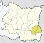
| District | Ilam District |
| Population (1991) | |
| • Total | 3,277 |
| Time zone | UTC+5:45 (Nepal Time) |
| Postal code | 57309 |
| Area code | 027 |
Jamuna is a town and Village Development Committee in Ilam District in the Province No. 1 of eastern Nepal. At the time of the 1991 Nepal census it had a population of 3,277 persons living in 567 individual households.[1]
References
- ^ "Nepal Census 2001". Nepal's Village Development Committees. Digital Himalaya. Archived from the original on 12 October 2008. Retrieved 17 September 2008.
External links
- UN map of the municipalities of Ilam District
- v
- t
- e
Ilam District
Headquarter: Ilam
- Phakphokthum
- Chulachuli
- Maijogmai
- Mangsebung
- Rong
- |Sandakpur
 | This article about a location in Ilam District, Nepal is a stub. You can help Wikipedia by expanding it. |
- v
- t
- e


