Hrastje pri Grosupljem
Place in Lower Carniola, Slovenia
Hrastje pri Grosupljem Hrastje (until 1955) | |
|---|---|
 | |
| 45°58′17.29″N 14°38′44.33″E / 45.9714694°N 14.6456472°E / 45.9714694; 14.6456472 | |
| Country |  Slovenia Slovenia |
| Traditional region | Lower Carniola |
| Statistical region | Central Slovenia |
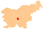
| Municipality | Grosuplje |
| Area | |
| • Total | 1.02 km2 (0.39 sq mi) |
| Elevation | 359.3 m (1,178.8 ft) |
| Population (2002) | |
| • Total | 60 |
| [1] | |
Hrastje pri Grosupljem (pronounced [ˈxɾaːstjɛ pɾi ɡɾɔˈsuːpljɛm]) is a settlement between Grosuplje and Šmarje-Sap in central Slovenia. The Slovenian A2 motorway runs across the settlement's territory. The area is part of the historical region of Lower Carniola. The Municipality of Grosuplje is now included in the Central Slovenia Statistical Region.[2]
Name
The name of the settlement was changed from Hrastje to Hrastje pri Grosupljem (literally, 'Hrastje near Grosuplje') in 1955.[3] The name Hrastje is derived from the Slovene common noun hrast 'oak', referring to the local vegetation.[4]
References
External links
 Media related to Hrastje pri Grosupljem at Wikimedia Commons
- Hrastje pri Grosupljem on Geopedia
- v
- t
- e
Municipality of Grosuplje
Administrative seat: Grosuplje
- Boštanj Castle
- Čušperk Castle
- Grosuplje Library
- Mount Mary Magdalene archeological site
- Praproče Mansion
- Račna Karst Field
- Zavrh Castle


