High Stones

High Stones
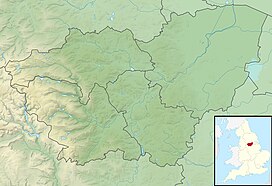
High Stones in South Yorkshire
 England
High Stones, at 548 metres (1,798 ft), is the highest point within the boundaries of both the City of Sheffield and South Yorkshire, England.[1]
High Stones lies on the Howden Moors towards in the northern Peak District National Park, between Langsett Reservoir to the north-east and Howden Reservoir to the south-west. The area is managed by the National Trust, as part of the Nether Hey area of their High Peak Estate.
Representation on Mapping
High Stones is about 1 mile (1.6 km) south of Margery Hill which, at 546m, is the highest marked point within Sheffield. High Stones is only shown on 1:25,000 scale maps and larger.
The cairn at High Stones is at the marked 548 metres (1,798 ft) point; being something over two feet tall means that the top of the cairn is just over 1800 ft above sea level. The most recent 1:25,000 Ordnance Survey Map[2] shows a small 550m contour just west of the High Stones marked point, meaning that small patch of moorland is the highest point in Sheffield at just slightly over 550 metres (1,804 ft).
References
- ^ a b Bathurst, David (2012). Walking the county high points of England. Chichester: Summersdale. pp. 192–201. ISBN 978-1-84-953239-6.
- ^ "Ordnance Survey Map of High Stones". Archived from the original on 26 October 2012. Retrieved 6 February 2011.
- v
- t
- e
Peaks of the Peak District of England
- Black Hill
- The Cloud
- Gun
- Kinder Scout
- Shining Tor

- Abney Low
- Aleck Low
- Allman Well Hill
- Alport Height
- Axe Edge Moor
- Back Tor
- Beeley Moor
- Big Moor
- Birchen Edge
- Blacka Moor
- Black Chew Head
- Black Edge
- Blake Low
- Blakelow Hill
- Bleaklow
- Bole Hill
- Bolehill
- Bosley Minn
- Britland Edge Hill
- Brittain's Plantation
- Brown Knoll
- Bunster Hill
- Burbage Edge
- Burton Bole End
- Calver Peak
- Cheeks Hill
- Chinley Churn
- Chrome Hill
- The Cloud
- Combs Moss
- Corbar Hill
- Croker Hill
- Crook Hill
- Dead Edge End
- Derwent Edge
- Durham Edge
- Eccles Pike
- Ecton Hill
- Eldon Hill
- Emlin
- Eyam Moor - Sir William Hill
- Featherbed Moss
- Featherbed Top
- Fin Cop
- Froggatt Edge
- Gardom's Edge
- Gautries Hill
- Gibraltar Rocks
- Gratton Hill
- Great Ridge
- Grindslow Knoll
- Grin Low
- Gun
- Harborough Rocks
- Hare Edge Hill
- Harridge Pike
- Hartcliff Hill
- Haven Hill
- Hawks Low
- The Height
- Heights of Abraham
- Higger Tor
- High Edge
- High Field
- High Low
- Hollins Hill
- High Neb
- High Wheeldon
- Higher Shelf Stones
- Hollins Cross
- Houndkirk Hill
- Lantern Pike
- Lees Moor
- Longstone Moor
- Lord's Seat
- Lose Hill
- Lost Lad
- Low Moor
- Mam Tor
- Margery Hill
- Merryton Low
- Middleton Moor
- Minninglow Hill
- Mount Famine
- Nelson's Monument
- Ossoms Hill
- Parkhouse Hill
- Pike Low
- Pikenaze Hill
- The Roaches
- Rock Hall
- Rushup Edge
- Sheen Hill
- Shutlingsloe
- Slipper Low
- Snailsden Pike End
- Snels Low
- South Head
- Sponds Hill
- Stanage Edge
- Stanton Moor
- Tegg's Nose
- Thorpe Cloud
- Totley Moor
- Ughill Height
- Wardlow Hay Cop
- West Nab
- Wetton Hill
- Whaley Moor
- Wibben Hill
- Wild Bank
- Win Hill
- Windgather Rocks
- Wire Stone
- Wolfscote Hill


