Deception Pass Bridge
Bridge in Oak Harbor, Washington
48°24′22″N 122°38′42″W / 48.4061°N 122.645°W / 48.4061; -122.645 SR 20
SR 20Deception Pass Bridge

Deception Pass Bridge, connecting Whidbey Island to Pass Island.

Deception Pass Bridge is the common name for two two-lane bridges on Washington State Route 20 connecting Whidbey Island in Island County, to Fidalgo Island in Skagit County, in the U.S. state of Washington. It was a Washington State Highways project, and included project elements built by young workers from the Civilian Conservation Corps. Completion of the bridge was a factor in the decision to build Naval Air Station Whidbey Island and helped Oak Harbor flourish. The bridge is a commonly photographed landmark of the Puget Sound region.
History
In the spring of 1792, Joseph Whidbey, master of HMS Discovery and Captain Vancouver's chief navigator proved that it was not really a small bay as charted by the Spaniards (hence the name "Deception"), but a deep and turbulent channel that connects the Strait of Juan de Fuca with the Saratoga Passage, which separates the mainland from what they believed was a peninsula (actually Fidalgo Island and Whidbey Island). Thomas Coupe, a sea captain and founder of Coupeville, was the only man ever to sail a full-rigged ship through the strait discovered by Whidbey.
In the early years of the 20th century, travelers of the horse-and-buggy era used an unscheduled ferry to cross from Fidalgo Island to Whidbey Island. To call the ferry, they banged a saw with a mallet and then sat back to wait.
The bridge, one of the scenic wonders of the Pacific Northwest, is actually two spans, one over Canoe Pass to the north, and another over Deception Pass to the south. Pass Island lies between the two bridges. Construction began in August 1934, and the completed bridge was dedicated at noon on July 31, 1935. The Wallace Bridge and Structural Co. of Seattle, Washington provided 460 tons of steel for the 511-foot (156 m) Canoe Pass arch and 1130 tons for the 976-foot (297 m) Deception Pass span. The cost of the New Deal-era construction was $482,000, made possible through the Public Works Administration and county funds.
In 1982, the bridge was listed in the National Register of Historic Places ahead of a repainting project that cost more than the original construction cost.[1] A second repainting was completed in 1997.[citation needed] A third repainting project began in May 2019 and is expected to be completed in late 2021 at a cost of $22.6 million.[needs update] The bridge will retain its current color, named "Evergreen Green", using lead-free paint; the project also includes replacement of steel pieces that have signs of corrosion.[2][3]
Bridge Facts
- Height from water to roadway: about 180 feet (55 m), depending on the tide
- Roadway: two 11-foot (3.4 m) lanes, one in each direction
- Sidewalks: 3-foot-wide (0.91 m) sidewalk on each side
- Width of bridge deck: 28 feet (8.5 m)
- Total length: 1,487 feet (453 m) (more than a quarter mile)
- Canoe Pass: one 350-foot (110 m) arch and three concrete T-beam approach spans
- Deception Pass: two 175-foot (53 m) cantilever spans, one 200-foot (61 m) suspended span, and four concrete T-beam approach spans
- Vehicle crossings: 20,000 per day on average
- Maximum speed of current in Deception Pass at flood/ebb tide: 9 kts
- Maximum speed of current in Canoe Pass at flood/ebb tide: 10 kts
- 12 total suicides by jumping from the bridge in 2009 and 15 in 2010
-
 A view of the east side of the bridge
 -
 Looking south towards Canoe pass (foreground) and Deception pass
 -
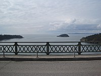 Looking west towards Deception Pass strait from the top of the bridge
 -
 Aerial view of the bridge


See also
- List of bridges documented by the Historic American Engineering Record in Washington (state)
References
- ^ Fiege, Gale (November 13, 2014). "Plenty of places to explore in Oak Harbor, around north Whidbey". The Everett Herald. Retrieved May 7, 2020.
- ^ "Deception Pass bridges undergoing repair, painting". Skagit Valley Herald. May 7, 2019. Retrieved May 7, 2020.
- ^ Gilbert, Emily (May 3, 2019). "Deception Pass Bridge repair project starts Monday". KING 5 News. Retrieved May 7, 2020.
External links
 Media related to Deception Pass Bridge at Wikimedia Commons
- Deception Pass Park Foundation webpage
- Deception Pass Bridge at Structurae
- Historic American Engineering Record (HAER) No. WA-103, "Deception Pass Bridge, Spanning Deception Pass at State Route 20, Anacortes, Skagit County, WA", 7 photos, 3 color transparencies, 14 data pages, 1 photo caption page
- Maritime Heritage Network
- v
- t
- e
- List of U.S. National Historic Landmarks by state:
- Alabama
- Alaska
- Arizona
- Arkansas
- California
- Colorado
- Connecticut
- Delaware
- Florida
- Georgia
- Hawaii
- Idaho
- Illinois
- Indiana
- Iowa
- Kansas
- Kentucky
- Louisiana
- Maine
- Maryland
- Massachusetts
- Michigan
- Minnesota
- Mississippi
- Missouri
- Montana
- Nebraska
- Nevada
- New Hampshire
- New Jersey
- New Mexico
- New York
- North Carolina
- North Dakota
- Ohio
- Oklahoma
- Oregon
- Pennsylvania
- Rhode Island
- South Carolina
- South Dakota
- Tennessee
- Texas
- Utah
- Vermont
- Virginia
- Washington
- West Virginia
- Wisconsin
- Wyoming
 National Register of Historic Places portal
 Category


Authority control databases | |
|---|---|
| International |
|
| National |
|
| Geographic |
|


