Coalwood, Montana
Unincorporated community in Montana, United States
45°43′41″N 105°35′26″W / 45.72806°N 105.59056°W / 45.72806; -105.59056[1]
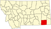
Coalwood is an unincorporated community in northern Powder River County, Montana, United States. It lies along Montana Highway 59, 23.5 miles (37.8 km) north of the town of Broadus, the county seat of Powder River County.[2]
Geography
Coalwood is located at 3,340 feet (1,018 m) above sea level. The community lies in the Mountain Time Zone (MST/MDT), observes Daylight saving time, and lies within the 406 area code.
Climate
According to the Köppen Climate Classification system, Coalwood has a semi-arid climate, abbreviated "BSk" on climate maps.[3]
History
Coalwood was established in 1910, in Custer County. In 1919, it became part of the newly created Powder River County, with the town of Broadus as the county seat.
References
- ^ a b U.S. Geological Survey Geographic Names Information System: Coalwood, Montana
- ^ Rand McNally. The Road Atlas '08. Chicago: Rand McNally, 2008, p. 61.
- ^ Climate Summary for Belle Creek, Montana