Chalus County
County in Mazandaran province, Iran
County in Mazandaran, Iran
Chalus County Persian: شهرستان چالوس | |
|---|---|
County | |
 Location of Chalus County in Mazandaran province (center left, purple) | |
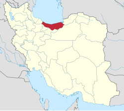 Location of Mazandaran province in Iran | |
| Coordinates: 36°25′N 51°14′E / 36.417°N 51.233°E / 36.417; 51.233[1] | |
| Country |  Iran Iran |
| Province | Mazandaran |
| Capital | Chalus |
| Districts | Central, Marzanabad |
| Area | |
| • Total | 1,597.30 km2 (616.72 sq mi) |
| Population (2016)[3] | |
| • Total | 116,542 |
| • Density | 73/km2 (190/sq mi) |
| Time zone | UTC+3:30 (IRST) |
| Chalus County can be found at GEOnet Names Server, at this link, by opening the Advanced Search box, entering "9207249" in the "Unique Feature Id" form, and clicking on "Search Database". | |
Chalus County (Persian: شهرستان چالوس) is in Mazandaran province, Iran. Its capital is the city of Chalus.[4]
Demographics
Language
The people residing in Chalus speak Mazanderani. In western Chalus, the dialect of Kalarestaqi is spoken[5] and in eastern Chalus, the dialect of Kojuri.[6] During the Pahlavi dynasty, a group of Langrud people migrated from Gilan to Chalus. The Langrudi living in Chalus speak Eastern Gilaki. The Eastern Gilaki language is spoken in the entire Chalus River valley, though some Kurdish tribes were established in Kojur and Kelardasht in the Qajar period.[7]
Population
At the time of the 2006 National Census, the county's population was 119,559 in 33,193 households.[8] The following census in 2011 counted 122,736 people in 37,756 households.[9] At the 2016 census, the county's population was 116,542 in 39,105 households,[3] by which time Kelardasht District had been separated from the county to form Kelardasht County.[10]
Administrative divisions
Chalus County's population history and administrative structure over three consecutive censuses are shown in the following table.
| Administrative Divisions | 2006[8] | 2011[9] | 2016[3] |
|---|---|---|---|
| Central District | 83,101 | 88,216 | 96,224 |
| Kelarestaq-e Gharbi RD | 13,953 | 13,798 | 4,854 |
| Kelarestaq-e Sharqi RD | 24,530 | 26,537 | 15,776 |
| Chalus (city) | 44,618 | 47,881 | 65,196 |
| Hachirud (city) | 10,398 | ||
| Kelardasht District | 36,458 | 17,350 | |
| Birun Bashm RD | 5,852 | ||
| Kelardasht RD | 8,460 | ||
| Kelardasht-e Gharbi RD[a] | 5,145 | ||
| Kelardasht-e Sharqi RD[a] | 3,083 | ||
| Kuhestan RD | 5,147 | ||
| Kelardasht (city)[a] | 11,921 | 9,122 | |
| Marzanabad (city) | 5,078 | ||
| Marzanabad District | 17,170 | 20,318 | |
| Birun Bashm RD | 5,865 | 6,678 | |
| Kuhestan RD | 5,516 | 6,942 | |
| Marzanabad (city) | 5,789 | 6,698 | |
| Total | 119,559 | 122,736 | 116,542 |
| RD = Rural District | |||
Climate
The warm, humid climate of Chalus was formerly considered unhealthy, and the bulk of the population of Chalus, as of all other towns in this region, used to migrate in summer to the summer pastures on the slopes around Delir and in the Kelardasht basin, one of the most popular and longest-settled districts in the region.
See also
![]() Media related to Chalus County at Wikimedia Commons
Media related to Chalus County at Wikimedia Commons
 Iran portal
Notes
- ^ a b c Transferred to Kelardasht County[10]
References
- ^ OpenStreetMap contributors (23 May 2023). "Chalus County" (Map). OpenStreetMap. Retrieved 23 May 2023.
- ^ Management and Planning Organization of Mazandaran, 2006
- ^ a b c "Census of the Islamic Republic of Iran, 1395 (2016)". AMAR (in Persian). The Statistical Center of Iran. p. 02. Archived from the original (Excel) on 7 October 2021. Retrieved 19 December 2022.
- ^ Habibi, Hassan (15 July 1375). "Creation and establishment of Chalus County with the center of Chalus city in the citizenship of Mazandaran province". Islamic Council Research Center (in Persian). Ministry of Interior, Political-Defense Commission of the Government Board. Archived from the original on 31 August 2021. Retrieved 16 January 2024.
- ^ "Welcome to Encyclopaedia Iranica".
- ^ "Welcome to Encyclopaedia Iranica".
- ^ "ČĀLŪS – Encyclopaedia Iranica". www.iranicaonline.org. Retrieved 9 November 2019.
- ^ a b "Census of the Islamic Republic of Iran, 1385 (2006)". AMAR (in Persian). The Statistical Center of Iran. p. 02. Archived from the original (Excel) on 20 September 2011. Retrieved 25 September 2022.
- ^ a b "Census of the Islamic Republic of Iran, 1390 (2011)". Syracuse University (in Persian). The Statistical Center of Iran. p. 02. Archived from the original (Excel) on 19 January 2023. Retrieved 19 December 2022.
- ^ a b Rahimi, Mohammad Reza (20 December 2013). "The transformation of Kelardasht District in Mazandaran province to a county". Qavanin (in Persian). Ministry of Interior. Archived from the original on 23 May 2023. Retrieved 23 May 2023.
- v
- t
- e
Mazandaran Province, Iran
- Mount Damavand
- Abbas Abad Historical Complex
- Lar National Park
- Badab-e Surt
- Mausoleum of Mir Bozorg
- Davazdah Cheshmeh
- Dasht-e Naz National Park
- Gohar Tepe
- Larijan Hot Spring
- Imamzadeh Abbas of Sari
- Resket Tower
- Shahandasht Waterfall
- Tomb of Haydar Amuli
- Miankaleh peninsula
- Farahabad Complex
- Watchtower of Babol
- Mollana Mosque
- Dohezar Forest
- Lajim Tower
- Kangelo Castle
- Sisangan Forest Park
- Challdareh National Park
- Veresk Bridge
- Mohammad Hassan Khan Bridge
- Chaikhoran Palace
- Namakabrood Aerial tramway
- Javaher Deh
- Nima Yooshij House
- Sefid Chah Cemetery
- Ab Pari Waterfall
- Kolbadi House
- Lake of Ghosts
- Mijran Lake
- Safi Abad Palace
- Gharmerez spa
- Avidar Lake
- Alendan lake
- Lar Dam
- Azad Kuh
- Alasht
- Kolakchal
- Deryuok
- Sari Clock Square
- Tamishan Palace
- Gerdkooh Hills
- Filband
- Alam-Kuh
- Jameh Mosque of Amol
- Jameh Mosque of Babol
- Jameh Mosque of Sari
- Palaeolithic Hotu and Kamarband Caves
- Markuh Castle
- Galehgardan
- Vaziri Bath of Sari
- Ramsar Palace
- Dalkhani Jungle
- Paein Lamouk Park
- Babol Museum
- Khoshedaran Museum of natural history
- Kandolus
- Sari's clock square
- Palace of Behshahr
- Churat Lake
- Gol-e Zard Cave
- Tirkan Waterfall
- Danial Cave
- Babolsar Boating Pier
- Elimalat Lake
- Gabri Tonekabon
- Espahbod Khorshid Cave
- Mirza Kuchak Khan Forest Park
- Alimastan Village
- Imamzadeh Kati Hill
- Moalagh Bridge
- Ramsar Hotel
- Nassereddin Shah relief
- Kashpel Forest Park
- Shur Mast Lake
- Baliran Jungle
- Kheshtpol Bridge
- Valasht lake of Kelardasht
- Tomb of Sultan Mohammad Taher
- Takor Tekyeh
- Sorkh Roud Wetland
- Dokhaharan lake
- Qaleh Gardan
- Malek Bahman Castle
- Chehel dar Castle
- Gazou Waterfall
- Cheshmeh Kileh Bridge
- Sangeno Waterfall
- DD Center Amir Abad
- Ecobiology Garden Nowshahr
- Saghanefar
 | This Mazandaran location article is a stub. You can help Wikipedia by expanding it. |
- v
- t
- e


