Châu Thành district, Long An province
You can help expand this article with text translated from the corresponding article in Vietnamese. (March 2009) Click [show] for important translation instructions.
- View a machine-translated version of the Vietnamese article.
- Machine translation, like DeepL or Google Translate, is a useful starting point for translations, but translators must revise errors as necessary and confirm that the translation is accurate, rather than simply copy-pasting machine-translated text into the English Wikipedia.
- Do not translate text that appears unreliable or low-quality. If possible, verify the text with references provided in the foreign-language article.
- You must provide copyright attribution in the edit summary accompanying your translation by providing an interlanguage link to the source of your translation. A model attribution edit summary is
Content in this edit is translated from the existing Vietnamese Wikipedia article at [[:vi:Châu Thành, Long An]]; see its history for attribution. - You may also add the template
{{Translated|vi|Châu Thành, Long An}}to the talk page. - For more guidance, see Wikipedia:Translation.
District in Mekong Delta, Vietnam
Châu Thành district Huyện Châu Thành | |
|---|---|
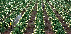 Dragon fruit farm in Châu Thành district | |
 | |
| Country |  Vietnam Vietnam |
| Region | Mekong Delta |
| Province | Long An |
| Capital | Tầm Vu |
| Area | |
| • Total | 58 sq mi (151 km2) |
| Population (2003) | |
| • Total | 102,409 |
| Time zone | UTC+07:00 (Indochina Time) |
Châu Thành is a rural district (huyện) of Long An province in the Mekong River Delta region of Vietnam. It is the birthplace of former Army of the Republic of Vietnam general Trần Thiện Khiêm. As of 2003 the district had a population of 102,409.[1] The district covers an area of 151 km². The district capital lies at Tầm Vu.[1]
References
- ^ a b "Districts of Vietnam". Statoids. Retrieved March 13, 2009.
- v
- t
- e
Districts of the Mekong Delta

- Cao Lãnh city※
- Hồng Ngự city
- Sa Đéc city
- Cao Lãnh
- Châu Thành
- Hồng Ngự
- Lai Vung
- Lấp Vò
- Tân Hồng
- Tam Nông
- Thanh Bình
- Tháp Mười
- Ngã Bảy city
- Vị Thanh city※
- Long Mỹ town
- Châu Thành
- Châu Thành A
- Long Mỹ
- Phụng Hiệp
- Vị Thủy
- Mỹ Tho city※
- Cai Lậy town
- Gò Công town
- Cái Bè
- Cai Lậy
- Châu Thành
- Chợ Gạo
- Gò Công Đông
- Gò Công Tây
- Tân Phú Đông
- Tân Phước
※ denotes provincial seat.
10°27′52″N 106°30′00″E / 10.46444°N 106.50000°E / 10.46444; 106.50000
 | This article about a location in Long An Province, Vietnam is a stub. You can help Wikipedia by expanding it. |
- v
- t
- e


