Caribou, Minnesota
Unincorporated community in Minnesota, United States
Unincorporated community in Minnesota, United States
48°58′57″N 96°26′58″W / 48.98250°N 96.44944°W / 48.98250; -96.4494456735
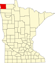
Caribou is an unincorporated community in Caribou Township, Kittson County, Minnesota, United States.
The community is located northeast of Lancaster, along Kittson County Road 4, near its junction with Kittson County Road 53.[1]
Caribou is located along the Roseau River in northeast Kittson County, 1.2 miles (1.9 km) south of the Canada–United States border.[1]
Nearby places include Lancaster, Lake Bronson, Greenbush, and Badger.
History
The community of Caribou was settled in the early 1900s by Ukrainian immigrants.[2]
St. Nicholas Orthodox Church in Caribou is listed on the National Register of Historic Places.[2]
References
- ^ a b c d U.S. Geological Survey Geographic Names Information System: Caribou, Minnesota
- ^ a b Harvey, Thomas (October 31, 1983). "National Register of Historic Places Inventory - Nomination Form: St. Nicholas Orthodox Church" (PDF). National Park Service. Retrieved December 25, 2013.[permanent dead link]
- v
- t
- e
Municipalities and communities of Kittson County, Minnesota, United States
County seat: Hallock
territories
communities
- Minnesota portal
- United States portal
This article about a location in Kittson County, Minnesota is a stub. You can help Wikipedia by expanding it. |
- v
- t
- e


