Canal de São Vicente
16°56′N 25°5′W / 16.933°N 25.083°W / 16.933; -25.083Ocean/sea sources Atlantic Ocean Basin countries Cape Verde Max. length 25 km (16 mi) Max. width 11 km (7 mi) Islands Ilhéu dos Pássaros[1] Settlements Porto Novo, Santo Antåo Island Communities and settlements 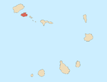
Mountains Streams Other geographical features Topics Culture
The Canal de São Vicente is a strait of the Atlantic Ocean separating the islands of Santo Antão and São Vicente, Cape Verde.[2] At its narrowest point, it is 11 km (7 mi) wide.[2] The ferry route between the ports of Porto Novo on Santo Antão and Mindelo on São Vicente crosses the canal. The channel begins in São Vicente's northwesternmost cape near Monte Cara up to the headland Ponta de João d'Évora in the northeast.
The Canal de São Vicente is the habitat of some endemic species, including the demosponge Amphilectus strepsichelifer[3] and the cone snail Conus fernandesi.[4]
References
- ^ "Ilhéu dos Pássaros". Mapcarta. Retrieved 17 October 2016.
- ^ a b Sailing Directions (Enroute), Pub. 143: West Coast of Europe and Northwest Africa (PDF). Sailing Directions. United States National Geospatial-Intelligence Agency. 2017. p. 236.
- ^ van Soest, Rob W. M.; Beglinger, Elly J.; de Voogd, Nicole J. (2012). "Sponges of the family Esperiopsidae (Demospongiae, Poecilosclerida) from northwest Africa, with the descriptions of four new species". European Journal of Taxonomy. 18: 1–21.
- ^ Tenorio, M.J. (2012). "Conus fernandesi". IUCN Red List of Threatened Species. 2012: e.T192823A2168622. doi:10.2305/IUCN.UK.2012-1.RLTS.T192823A2168622.en. Retrieved 13 November 2021.
- v
- t
- e
The island of São Vicente

- Baleia
- Boca de Lapa
- Canal de São Vicente
- Farol de D. Amélia
- Fateixa
- Ilhéu dos Pássaros
- Ponta João d'Évora
- Ponta João Ribeiro
- Porto Grande Bay
- Praia dos Flamengos
- Praia Grande
African seas | |
|---|---|
| Oceans and seas | |
| Gulfs and bays |
|
| Straits |
|
| Historical seas | |
 Africa portal Africa portal  Oceans portal Oceans portal | |


