California Historical Landmarks in Shasta County
Map all coordinates using OpenStreetMap
Download coordinates as:
- KML
- GPX (all coordinates)
- GPX (primary coordinates)
- GPX (secondary coordinates)
This list includes properties and districts listed on the California Historical Landmark listing in Shasta County, California. Click the "Map of all coordinates" link to the right to view a Google map of all properties and districts with latitude and longitude coordinates in the table below.
| Image | [1] | Landmark name | Location | City or town | Summary |
|---|---|---|---|---|---|
 | 148 | Bass Hill | Castle Crags State Park 40°45′15″N 122°19′23″W / 40.754134°N 122.323094°W / 40.754134; -122.323094 (Bass Hill) | Central Valley | California-Oregon Stagecoach Company road on Bass Hill |
 | 116 | Battle Rock | Castle Crags State Park 41°08′54″N 122°19′17″W / 41.148326°N 122.321521°W / 41.148326; -122.321521 (Battle Rock) | Castella | |
| 519 | Bell's Bridge | Hwy 99 & Clear Creek Rd. 40°31′00″N 122°22′54″W / 40.516569°N 122.3816°W / 40.516569; -122.3816 (Bell's Bridge) | Redding | |
 | 78 | Clear Creek | Old Hwy 99 and Canyon Rd. 40°35′32″N 122°28′40″W / 40.592222°N 122.477778°W / 40.592222; -122.477778 (Clear Creek) | Redding | Pierson B. Reading gold find site |
 | 120 | Dersch Homestead | Dersch Rd. at Bear Creek 40°29′10″N 122°09′03″W / 40.486217°N 122.150867°W / 40.486217; -122.150867 (Dersch Homestead) | Anderson | |
 | 355 | Fort Crook | McArthur Rd. & Soldier Mountain Dr. 41°05′19″N 121°30′52″W / 41.088633°N 121.51435°W / 41.088633; -121.51435 (Fort Crook) | Glenburn | |
 | 379 | Fort Reading | Deschutes and Dersch Rds. 40°28′35″N 122°13′49″W / 40.47645°N 122.230367°W / 40.47645; -122.230367 (Fort Reading) | Anderson | |
 | 483 | Foundation of Catholic Basilica | Red Bluff Rd and Crocker Alley 40°35′34″N 122°29′19″W / 40.592683°N 122.488733°W / 40.592683; -122.488733 (Foundation of Catholic Basilica) | Shasta | |
 | 166 | French Gulch | Historic district 40°41′58″N 122°38′19″W / 40.699483°N 122.638733°W / 40.699483; -122.638733 (French Gulch) | French Gulch | |
 | 555 | Lockhart Ferry | State Hwy 299 41°00′09″N 121°26′38″W / 41.0024°N 121.4438°W / 41.0024; -121.4438 (Lockhart Ferry) | Fall River Mills | |
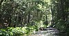
 | 11 | Noble Pass Route | Lassen Volcanic National Park 40°33′29″N 121°31′54″W / 40.5581444444444°N 121.531777777778°W / 40.5581444444444; -121.531777777778 (Noble Pass Route) | ||
| 58 | Old California-Oregon Road | NW corner of Hwy 273 and Spring Gulch Rd. 40°27′57″N 122°19′30″W / 40.465928°N 122.32487°W / 40.465928; -122.32487 (Old California-Oregon Road) | Anderson | |
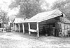
 | 77 | Old town of Shasta | Shasta State Historic Park 40°35′56″N 122°29′32″W / 40.599°N 122.49225°W / 40.599; -122.49225 (Old town of Shasta) | Shasta | Also on the NRHP list as NPS-71000199 |
 | 377 | Pioneer baby's grave | State Hwy 299 40°36′14″N 122°29′58″W / 40.603983°N 122.499417°W / 40.603983; -122.499417 (Pioneer baby's grave) | Shasta | |
 | 10 | Reading Adobe | Reading Island Park, 213 Adobe Rd. 40°22′17″N 122°17′01″W / 40.371283°N 122.283717°W / 40.371283; -122.283717 (Reading Adobe) | Cottonwood | |
 | 32 | Reading's Bar | Clear Creek Bridge 40°29′41″N 122°29′50″W / 40.49465°N 122.49725°W / 40.49465; -122.49725 (Reading's Bar) | Redding | Also the site of Clear Creek Diggings-Horsetown. |
 | 759 | Site of first school in Fall River Valley | State Hwy 299 41°04′15″N 121°20′15″W / 41.070967°N 121.337483°W / 41.070967; -121.337483 (Site of first school in Fall River Valley) | McArthur | |
 | 33 | Southern Hotel & Stage Station | On old Hwy 99, 0.7 mi SW of Sims exit 41°04′01″N 122°21′42″W / 41.066937°N 122.36153°W / 41.066937; -122.36153 (Southern Hotel & Stage Station) | Castella | |
 | 131 | Whiskeytown | Whiskey Creek Rd. & State Hwy 299 40°38′05″N 122°33′40″W / 40.6348°N 122.561°W / 40.6348; -122.561 (Whiskeytown) | Whiskeytown | The site of Whiskeytown is under Whiskeytown Lake, marker is by the lake. |
References
- ^ "California Historical Landmarks By County". Ohp.parks.ca.gov. Retrieved 2019-04-03.
See also
Wikimedia Commons has media related to California Historical Landmarks in Shasta County, California.
- List of California Historical Landmarks
- National Register of Historic Places listings in Shasta County, California
- v
- t
- e
| |||||||||||||||||
National Forests and Grasslands | |||||||
|---|---|---|---|---|---|---|---|
| |||||||
|
| |||||||
| |||||||
|
|
- Heritage registers
- National Natural Landmarks


