Brezina (village)
Slovakian community
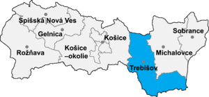
Brezina (Hungarian: Kolbása) is a village and municipality in the Trebišov District in the Košice Region of eastern Slovakia.
History
In historical records the village was first mentioned in 1300.
Geography
The village lies at an altitude of 186 metres and covers an area of 12.964 km². It has a population of about 715 people.
Demography
The village is about 88% Slovak.
- Development of the population from 1850 to present

Facilities
The village has a public library and a football pitch.
Genealogical resources
The records for genealogical research are available at the state archive "Statny Archiv in Kosice, Slovakia"
- Roman Catholic church records (births/marriages/deaths): 1774-1900 (parish B)
- Greek Catholic church records (births/marriages/deaths): 1826-1897 (parish A)
- Reformated church records (births/marriages/deaths): 1773-1897 (parish A)
See also
External links
- https://web.archive.org/web/20070513023228/http://www.statistics.sk/mosmis/eng/run.html
- Surnames of living people in Brezina
- v
- t
- e
Municipalities of Trebišov District
- Čierna nad Tisou
- Kráľovský Chlmec
- Sečovce
- Trebišov
- Bačka
- Bačkov
- Bara
- Biel
- Boľ
- Borša
- Boťany
- Brehov
- Brezina
- Byšta
- Cejkov
- Čeľovce
- Čerhov
- Černochov
- Čierna
- Dargov
- Dobrá
- Dvorianky
- Egreš
- Hraň
- Hrčeľ
- Hriadky
- Kašov
- Kazimír
- Klin nad Bodrogom
- Kožuchov
- Kravany
- Kuzmice
- Kysta
- Ladmovce
- Lastovce
- Leles
- Luhyňa
- Malá Tŕňa
- Malé Ozorovce
- Malé Trakany
- Malý Horeš
- Malý Kamenec
- Michaľany
- Nižný Žipov
- Novosad
- Nový Ruskov
- Parchovany
- Plechotice
- Poľany
- Pribeník
- Rad
- Sirník
- Slivník
- Slovenské Nové Mesto
- Soľnička
- Somotor
- Stanča
- Stankovce
- Strážne
- Streda nad Bodrogom
- Svätá Mária
- Svätuše
- Svinice
- Trnávka
- Veľaty
- Veľká Tŕňa
- Veľké Ozorovce
- Veľké Trakany
- Veľký Horeš
- Veľký Kamenec
- Viničky
- Višňov
- Vojčice
- Vojka
- Zatín
- Zbehňov
- Zemplín
- Zemplínska Nová Ves
- Zemplínska Teplica
- Zemplínske Hradište
- Zemplínske Jastrabie
- Zemplínsky Branč

48°33′00″N 21°33′12″E / 48.55000°N 21.55333°E / 48.55000; 21.55333
 | This article relating to the geography of the Trebišov District is a stub. You can help Wikipedia by expanding it. |
- v
- t
- e


