Birs
River in Switzerland
47°33′28″N 7°37′04″E / 47.5579°N 7.6177°E / 47.5579; 7.6177The Birs (French: Birse) is a 73-kilometre (45 mi) long river in Switzerland that flows through the Jura region and ends as a tributary to the Rhine between Basel and Birsfelden. It is the most important river of the Swiss Jura.
Course
The Birs has its source in a spring near the Col de Pierre Pertuis at 762 metres (2,500 ft) above sea level a little southwest of Tavannes in the Jura bernois. It starts as a proper river; the large amount of water is the product of an extended underground river system.
The Birs runs through wider valleys (Vallée de Tavannes) and narrow gorges. Near Delémont, the capital of the canton of Jura, it joins the Sorne and the Scheulte. Between Soyhières and Liesberg, it leaves the French-speaking part of Switzerland, enters the canton of Basel-Landschaft and receives the Lützel from the left. In Laufen it forms a waterfall, which was the source of power and of the name of the city.
At the gorge of Angenstein, the river runs into the Birseck, the lowland by Aesch. Between Aesch and Dornach, the Birs is rich in fresh-water crabs, the native species of which are now threatened by the American red crab. Earlier, the Birs was polluted and dammed, but it has largely been restored to its original state.
The Reinacherheide is a wildlife preserve with 83 species of bird.
The mouth of the Birs was hardly settled until the 18th century. Today, the city of Birsfelden stands there. The lower stretches of the Birs form the border between Basel-Stadt and Basel-Landschaft. In 2004, it was restored from a concrete canal to a more natural river. Beavers have even been sighted along the river. The Birs also forms the border between the cities of Basel and Birsfelden. It flows into the Rhine at Birskopf after 73 kilometres (45 mi).
See also
References
- Birs in the Historisches Lexikon der Schweiz
Picture gallery
-
 The Birs Source south of Tavannes
 -
 Headwaters of the Birs by Tavannes
 -
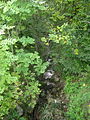
 The Birs south of Court (Gorges de Court)
 -
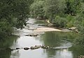
 Gorges de Moutier
 -
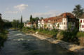
 The restored Birs in Münchenstein
 -
 The Birs by the Elektra Birseck Münchenstein
 -
 Birs waterfall in the Neue Welt, Münchenstein
 -
 The Birs by Birsfelden
 -
 Aerial view of the Rhine, with Birs entering the Rhine


Wikimedia Commons has media related to Birs.
- v
- t
- e
Tributaries of the Rhine
- Vorderrhein
- Aua da Russein
- Schmuèr
- Alpine Rhine
- Vorderrhein
- Tamina
- Saar
- Alter Rhein
- Rheintaler Binnenkanal
- Upper Lake Constance
- Goldach
- Aach (Arbon)
- Aach (Romanshorn)
- Lake Rhine
- Grenzbach
- Dorfbach
- Lower Lake Constance
- Anderbach
- High Rhine
- Thur
- Töss
- Glatt
- Aare
- Sissle
- Möhlinbach
- Ergolz
- Birs
- Upper Rhine
- Birsig
- Ill
- Moder
- Sauer
- Lauter
- Spiegelbach
- Queich
- Speyerbach
- Rehbach
- Isenach
- Eckbach
- Eisbach
- Pfrimm
- Selz
- Middle Rhine
- Welzbach
- Nahe
- Moselle
- Nette
- Brohlbach
- Ahr
- Lower Rhine
- Erft

- Vorderrhein
- Rein da Tuma
- Rein da Curnera
- Rein da Medel
- Rein da Sumvitg
- Glogn
- Rabiusa
- Hinterrhein
- Ragn da Ferrera
- Albula/Alvra
- Alpine Rhine
- Hinterrhein
- Plessur
- Landquart
- Mülbach
- Liechtenstein inland canal
- Ill
- Frutz
- Upper Lake Constance
- Dornbirner Ach
- Bregenzer Ach
- Leiblach
- Argen
- Schussen
- Rotach
- Brunnisach
- Lipbach
- Seefelder Aach
- Stockacher Aach
- Lower Lake Constance
- Radolfzeller Aach
- High Rhine
- Biber
- Durach
- Wutach
- Alb
- Murg
- Wehra
- Upper Rhine
- Wiese
- Kander
- Elz
- Kinzig
- Rench
- Acher
- Murg
- Alb
- Pfinz
- Saalbach
- Kraichbach
- Leimbach
- Neckar
- Weschnitz
- Modau
- Main
- Middle Rhine
- Wisper
- Lahn
- Wied
- Lower Rhine
- Sieg
- Wupper
- Düssel
- Ruhr
- Emscher
- Lippe
- IJssel
- Oude IJssel/Issel
- Berkel
- Schipbeek
Authority control databases | |
|---|---|
| International |
|
| National |
|
| Other |
|


