Aranthangi taluk
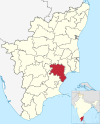
10°09′47″N 78°59′46″E / 10.1631°N 78.9962°E / 10.1631; 78.9962 Ara(m)nthangi taluk is a taluk of Pudukkottai district of the Indian state of Tamil Nadu. The headquarters of the taluk is the town of Aranthangi
Demographics
According to the 2011 census, the taluk of Aranthangi had a population of 195798 with 95235 males and 100563 females. There were 1056 women for every 1000 men. The taluk had a literacy rate of 72.86. Child population in the age group below 6 was 10609 Males and 10101 Females.[1]
References
- ^ "Provisional Population Totals - Tamil Nadu-Census 2011" (PDF). Census Tamil Nadu. Archived from the original (PDF) on 17 June 2013. Retrieved 4 July 2013.
- v
- t
- e
Pudukkottai district
Headquarters: Pudukkottai
- Pudukottai
- Aranthangi
and towns
- Alangudi
- Annavasal
- Aranthangi
- Arimalam
- Avudaiyarkoil
- Iluppur
- Karambakkudi
- Keeramangalam
- Keeranur
- Kottaipattinam
- Mangudi-pudukottai
- Nathampannai
- Ponnamaravathi
- Pudukkottai
- Sittanavasal
- Thirumayam
- Viralimalai
- Alangudi
- Aranthangi
- Avadaiyarkoil
- Gandarvakottai
- Illuppur
- Kulathur
- Manamelkudi
- Pudukkottai
- Thirumayam
- Virallimalai
| Divisions |
|
|---|---|
| Blocks |
- Aranthangi Fort
- Atmanatha Temple, Avudaiyarkoil
- Avur Church
- Government Museum, Thirukokarnam
- Kattubava Mosque
- 81 feet Sivan Statue, keeramangalam
- Kokarneswarar Temple, Thirukokarnam
- Moovar Koil
- Murugan Temple, Kumaranmalai
- Narthamalai
- Sikharagiriswara Temple, Kudumiyamalai
- Sittanavasal Cave
- Thirumayam Fort
- Viralimalai Murugan temple
- People
- Villages
- Pudukkottai State
 | This article related to a location in Pudukkottai district, Tamil Nadu, India is a stub. You can help Wikipedia by expanding it. |
- v
- t
- e


