Akinyele, Oyo State
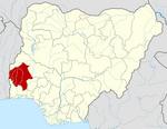
LGA in Oyo State, Nigeria
7°31′25″N 3°54′53″E / 7.5237°N 3.9147°E / 7.5237; 3.9147 Nigeria
 (2006)

Akinyele is a Local Government Area in Oyo State, Nigeria. It is one of the eleven local governments that make up Ibadan metropolis[2] with Afijio Local Government to the north, Lagelu Local Government Area to the east, Ido Local Government Area to the west and Ibadan North Local Government Area to the south. Its headquarters are at Moniya. Akinyele local government area was created in 1976 and it shares boundaries with It occupies a land area of 432.2 square kilometers.[3]
It was named after the late Olubadan, Isaac Babalola Akinyele.
Akinyele local government area is subdivided into 12 wards: Ikereku, Olanla/Oboda/Labode, Arulogun/Eniosa/Aroro, Olode/Amosun/Onidundu, Ojo-Emo/Moniya, Akinyele/Isabiyi/Irepodun, Iwokoto/Talonta/Idi-oro, Ojoo/Ajibode/Laniba, Ijaye/Ojedeji, Ajibade/Alabata/Elekuru, Olorisa-Oko/Okegbemi/Mele, and Iroko.
The local government is governed by an elected chairman and 12 councilors, one elected from each ward.
References
- ^ "Federal Republic of Nigeria Official Gazette" (PDF). Gazettes.Africa. The Federal Government Printer, Abuja, Nigeria.
- ^ a b Tomori M.A. "IBADAN METROPOLITAN AREA AND THE CHALLENGES TO SUSTAINABLE DEVELOPMENT".
- ^ a b "AKINYELE". City Population.
- v
- t
- e
Oyo StateState capital: Ibadan
- Afijio
- Akinyele
- Atiba
- Atisbo
- Egbeda
- Ibadan North
- Ibadan North-East
- Ibadan North-West
- Ibadan South-East
- Ibadan South-West
- Ibarapa Central
- Ibarapa East
- Ibarapa North
- Ido
- Irepo
- Iseyin
- Itesiwaju
- Iwajowa
- Kajola
- Lagelu
- Ogbomosho North
- Ogbomosho South
- Ogo Oluwa
- Olorunsogo
- Oluyole
- Ona Ara
- Orelope
- Ori Ire
- Oyo East
- Oyo West
- Saki East
- Saki West
- Surulere